Chest opened
+${chestReward.xp} XP
Explorer
NOUVEAU ×${chestReward.collectible.quantity}
tapez pour fermer
Chest locked

Open chests in the app

Around Us is built for your phone — chests unlock when you walk, explore and capture nearby places.

Enable Location

We need your location to show you interesting places around you

Discover nearby places

Find interesting locations and hidden gems around you

Precise directions

Get accurate directions and distances to places

Your location is never shared with other users. It's only used when you tap the location button.

Log in to your account

Start exploring — it's free

Trusted by 72,887 travelers worldwide

Continue with Google
Continue with Apple
or

We will send you a code to connect

By continuing, you accept our Terms and Conditions and our Privacy Policy

Check your inbox

We've sent a pincode in your inbox. Please enter the code below.

Colville Delta
Discussion Reviews Photo
9.3k Popularity

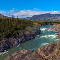
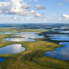
Colville Delta, River delta in northern Alaska, United States

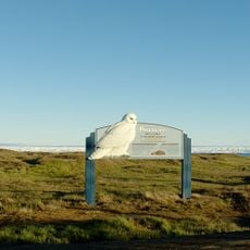
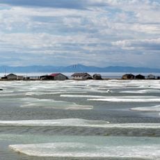
The Colville Delta empties into Harrison Bay as a broad network of shallow channels and wetlands across the Arctic tundra of northern Alaska. The terrain is flat and laced with waterways that shift in character with the seasons.

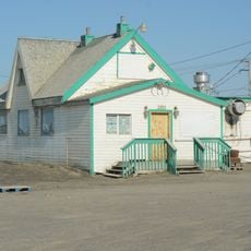
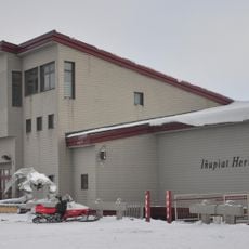
British explorers named the river in 1837 after Andrew Colvile, a director of the Hudson's Bay Company, to mark a reference point for Arctic navigation. Long before that, the Iñupiat had used the delta for fishing and hunting across many generations.

The Iñupiat communities of the region have fished and hunted along the delta's channels for generations, following the seasonal movements of animals. In summer, families gather at traditional spots along the water to catch fish that are dried and stored for winter.

The delta is locked in ice for more than half the year, making summer the only realistic window for a visit. Spring flooding can cut off large sections of the terrain and make moving through the area very difficult.

The river bluffs hold the largest known collection of Arctic dinosaur fossils in North America, a discovery that few visitors associate with this remote tundra. These fossils show that polar regions were once home to a wide range of dinosaur species.

The community of curious travelers

AroundUs brings together thousands of curated places, local tips, and hidden gems, enriched daily by 60,000 contributors worldwide.

Start exploring
GPS coordinates
70.40000,-150.80000
Latest update
March 3, 2026 10:13
Around this place
Arctic National Wildlife Refuge
United States of America

Arctic National Wildlife Refuge

337.6 km
Kobuk Valley National Park
United States of America

Kobuk Valley National Park

463.4 km
Ivvavik National Park
Canada

Ivvavik National Park

440.4 km
Vuntut National Park
Canada

Vuntut National Park

481.1 km
Mount Isto
United States of America

Mount Isto

300 km
Rogers-Post Site
United States of America

Rogers-Post Site

243.8 km
Point Barrow Long Range Radar Site
United States of America

Point Barrow Long Range Radar Site

236.5 km
Gates of the Arctic Wilderness
United States of America

Gates of the Arctic Wilderness

271.2 km
Yukon Flats National Wildlife Refuge
United States of America

Yukon Flats National Wildlife Refuge

493.3 km
Mount Igikpak
United States of America

Mount Igikpak

371.9 km
Arrigetch Peaks
United States of America

Arrigetch Peaks

358.2 km
Point Barrow Refuge Station
United States of America

Point Barrow Refuge Station

239.8 km
Leffingwell Camp Site
United States of America

Leffingwell Camp Site

179.7 km
Noatak Wilderness
United States of America

Noatak Wilderness

431.7 km
Kanuti National Wildlife Refuge
United States of America

Kanuti National Wildlife Refuge

445.4 km
John River
United States of America

John River

332.4 km
Birnirk Site
United States of America

Birnirk Site

238.4 km
North Fork Koyukuk River
United States of America

North Fork Koyukuk River

327.2 km
Herschel Island-Qikiqtaruk Territorial Park
Canada

Herschel Island-Qikiqtaruk Territorial Park

456.2 km
Gallagher Flint Station Archeological Site
United States of America

Gallagher Flint Station Archeological Site

140.3 km
Onion Portage Archeological District
United States of America

Onion Portage Archeological District

475.5 km
Itkillik River
United States of America

Itkillik River

128.9 km
Walker Lake
United States of America

Walker Lake

391.5 km
Iñupiat Heritage Center
United States of America

Iñupiat Heritage Center

239.2 km
Kanuti River
United States of America

Kanuti River

465.7 km
Peters Glacier (Brooks Range)
United States of America

Peters Glacier (Brooks Range)

256.3 km
Utqiaġvik Church Manse
United States of America

Utqiaġvik Church Manse

239.8 km
Salmon River
United States of America

Salmon River

480.7 km
Show the full map
Reviews
Share your experience

No review yet

Discussions
Start a discussion...

No discussion yet

« Colville Delta - River delta in northern Alaska, United States » is provided by Around Us (aroundus.com). Images and texts are derived from Wikimedia project under a Creative Commons license. You are allowed to copy, distribute, and modify copies of this page, under the conditions set by the license, as long as this note is clearly visible.

Discover hidden gems everywhere you go!

From secret cafés to breathtaking viewpoints, skip the crowded tourist spots and find places that match your style. Our app makes it easy with voice search, smart filtering, route optimization, and insider tips from travelers worldwide. Download now for the complete mobile experience.

Around Us App Screenshot

A unique approach to discovering new places

Le Figaro

All the places worth exploring

France Info

A tailor-made excursion in just a few clicks

20 Minutes

Around Us
Travel Guide & Maps
Download

Send to your phone

QR Code
1

Open the camera app on your mobile.

2

Point at the QR code with your camera. A notification will appear.

3

Tap the notification to open the link.