Johor Bahru District

Log in to your account

AroundUs is a community-driven map of interesting places, built by curious explorers like you. It grows with every review, story, and photo you share.
Connect to save your favorite spots, contribute locations, and create personalized routes.
Continue with Google
Continue with Apple
Continue with X
Continue with Facebook
Continue with email
By continuing, you accept our Terms and Conditions and our Privacy Policy
Create an account
Add to collection
Map
Suggest a change
Share

Johor Bahru District, Administrative district in Johor, Malaysia.

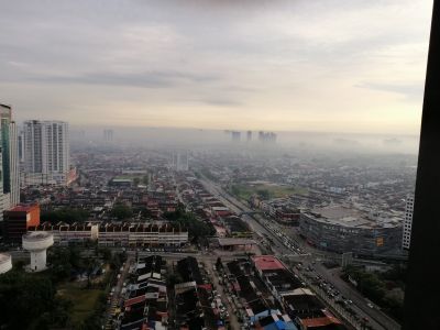
Johor Bahru District is an administrative district in Johor, Malaysia, that encompasses several administrative zones called mukim, including Plentong. The region combines urban areas, residential neighborhoods, and rural landscapes spread across a large territory.

The district grew from rural land into an administrative center after the 1800s, when it began as a Kangchu settlement. These early origins shaped the village structure that still defines the region today.

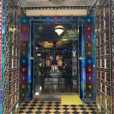
The district houses religious buildings for many faiths, including the Majodi Centre, Saint Joseph Church, Ban Fook Temple, and numerous mosques that serve the local communities. These sites reveal how different traditions coexist within daily life here.

The district is served by bus routes like P-301 Muafakat, while major highways provide direct access to Singapore and other Malaysian regions. The large size of the area means having your own transport is helpful for exploring the various neighborhoods and villages.

Mukim Plentong contains one of Johor's largest granite quarries, which supplies much of the building material for the region. The area is divided into eleven separate villages, each with its own village head called Ketua Kampung.

Location: Johor

Capital city: Johor Bahru

Shares border with: Kulai District, Pontian District, Kota Tinggi District

Address: Johor Bahru, Johor, Malaysia

Website: http://pdnj.johor.gov.my/profil/pd-johorbahru/profil_jabatan

GPS coordinates: 1.45681,103.75007

Latest update: December 14, 2025 03:02

Photos
Reviews

Visited this place? Tap the stars to rate it and share your experience / photos with the community! Try now! You can cancel it anytime.

Administrative divisions
« Johor Bahru District - Administrative district in Johor, Malaysia » is provided by Around Us (aroundus.com). Images and texts are derived from Wikimedia project under a Creative Commons license. You are allowed to copy, distribute, and modify copies of this page, under the conditions set by the license, as long as this note is clearly visible.

Discover hidden gems everywhere you go!

From secret cafés to breathtaking viewpoints, skip the crowded tourist spots and find places that match your style. Our app makes it easy with voice search, smart filtering, route optimization, and insider tips from travelers worldwide. Download now for the complete mobile experience.

Around Us App Screenshot

A unique approach to discovering new places

Le Figaro

All the places worth exploring

France Info

A tailor-made excursion in just a few clicks

20 Minutes