Chest opened
+${chestReward.xp} XP
Explorer
NOUVEAU ×${chestReward.collectible.quantity}
tapez pour fermer

See the monuments around you in AR Open chests in the app

Around Us is built for your phone — point your camera at the streets and discover the monuments and places around you in augmented reality. Around Us is built for your phone — chests unlock when you walk, explore and capture nearby places.

•

Enable Location

We need your location to show you interesting places around you

Discover nearby places

Find interesting locations and hidden gems around you

Precise directions

Get accurate directions and distances to places

Your location is never shared with other users. It's only used when you tap the location button.

Aguas Calientes

Log in to your account

Start exploring — it's free

Trusted by 94,395 travelers worldwide

Continue with Google
Continue with Apple
or

We will send you a code to connect

By continuing, you accept our Terms and Conditions and our Privacy Policy

Check your inbox

We've sent a pincode in your inbox. Please enter the code below.

Aguas Calientes

Aguas Calientes, Stratovolcano in Antofagasta Region, Chile

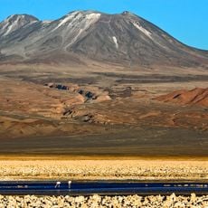
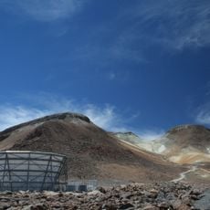
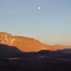
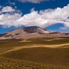
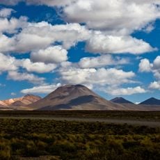
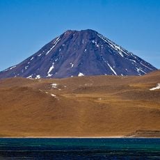
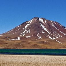
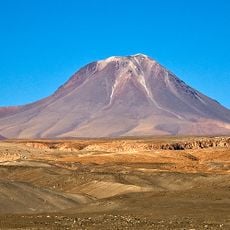
Aguas Calientes is a cone-shaped stratovolcano in Chile's Antofagasta Region, about 5 km east of Lascar volcano. It is built from andesite and dacite lavas containing hornblende and anhydrite, with a diameter of roughly 7 km. Its upper slopes reach about 45° due to viscous, short lava flows, while the lower flanks are covered by fine debris and Lascar ash.

The first recorded ascent was made on 27 October 1971 by Sergio Kunstmann, Pedro Rosende and José Carrasco of the Club Andino de Chile, a few days after the same team carried out an archaeological ascent of Acamarachi. Like other high summits of the Puna de Atacama, the peak may have been visited by the Incas. No historical eruption is known; the youngest summit lava flow may be Holocene.

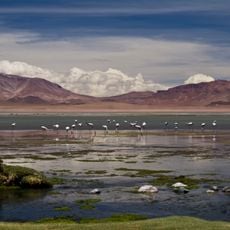
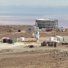
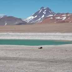
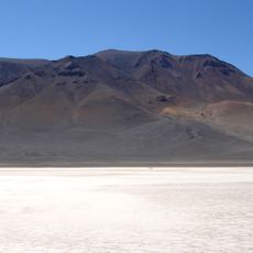
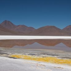
The name Aguas Calientes refers to the small thermal springs on the shores of the Salar de Aguas Calientes II, a 134 km² salt flat southeast of the volcano inside Los Flamencos National Reserve. A second, smaller salt flat, Aguas Calientes I, lies east of the massif between the Pujsa and Tara salt flats and also has thermal outcrops. Like most high summits of the Puna de Atacama, the peak may have been visited by the Incas.

Access to the volcano requires specialized high-altitude equipment and time for acclimatization before attempting the ascent. Visitors must register at the nearest CONAF office before climbing to ensure safety and track access.

The crater lake at 5,870 m is one of the highest lakes in the world, with a surface of about 2,500 square metres. Its water is acidic, and winds from Lascar carry sulfuric acid and water vapour to it. Researchers found only a few bacterial taxa and many DNA sequences that match no known phylogenetic group, and the lake has been studied as a possible analogue to Mars.

The community of curious travelers

AroundUs brings together thousands of curated places, local tips, and hidden gems, enriched daily by 94,395 contributors worldwide.

Start exploring
GPS coordinates
-23.36486,-67.68183
Latest update
October 25, 2026 04:23
Reviews
Share your experience

No review yet

Discussions
Start a discussion...

No discussion yet

« Aguas Calientes - Stratovolcano in Antofagasta Region, Chile » is provided by Around Us (aroundus.com). Images and texts are derived from Wikimedia project under a Creative Commons license. You are allowed to copy, distribute, and modify copies of this page, under the conditions set by the license, as long as this note is clearly visible.

Discover hidden gems everywhere you go!

From secret cafés to breathtaking viewpoints, skip the crowded tourist spots and find places that match your style. Our app makes it easy with voice search, smart filtering, route optimization, and insider tips from travelers worldwide. Download now for the complete mobile experience.
Around Us App Screenshot
❝

A unique approach to discovering new places❞

— Le Figaro

❝

All the places worth exploring❞

— France Info

❝

A tailor-made excursion in just a few clicks❞

— 20 Minutes

Around Us
Travel Guide & Maps
Download

Send to your phone

QR Code
1

Open the camera app on your mobile.

2

Point at the QR code with your camera. A notification will appear.

3

Tap the notification to open the link.