Bengkulu, Province on western coast of Sumatra, Indonesia
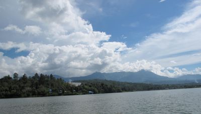
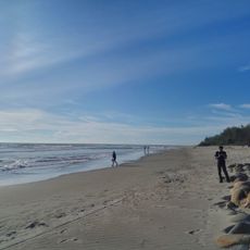
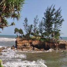
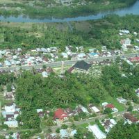
Bengkulu occupies the western coast of Sumatra and includes flat coastal areas, rolling central hills and forested mountains in the east along the Indian Ocean. The area is divided into ten administrative districts connected by a road network that runs along the shore and inland.
A British trading settlement was founded here in the late 17th century when Fort Marlborough was built. The territory later passed to the Dutch colonial empire and developed under different administrations until Indonesian independence.
The province population includes Rejang and Serawai as main ethnic groups, making up 40 percent of inhabitants, with Javanese forming another significant community.
Most visitors arrive by the coastal airport or take long-distance buses that run along the western main road. Roads inland can be more challenging during the rainy season, especially in the mountainous sections.
This region sits directly on the boundary between two tectonic plates, which causes regular seismic activity. Earthquakes are part of everyday life here and have shaped building design and emergency planning.
Location: Indonesia
Inception: November 18, 1968
Capital city: Bengkulu
Elevation above the sea: 100 m
Reference: 17
Shares border with: West Sumatra, Jambi, South Sumatra, Lampung
Website: http://bengkuluprov.go.id
GPS coordinates: -3.80000,102.25000
Latest update: December 15, 2025 22:25
Dempo
100.4 km
Kerinci Seblat National Park
176 km
Fort Marlborough
1.4 km
Bung Karno Seclusion House
1.3 km
Tropical Rainforest Heritage of Sumatra
167 km
Prasasti Karang Berahi
195.2 km
Panjang Beach
2.3 km
Mount Kaba
51.6 km
Fatmawati's house
1.8 km
Gunung Masurai
149.6 kmBengkulu Jamik Mosque
1.6 kmMount Besar
173 km
Thomas Parr Monument
1.3 kmBengkulu Museum
4.5 kmMosque Agung Pondok Tinggi
215.2 km
Sungai Suci Beach
9.1 km
Mount Kunyit
190.1 km
Serasan Sekate Stadium
203.8 kmBukit Daun
48.3 kmBukit Lumut Balai
159.2 kmPasemah megalithic site
123.6 kmSemurup Hot Spring
225.1 kmSeblat Mount
103 kmMount Pendan
111.1 km
Belirang-Beriti
109.1 kmMuseum Subkoss Garuda Sriwijaya
88.1 kmMount Hutapanjang
178.9 kmMerangin Geopark
164.2 kmVisited this place? Tap the stars to rate it and share your experience / photos with the community! Try now! You can cancel it anytime.
Discover hidden gems everywhere you go!
From secret cafés to breathtaking viewpoints, skip the crowded tourist spots and find places that match your style. Our app makes it easy with voice search, smart filtering, route optimization, and insider tips from travelers worldwide. Download now for the complete mobile experience.
A unique approach to discovering new places❞
— Le Figaro
All the places worth exploring❞
— France Info
A tailor-made excursion in just a few clicks❞
— 20 Minutes