Chukotsky District

Log in to your account

AroundUs is a community-driven map of interesting places, built by curious explorers like you. It grows with every review, story, and photo you share.
Connect to save your favorite spots, contribute locations, and create personalized routes.
Continue with Google
Continue with Apple
Continue with X
Continue with Facebook
Continue with email
By continuing, you accept our Terms and Conditions and our Privacy Policy
Create an account
Add to collection
Map
Suggest a change
Share

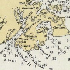
Chukotsky District, Municipal district in Chukotka Autonomous Okrug, Russia

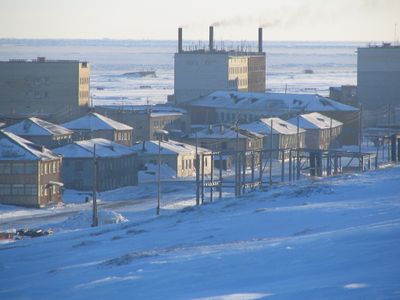
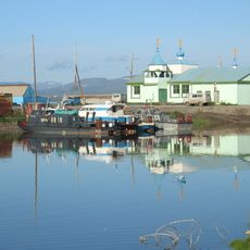
Chukotsky District is a municipal area at the northeastern edge of Eurasia, stretching across thousands of square kilometers and bordered by the Chukchi Sea and the Bering Sea. The region is sparsely populated, with Lavrentiya serving as the administrative center and smaller settlements scattered across the vast Arctic terrain.

The district was established as an administrative unit in 1927, though the Chukchi people had inhabited this land for centuries. A major territorial reorganization occurred in 1957 when portions were transferred to neighboring administrative units.

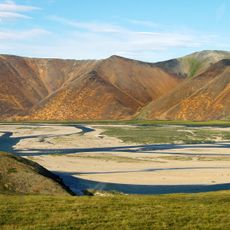
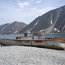
The people here are primarily Chukchi who continue traditional practices of hunting sea mammals and herding reindeer. These ways of life shape daily routines and the community's deep connection to the Arctic landscape.

This region is extremely remote and difficult to reach, so visitors should prepare for long periods of darkness during winter months. Summer is the best time to visit, when snow melts and conditions for travel and exploration become more manageable.

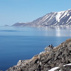
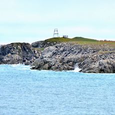
The settlement of Uelen sits at the easternmost reach of inhabited Eurasia and lies near Cape Dezhnev, a dramatic geographical turning point of the continent. This extraordinary location makes it a rare destination for those seeking the extreme margins of human settlement.

Location: Chukotka Autonomous Okrug

Inception: 1927

Capital city: Lavrentiya

Website: http://chukotraion.ru

GPS coordinates: 66.31278,-172.41778

Latest update: December 10, 2025 15:52

Photos
Around this place
Whale Bone Alley
Russian Federation

Whale Bone Alley

186 km
Beringia National Park
Russian Federation

Beringia National Park

220.5 km
United States of America

Ipiutak Site

329.5 km
Monument to Semyon Dezhnev
Russian Federation

Monument to Semyon Dezhnev

126.1 km
Trail Creek Caves
United States of America

Trail Creek Caves

410.5 km
Pilgrim Hot Springs
United States of America

Pilgrim Hot Springs

368.9 km
Cape Nome Mining District Discovery Sites
United States of America

Cape Nome Mining District Discovery Sites

379.5 km
Palyavaam River
Russian Federation

Palyavaam River

465.7 km
Council City and Solomon River Railroad
United States of America

Council City and Solomon River Railroad

418.3 km
Old St. Joseph's Catholic Church
United States of America

Old St. Joseph's Catholic Church

382 km
Nome River
United States of America

Nome River

378.2 km
Snake River
United States of America

Snake River

371.2 km
Chamisso Wilderness
United States of America

Chamisso Wilderness

474.1 km
Wales Site
United States of America

Wales Site

211.5 km
Cape Vankarem
Russian Federation

Cape Vankarem

225.4 km
Kougarok River
United States of America

Kougarok River

363.2 km
Kuzitrin River
United States of America

Kuzitrin River

382.3 km
Swanberg Dredge
United States of America

Swanberg Dredge

384.2 km
Solomon Roadhouse
United States of America

Solomon Roadhouse

417.2 km
Niukluk River
United States of America

Niukluk River

419 km
Kugruk River
United States of America

Kugruk River

444.3 km
Shishmaref Inlet
United States of America

Shishmaref Inlet

292.1 km
Noxapaga River
United States of America

Noxapaga River

386.7 km
Slavyanka Cove
Russian Federation

Slavyanka Cove

220.8 km
Историко-культурный комплекс Пловер
Russian Federation

Историко-культурный комплекс Пловер

221.6 km
Памятный знак в честь 250-летия Первой Камчатской экспедиции (Провидения)
Russian Federation

Памятный знак в честь 250-летия Первой Камчатской экспедиции (Провидения)

214.4 km
Историко-этнографический памятник «Коса Святого Александра» (Анадырь)
Russian Federation

Историко-этнографический памятник «Коса Святого Александра» (Анадырь)

495 km
Памятник «Авиаторам — первопроходцам и защитникам неба Чукотки» (Угольные Копи)
Russian Federation

Памятник «Авиаторам — первопроходцам и защитникам неба Чукотки» (Угольные Копи)

487.8 km
Show the full map
Reviews

Visited this place? Tap the stars to rate it and share your experience / photos with the community! Try now! You can cancel it anytime.

« Chukotsky District - Municipal district in Chukotka Autonomous Okrug, Russia » is provided by Around Us (aroundus.com). Images and texts are derived from Wikimedia project under a Creative Commons license. You are allowed to copy, distribute, and modify copies of this page, under the conditions set by the license, as long as this note is clearly visible.

Discover hidden gems everywhere you go!

From secret cafés to breathtaking viewpoints, skip the crowded tourist spots and find places that match your style. Our app makes it easy with voice search, smart filtering, route optimization, and insider tips from travelers worldwide. Download now for the complete mobile experience.

Around Us App Screenshot

A unique approach to discovering new places

Le Figaro

All the places worth exploring

France Info

A tailor-made excursion in just a few clicks

20 Minutes