Enable Location

We need your location to show you interesting places around you

Discover nearby places

Find interesting locations and hidden gems around you

Precise directions

Get accurate directions and distances to places

Your location is never shared with other users. It's only used when you tap the location button.

Bristol Bay

Log in to your account

Start exploring — it's free

Trusted by 67,571 travelers worldwide

Continue with Google
Continue with Apple
or

We will send you a code to connect

By continuing, you accept our Terms and Conditions and our Privacy Policy

Check your inbox

We've sent a pincode in your inbox. Please enter the code below.

Bristol Bay
Discussion Reviews 2 Photos
32.3k Popularity

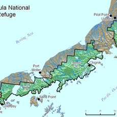
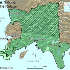
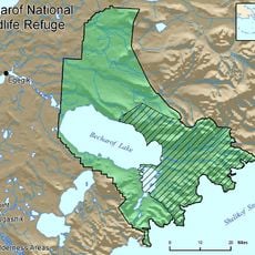
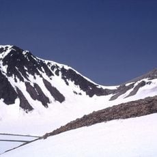
Bristol Bay, Bay inlet in Southwest Alaska, United States

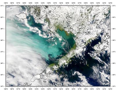
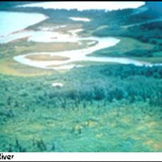
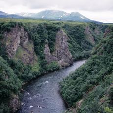
Bristol Bay is a large inlet in Southwest Alaska that extends inland from the Bering Sea for roughly 200 miles and opens to a mouth spanning about 270 miles between two major headlands. The body of water forms a expansive basin that receives water from several rivers and streams.

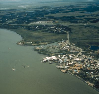
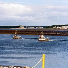
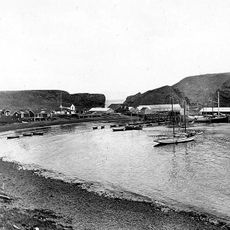
British navigator Captain James Cook explored this region in 1778 and named it after Admiral Earl of Bristol from England. The area later became a center for commercial activities as fishing and trade developed in response to abundant marine resources.

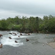
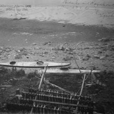
Yup'ik, Aleut, and Athabaskan communities here continue fishing methods passed down through generations and integrate them with contemporary work. These traditions remain central to how people live and work along the coast.

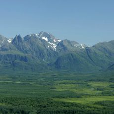
This location can only be reached by boat or aircraft, as there are no roads leading to the bay. Visitors should prepare for cold ocean winds, rough seas, and rapidly changing weather conditions.

Water levels in the upper sections can fluctuate by more than 30 feet, creating particular challenges for fishing boats navigating these waters. These extreme tidal swings are among the most dramatic on the North American coast.

The community of curious travelers

AroundUs brings together thousands of curated places, local tips, and hidden gems, enriched daily by 60,000 contributors worldwide.

Start exploring
Location
Part of
Bering Sea
GPS coordinates
57.32639,-159.80806
Latest update
December 20, 2025 00:33
Around this place
Mount Pavlof
United States of America

Mount Pavlof

248.4 km
Brooks Falls
United States of America

Brooks Falls

273.9 km
Mount Aniakchak
United States of America

Mount Aniakchak

107.4 km
Aniakchak National Monument and Preserve
United States of America

Aniakchak National Monument and Preserve

113.2 km
Mount Veniaminof
United States of America

Mount Veniaminof

128.4 km
Mount Chiginagak
United States of America

Mount Chiginagak

171.1 km
Alaska Peninsula National Wildlife Refuge
United States of America

Alaska Peninsula National Wildlife Refuge

155.7 km
Togiak National Wildlife Refuge
United States of America

Togiak National Wildlife Refuge

224.9 km
Ukinrek Maars
United States of America

Ukinrek Maars

204.7 km
Naknek River
United States of America

Naknek River

237.2 km
Becharof National Wildlife Refuge
United States of America

Becharof National Wildlife Refuge

224.7 km
United States of America

Becharof Wilderness

256.1 km
Togiak Wilderness
United States of America

Togiak Wilderness

258.2 km
Pavlof Sister
United States of America

Pavlof Sister

243.3 km
Mount Emmons
United States of America

Mount Emmons

261.5 km
Mount Dana
United States of America

Mount Dana

207.3 km
Brooks River Archeological District
United States of America

Brooks River Archeological District

274 km
Ugashik River
United States of America

Ugashik River

156.5 km
Elevation of Holy Cross Church
United States of America

Elevation of Holy Cross Church

226.4 km
St. Nicholas Chapel
United States of America

St. Nicholas Chapel

225.5 km
Brooks River Historic Ranger Station
United States of America

Brooks River Historic Ranger Station

274.7 km
St. John the Baptist Chapel
United States of America

St. John the Baptist Chapel

227.1 km
Transfiguration of Our Lord Chapel
United States of America

Transfiguration of Our Lord Chapel

196.5 km
St. Nicholas Church
United States of America

St. Nicholas Church

141 km
Kemuk River
United States of America

Kemuk River

248.5 km
Brooks Camp Visitor Center
United States of America

Brooks Camp Visitor Center

274.6 km
Brooks Camp Campground
United States of America

Brooks Camp Campground

274.6 km
Pirate Cove
United States of America

Pirate Cove

221.6 km
Show the full map
Reviews
Share your experience

No review yet

Discussions
Start a discussion...

No discussion yet

« Bristol Bay - Bay inlet in Southwest Alaska, United States » is provided by Around Us (aroundus.com). Images and texts are derived from Wikimedia project under a Creative Commons license. You are allowed to copy, distribute, and modify copies of this page, under the conditions set by the license, as long as this note is clearly visible.

Discover hidden gems everywhere you go!

From secret cafés to breathtaking viewpoints, skip the crowded tourist spots and find places that match your style. Our app makes it easy with voice search, smart filtering, route optimization, and insider tips from travelers worldwide. Download now for the complete mobile experience.

Around Us App Screenshot

A unique approach to discovering new places

Le Figaro

All the places worth exploring

France Info

A tailor-made excursion in just a few clicks

20 Minutes

Around Us
Travel Guide & Maps
Download

Send to your phone

QR Code
1

Open the camera app on your mobile.

2

Point at the QR code with your camera. A notification will appear.

3

Tap the notification to open the link.