Salton Sea

Log in to your account

AroundUs is a community-driven map of interesting places, built by curious explorers like you. It grows with every review, story, and photo you share.
Connect to save your favorite spots, contribute locations, and create personalized routes.
By continuing, you accept our Terms and Conditions and our Privacy Policy
Add to collection
Map
Suggest a change
Share

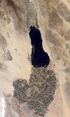
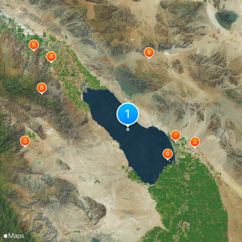
Salton Sea, Rift lake in Imperial Valley, California, US

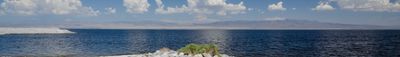
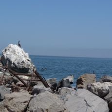
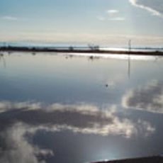
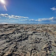
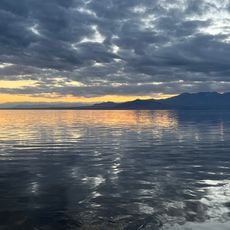
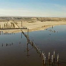
The Salton Sea is a lake in a California desert basin, roughly 35 miles long and 15 miles wide, sitting 226 feet (69 meters) below sea level. Mineral deposits and high salt content make the water appear cloudy, and it smells sulfurous along some stretches of the shore.

The lake formed in 1905 when the Colorado River broke through irrigation canals and filled the dry valley for about two years. The basin held the water due to evaporation and occasional inflows ever since, but it became increasingly salty.

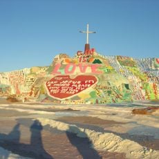
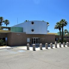
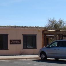
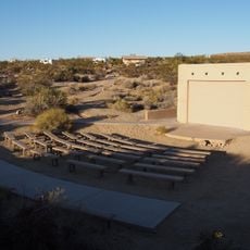
Abandoned buildings and old pier remains along the shore recall a time when the waterfront was a popular weekend escape for families from Southern California. Locals and artists visit the area today to photograph or paint the empty beaches and slowly decaying structures.

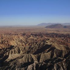
The lake lies far from major towns and requires car travel on straight desert roads where fuel and drinking water are limited. The sun heats the area intensely, especially in summer, so early morning or late afternoon visits work best.

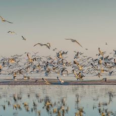
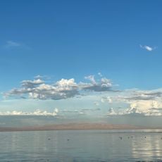
The water sits directly on the San Andreas Fault, through which minerals and salts enter the basin via seismic activity. Tilapia fish were introduced in the 1950s and survived the rising salinity until the balance tipped recently.

Location: Imperial County

Location: Riverside County

Elevation above the sea: -71.3 m

Height: 13 m

Website: http://saltonsea.ca.gov

GPS coordinates: 33.33770,-115.83910

Latest update: December 2, 2025 21:39

Alternative destinations in California

These California locations lie beyond main routes. The destinations include natural sites like canyons with fern walls, volcanic craters in Mojave Desert, and historical places like abandoned 19th century baths. The route leads to sand beaches, caves and nature parks.

Around this place
Show the full map
Salvation Mountain
United States of America

Salvation Mountain

35.3 km
Anza-Borrego Desert State Park
United States of America

Anza-Borrego Desert State Park

52.8 km
Humana Challenge
United States of America

Humana Challenge

51.6 km
Living Desert Zoo and Gardens
United States of America

Living Desert Zoo and Gardens

62.1 km
Salton Buttes
United States of America

Salton Buttes

25.5 km
Niland Geyser
United States of America

Niland Geyser

25.1 km
Tahquitz Canyon
United States of America

Tahquitz Canyon

47.3 km
General George S. Patton Memorial Museum
United States of America

General George S. Patton Memorial Museum

37.7 km
La Quinta Resort and Club
United States of America

La Quinta Resort and Club

58.3 km
Sonny Bono Salton Sea National Wildlife Refuge
United States of America

Sonny Bono Salton Sea National Wildlife Refuge

23.1 km
Galleta Meadows Estate
United States of America

Galleta Meadows Estate

50.2 km
Salton Sea State Recreation Area
United States of America

Salton Sea State Recreation Area

15.9 km
North Shore Beach and Yacht Club
United States of America

North Shore Beach and Yacht Club

21.1 km
Mud Caves
United States of America

Mud Caves

56.4 km
Shields Date Gardens
United States of America

Shields Date Gardens

57.2 km
Santa Rosa Wilderness
United States of America

Santa Rosa Wilderness

48.6 km
Fish Creek Mountains Wilderness
United States of America

Fish Creek Mountains Wilderness

43.6 km
Toro Peak
United States of America

Toro Peak

58.3 km
Corn Springs
United States of America

Corn Springs

57.5 km
Martinez Canyon Rockhouse
United States of America

Martinez Canyon Rockhouse

49 km
Ruby Lee Mill Site
United States of America

Ruby Lee Mill Site

55.7 km
Jack Nicklaus Resort Golf Course
United States of America

Jack Nicklaus Resort Golf Course

51.5 km
Cottonwood Visitor Center
United States of America

Cottonwood Visitor Center

45.8 km
Betz Beach
United States of America

Betz Beach

18.4 km
Sneaker Beach
United States of America

Sneaker Beach

20.4 km
Salton Beach
United States of America

Salton Beach

15.3 km
Cottonwood Campground Amphitheater
United States of America

Cottonwood Campground Amphitheater

45.3 km
Sea View Beach
United States of America

Sea View Beach

14.4 km
Show the full map

Reviews

Visited this place? Tap the stars to rate it and share your experience / photos with the community! Try now! You can cancel it anytime.

« Salton Sea - Rift lake in Imperial Valley, California, US » is provided by Around Us (aroundus.com). Images and texts are derived from Wikimedia project under a Creative Commons license. You are allowed to copy, distribute, and modify copies of this page, under the conditions set by the license, as long as this note is clearly visible.

Discover hidden gems everywhere you go!

From secret cafés to breathtaking viewpoints, skip the crowded tourist spots and find places that match your style. Our app makes it easy with voice search, smart filtering, route optimization, and insider tips from travelers worldwide. Download now for the complete mobile experience.

Around Us App Screenshot

A unique approach to discovering new places

Le Figaro

All the places worth exploring

France Info

A tailor-made excursion in just a few clicks

20 Minutes