Chest opened
+${chestReward.xp} XP
Explorer
NOUVEAU ×${chestReward.collectible.quantity}
tapez pour fermer
Chest locked

Open chests in the app

Around Us is built for your phone — chests unlock when you walk, explore and capture nearby places.

Enable Location

We need your location to show you interesting places around you

Discover nearby places

Find interesting locations and hidden gems around you

Precise directions

Get accurate directions and distances to places

Your location is never shared with other users. It's only used when you tap the location button.

Log in to your account

Start exploring — it's free

Trusted by 73,046 travelers worldwide

Continue with Google
Continue with Apple
or

We will send you a code to connect

By continuing, you accept our Terms and Conditions and our Privacy Policy

Check your inbox

We've sent a pincode in your inbox. Please enter the code below.

California's 36th congressional district
Discussion Reviews Photo
30.9k Popularity

California's 36th congressional district, Congressional district in Southern California, United States.

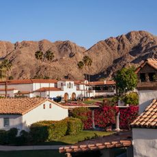
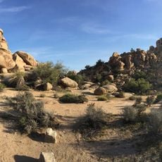
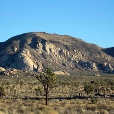
California's 36th congressional district covers portions of Riverside and San Bernardino counties in Southern California. The area combines urban centers with suburban and residential neighborhoods spread across different terrain.

The district was established in 1963 and redrawn multiple times to reflect population growth and demographic shifts in the region. These boundary changes followed patterns of expansion and demographic change across Southern California.

The district encompasses communities with different backgrounds and traditions that shape daily life and local priorities. Residents from various origins contribute to the social fabric and influence how the area develops.

Residents and visitors can reach out to their elected representative through local offices located throughout the area. It is useful to contact ahead to find the nearest office location and available meeting times.

The district stands out for its notably high voter participation rates compared to many other regions. This reflects strong community involvement in the electoral process and local governance.

The community of curious travelers

AroundUs brings together thousands of curated places, local tips, and hidden gems, enriched daily by 60,000 contributors worldwide.

Start exploring
Location
GPS coordinates
33.72667,-115.74278
Latest update
December 20, 2025 01:51
Around this place
United States of America

Humana Challenge

48.5 km
Niland Geyser
United States of America

Niland Geyser

51.5 km
General George S. Patton Memorial Museum
United States of America

General George S. Patton Memorial Museum

7.5 km
La Quinta Resort and Club
United States of America

La Quinta Resort and Club

52.1 km
Hidden Valley
United States of America

Hidden Valley

50.8 km
Salton Sea State Recreation Area
United States of America

Salton Sea State Recreation Area

31.2 km
North Shore Beach and Yacht Club
United States of America

North Shore Beach and Yacht Club

29.3 km
Shields Date Gardens
United States of America

Shields Date Gardens

48.6 km
Keys Desert Queen Ranch
United States of America

Keys Desert Queen Ranch

53.1 km
Desert Queen Mine
United States of America

Desert Queen Mine

44.9 km
Ryan Mountain
United States of America

Ryan Mountain

46.3 km
Corn Springs
United States of America

Corn Springs

40.3 km
Wall Street Mill
United States of America

Wall Street Mill

50 km
Malapai Hill
United States of America

Malapai Hill

39.8 km
Cow Camp
United States of America

Cow Camp

52.3 km
Ryan House and Lost Horse Well
United States of America

Ryan House and Lost Horse Well

47.3 km
Ruby Lee Mill Site
United States of America

Ruby Lee Mill Site

14.6 km
Joshua Tree Wilderness
United States of America

Joshua Tree Wilderness

45.8 km
Jack Nicklaus Resort Golf Course
United States of America

Jack Nicklaus Resort Golf Course

48.3 km
Joshua Tree National Park Visitor Center
United States of America

Joshua Tree National Park Visitor Center

53.9 km
Cottonwood Visitor Center
United States of America

Cottonwood Visitor Center

7.9 km
Hidden Valley Campground
United States of America

Hidden Valley Campground

50.5 km
White Tank Campground
United States of America

White Tank Campground

38.3 km
Jumbo Rocks Campground
United States of America

Jumbo Rocks Campground

41.8 km
Sheep Pass Campground
United States of America

Sheep Pass Campground

46.2 km
Cottonwood Campground Amphitheater
United States of America

Cottonwood Campground Amphitheater

6.8 km
Cottonwood Campground
United States of America

Cottonwood Campground

6.9 km
Belle Campground
United States of America

Belle Campground

39.9 km
Show the full map
Reviews
Share your experience

No review yet

Discussions
Start a discussion...

No discussion yet

« California's 36th congressional district - Congressional district in Southern California, United States » is provided by Around Us (aroundus.com). Images and texts are derived from Wikimedia project under a Creative Commons license. You are allowed to copy, distribute, and modify copies of this page, under the conditions set by the license, as long as this note is clearly visible.

Discover hidden gems everywhere you go!

From secret cafés to breathtaking viewpoints, skip the crowded tourist spots and find places that match your style. Our app makes it easy with voice search, smart filtering, route optimization, and insider tips from travelers worldwide. Download now for the complete mobile experience.

Around Us App Screenshot

A unique approach to discovering new places

Le Figaro

All the places worth exploring

France Info

A tailor-made excursion in just a few clicks

20 Minutes

Around Us
Travel Guide & Maps
Download

Send to your phone

QR Code
1

Open the camera app on your mobile.

2

Point at the QR code with your camera. A notification will appear.

3

Tap the notification to open the link.