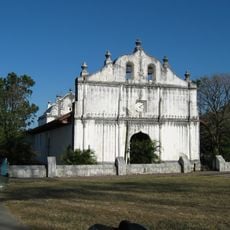
Liberia Canton, Administrative canton in Guanacaste Province, Costa Rica
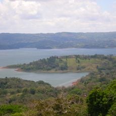
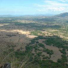
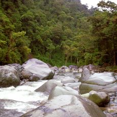
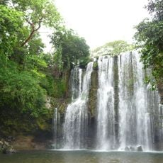
Liberia Canton consists of five administrative districts spread across the region: Liberia, Cañas Dulces, Mayorga, Nacascolo, and Curubandé. The landscape is predominantly rural, with rolling terrain suitable for farming and ranching at moderate elevation.
The region remained part of Nicaragua after Spain's independence in 1821, but became incorporated into Costa Rica in 1826. This shift marked a key moment in the territorial organization of Guanacaste Province.
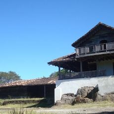
Cattle ranching shapes daily life here, with the pastures and livestock defining the working landscape. Local communities gather regularly to maintain these rural traditions and celebrate their connection to the land.
Daniel Oduber Quirós International Airport serves as the main entry point for visitors arriving by air. The airport is conveniently located and connected to the region's roads, making travel to different districts straightforward.
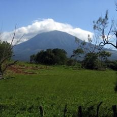
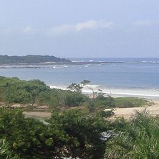
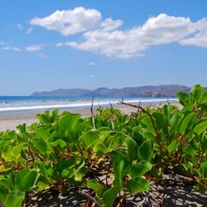
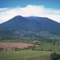
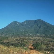
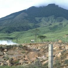
The active Rincón de la Vieja volcano sits within the canton, shaping the local geology. Sections of Santa Rosa National Park extend across the northwestern border, creating a rare meeting of protected wilderness and rural communities.
Location: Guanacaste Province
Capital city: Liberia
Elevation above the sea: 193 m
Shares border with: La Cruz Canton, Upala Canton, Bagaces Canton, Carrillo Canton
Website: https://muniliberia.go.cr
GPS coordinates: 10.63333,-85.43333
Latest update: December 7, 2025 20:41
Rincón de la Vieja Volcano
24.5 km
Lake Arenal
55.8 km
Hacienda Santa Rosa
29.7 km
Tenorio Volcano National Park
47.6 km
Puente La Amistad de Taiwán
47.6 km
Las Baulas National Marine Park
58.9 km
Santa Rosa National Park
46.6 km
Volcán Tenorio
46.2 km
Orosí Volcano
38.7 km
Palo Verde National Park
28.9 km
Rincón de la Vieja National Park
25 km
Playa Negra
65.4 km
Guanacaste National Park
25 km
Church of Saint Blaise of Nicoya
54.5 km
Playa Conchal
48.9 km
Area de Conservación Guanacaste World Heritage Site
31.4 km
Barra Honda National Park
52.2 km
Refugio de Vida Silvestre Los Guatuzos
70 km
Miravalles National Park
35 km
Río Orosí
49.6 km
Junquillal Bay Wildlife Refuge
45.9 km
Llanos de Cortés Waterfall
19.1 km
Playa Virador
28 km
Playa El Ostional
63.6 km
Tamarindo Beach
58.4 km
Playa Arenilla
23.6 km
Rio Celeste
45.4 kmVisited this place? Tap the stars to rate it and share your experience / photos with the community! Try now! You can cancel it anytime.
Discover hidden gems everywhere you go!
From secret cafés to breathtaking viewpoints, skip the crowded tourist spots and find places that match your style. Our app makes it easy with voice search, smart filtering, route optimization, and insider tips from travelers worldwide. Download now for the complete mobile experience.
A unique approach to discovering new places❞
— Le Figaro
All the places worth exploring❞
— France Info
A tailor-made excursion in just a few clicks❞
— 20 Minutes