Chest opened
+${chestReward.xp} XP
Explorer
NOUVEAU ×${chestReward.collectible.quantity}
tapez pour fermer
Chest locked

Open chests in the app

Around Us is built for your phone — chests unlock when you walk, explore and capture nearby places.

Enable Location

We need your location to show you interesting places around you

Discover nearby places

Find interesting locations and hidden gems around you

Precise directions

Get accurate directions and distances to places

Your location is never shared with other users. It's only used when you tap the location button.

Log in to your account

Start exploring — it's free

Trusted by 72,932 travelers worldwide

Continue with Google
Continue with Apple
or

We will send you a code to connect

By continuing, you accept our Terms and Conditions and our Privacy Policy

Check your inbox

We've sent a pincode in your inbox. Please enter the code below.

Agua Dulce Municipality
Discussion Reviews Photo
12.4k Popularity

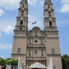
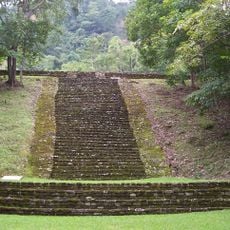
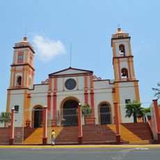
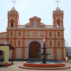
Agua Dulce Municipality, Administrative municipality in southern Veracruz, Mexico

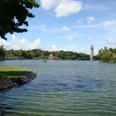
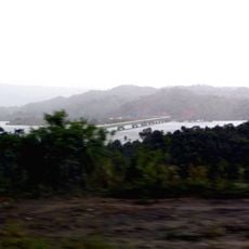
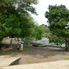
Agua Dulce is an administrative municipality in southern Veracruz that covers about 372 square kilometers along the Gulf of Mexico coast, bordering Tabasco state and Coatzacoalcos municipality. The territory is defined by natural features including the El Pesquero River and Coatzacoalcos River.

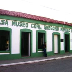
Settlement began in 1911 when the El Aguila petroleum company established operations in the area, driving early economic development. The territory was officially designated as a municipality in 1988, formalizing its administrative structure.

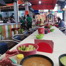
The Municipal Market serves as a gathering place where locals buy fresh produce, meats, and regional dishes reflecting everyday food traditions. It shows how people in the area source their ingredients and celebrate traditional eating habits through daily commerce.

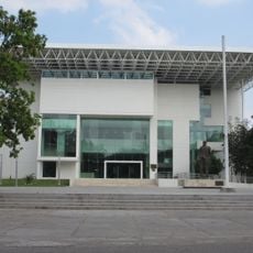
The municipality has multiple educational institutions ranging from kindergarten to higher education, including facilities from Cobaev, Cecytev, Cetmar, and UPAV systems. These schools and colleges provide various services that contribute to the local infrastructure.

The territory is shaped by three major waterways that define its boundaries: the Gulf of Mexico on the coast, the El Pesquero River, and the Coatzacoalcos River. These natural borders influence not just geography but also how residents relate to their environment and economy.

The community of curious travelers

AroundUs brings together thousands of curated places, local tips, and hidden gems, enriched daily by 60,000 contributors worldwide.

Start exploring
GPS coordinates
18.08995,-94.16236
Latest update
December 7, 2025 20:45
Reviews
Share your experience

No review yet

Discussions
Start a discussion...

No discussion yet

« Agua Dulce Municipality - Administrative municipality in southern Veracruz, Mexico » is provided by Around Us (aroundus.com). Images and texts are derived from Wikimedia project under a Creative Commons license. You are allowed to copy, distribute, and modify copies of this page, under the conditions set by the license, as long as this note is clearly visible.

Discover hidden gems everywhere you go!

From secret cafés to breathtaking viewpoints, skip the crowded tourist spots and find places that match your style. Our app makes it easy with voice search, smart filtering, route optimization, and insider tips from travelers worldwide. Download now for the complete mobile experience.

Around Us App Screenshot

A unique approach to discovering new places

Le Figaro

All the places worth exploring

France Info

A tailor-made excursion in just a few clicks

20 Minutes

Around Us
Travel Guide & Maps
Download

Send to your phone

QR Code
1

Open the camera app on your mobile.

2

Point at the QR code with your camera. A notification will appear.

3

Tap the notification to open the link.