São Lourenço do Oeste

Log in to your account

AroundUs is a community-driven map of interesting places, built by curious explorers like you. It grows with every review, story, and photo you share.
Connect to save your favorite spots, contribute locations, and create personalized routes.
Continue with Google
Continue with Apple
Continue with X
Continue with Facebook
Continue with email
By continuing, you accept our Terms and Conditions and our Privacy Policy
Create an account
Add to collection
Map
Suggest a change
Share

São Lourenço do Oeste, Municipality in Santa Catarina, Brazil

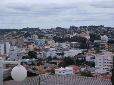
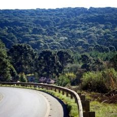
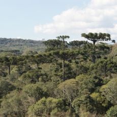
São Lourenço do Oeste is a municipality in western Santa Catarina, located on elevated terrain. The area is marked by rolling hills with scattered homes and farmland spread across the heights.

The municipality received its official administrative status in 1958 as an organized settlement in the expanding frontier region of southern Brazil. This founding was part of the broader settlement and development of western Santa Catarina.

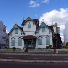
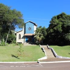
The people here maintain strong connections to German and Italian heritage through traditional celebrations, customs, and regional food. These influences show up in everyday life through local crafts and family recipes that have been passed down.

The area is connected to larger cities through an established road network, with Pato Branco Municipal Airport located around 23 kilometers from the center. Exploring the region is best done with your own vehicle since the scattered nature of settlements makes this practical.

The landscape shows distinctive farming patterns, with farms and fields arranged in a grid-like pattern across the gentle hills. This orderly layout came from intentional settlement planning and makes the region visually recognizable from a distance.

Location: Santa Catarina

Inception: 1958

Elevation above the sea: 737 m

Shares border with: Irati, Campo Erê, Formosa do Sul, Jupiá, Novo Horizonte, Renascença, Saltinho, São Bernardino, Vitorino

Website: http://saolourenco.sc.gov.br

GPS coordinates: -26.35889,-52.85083

Latest update: December 7, 2025 20:20

Photos
Reviews

Visited this place? Tap the stars to rate it and share your experience / photos with the community! Try now! You can cancel it anytime.

« São Lourenço do Oeste - Municipality in Santa Catarina, Brazil » is provided by Around Us (aroundus.com). Images and texts are derived from Wikimedia project under a Creative Commons license. You are allowed to copy, distribute, and modify copies of this page, under the conditions set by the license, as long as this note is clearly visible.

Discover hidden gems everywhere you go!

From secret cafés to breathtaking viewpoints, skip the crowded tourist spots and find places that match your style. Our app makes it easy with voice search, smart filtering, route optimization, and insider tips from travelers worldwide. Download now for the complete mobile experience.

Around Us App Screenshot

A unique approach to discovering new places

Le Figaro

All the places worth exploring

France Info

A tailor-made excursion in just a few clicks

20 Minutes