Log in to your account

AroundUs is a community-driven map of interesting places, built by curious explorers like you. It grows with every review, story, and photo you share.
Connect to save your favorite spots, contribute locations, and create personalized routes.
Continue with Google
Continue with Apple
Continue with X
Continue with Facebook
Continue with email
By continuing, you accept our Terms and Conditions and our Privacy Policy
Create an account
Add to collection
Map
Suggest a change
Share

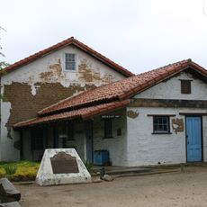
Rancho San Lucas, Historic ranch district in Monterey County, California

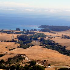
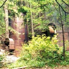
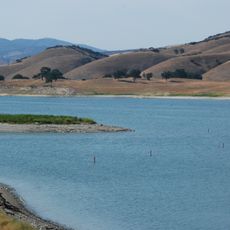
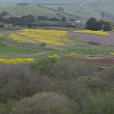
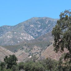
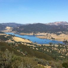
Rancho San Lucas is a historic ranch district in Monterey County located along the western bank of the Salinas River, covering thousands of acres of land. The property features an adobe barn from the 1800s and other architectural structures that show how ranches were built and organized during that era.

Governor Juan B. Alvarado granted the land to Rafael Estrada in 1842, beginning continuous ranch operations in the region under Mexican rule. Later, a Scottish sailor named James McKinley purchased the property in 1862 and sold it to Alberto Trescony, who expanded it significantly.

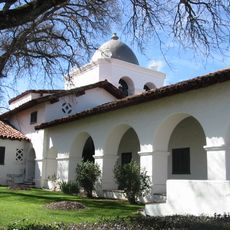
The ranch reflects the meeting of Mexican and American cultures in its landscape and buildings, showing how land and life changed over time in this region. You can see this cultural blend in the way the property is structured and used.

The property is located southwest of Paris Valley Road and can be observed from accessible viewing areas, allowing visitors to see the historic buildings from the outside. The landscape layout and river location make the site relatively easy to explore and understand.

A Scottish sailor became an unexpected owner of the property in 1862, playing a brief but important role in its history before selling to the next owner. This unusual connection shows how the American West attracted people from all corners of the world during that era.

Location: California

Inception: 1842

GPS coordinates: 36.04278,-121.00750

Latest update: December 14, 2025 18:00

Photos
Around this place
Hearst Castle
United States of America

Hearst Castle

42.3 km
Lake Nacimiento
United States of America

Lake Nacimiento

33.6 km
Mission Nuestra Señora de la Soledad
United States of America

Mission Nuestra Señora de la Soledad

51 km
Tassajara Hot Springs
United States of America

Tassajara Hot Springs

53.2 km
Hearst Ranch
United States of America

Hearst Ranch

40.8 km
Limekiln State Park
United States of America

Limekiln State Park

46.1 km
Lake San Antonio
United States of America

Lake San Antonio

21.7 km
Hearst San Simeon State Park
United States of America

Hearst San Simeon State Park

52.1 km
The Hacienda
United States of America

The Hacienda

21.5 km
Junipero Serra Peak
United States of America

Junipero Serra Peak

38.8 km
Piedras Blancas Light Station
United States of America

Piedras Blancas Light Station

48.8 km
William Randolph Hearst Memorial State Beach
United States of America

William Randolph Hearst Memorial State Beach

47.4 km
San Benito mountain
United States of America

San Benito mountain

48.9 km
Salmon Creek Falls
United States of America

Salmon Creek Falls

39.8 km
Sand Dollar Beach
United States of America

Sand Dollar Beach

43.6 km
Silver Peak Wilderness
United States of America

Silver Peak Wilderness

35.2 km
Laguna Mountain Recreation Area
United States of America

Laguna Mountain Recreation Area

36.8 km
Hernandez Reservoir
United States of America

Hernandez Reservoir

41.4 km
Rios-Caledonia Adobe
United States of America

Rios-Caledonia Adobe

43.9 km
King City High School Auditorium
United States of America

King City High School Auditorium

21.7 km
Sebastian Store
United States of America

Sebastian Store

47.5 km
Estrella Adobe Church
United States of America

Estrella Adobe Church

52.2 km
William Randolph Hearst Memorial Beach
United States of America

William Randolph Hearst Memorial Beach

47.6 km
Mission Soledad Museum
United States of America

Mission Soledad Museum

51 km
Bear Gulch Reservoir
United States of America

Bear Gulch Reservoir

50.5 km
Juniper Canyon Trail
United States of America

Juniper Canyon Trail

52 km
Fort Hunter Liggett
United States of America

Fort Hunter Liggett

22.5 km
Chalone Peak Lookout
United States of America

Chalone Peak Lookout

48.1 km
Show the full map
Reviews

Visited this place? Tap the stars to rate it and share your experience / photos with the community! Try now! You can cancel it anytime.

« Rancho San Lucas - Historic ranch district in Monterey County, California » is provided by Around Us (aroundus.com). Images and texts are derived from Wikimedia project under a Creative Commons license. You are allowed to copy, distribute, and modify copies of this page, under the conditions set by the license, as long as this note is clearly visible.

Discover hidden gems everywhere you go!

From secret cafés to breathtaking viewpoints, skip the crowded tourist spots and find places that match your style. Our app makes it easy with voice search, smart filtering, route optimization, and insider tips from travelers worldwide. Download now for the complete mobile experience.

Around Us App Screenshot

A unique approach to discovering new places

Le Figaro

All the places worth exploring

France Info

A tailor-made excursion in just a few clicks

20 Minutes