Chest opened
+${chestReward.xp} XP
Explorer
NOUVEAU ×${chestReward.collectible.quantity}
tapez pour fermer
Chest locked

Open chests in the app

Around Us is built for your phone — chests unlock when you walk, explore and capture nearby places.

Enable Location

We need your location to show you interesting places around you

Discover nearby places

Find interesting locations and hidden gems around you

Precise directions

Get accurate directions and distances to places

Your location is never shared with other users. It's only used when you tap the location button.

Williams

Log in to your account

Start exploring — it's free

Trusted by 72,886 travelers worldwide

Continue with Google
Continue with Apple
or

We will send you a code to connect

By continuing, you accept our Terms and Conditions and our Privacy Policy

Check your inbox

We've sent a pincode in your inbox. Please enter the code below.

Discussion Reviews 1 Photos
16.5k Popularity

Williams, city in Colusa County, California, United States

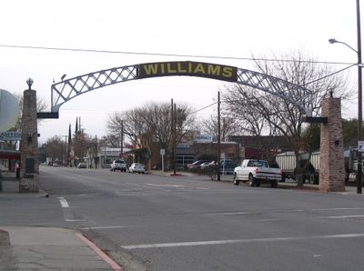
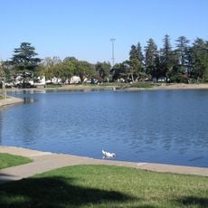
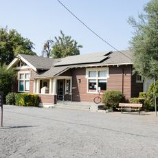
Williams is a small city in Colusa County, California, sitting in the flat Sacramento Valley farmland. Its main street runs through the center with basic shops, gas stations, and restaurants that serve travelers passing through on Interstate 5.

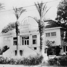
The town was named in 1876 after William Henry Williams, a landowner whose property the new railroad crossed. The railroad drew settlers and businesses, and the settlement was incorporated as a city in 1920.

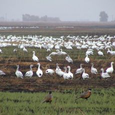
The name honors William Henry Williams, who founded the town. Agriculture remains central to daily life here, with farming families and rural traditions shaping how residents connect to the land and each other.

Williams sits directly on Interstate 5, making it easy to reach by car and well placed for a short stop. The flat terrain makes it easy to get around on foot or by bike if you want to explore beyond the main road.

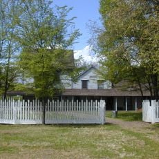
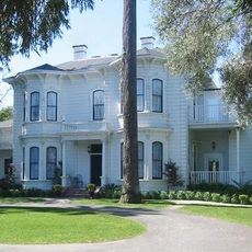
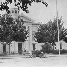
A fire in 1885 destroyed several buildings at the heart of the settlement, yet the town rebuilt quickly. Some of the oldest surviving structures in the city date from the years right after that fire.

The community of curious travelers

AroundUs brings together thousands of curated places, local tips, and hidden gems, enriched daily by 60,000 contributors worldwide.

Start exploring
Location
Inception
1920
Elevation above the sea
25 m
GPS coordinates
39.15472,-122.14944
Latest update
March 3, 2026 08:20
Around this place
Sutter Buttes
United States of America

Sutter Buttes

30.3 km
United States of America

Thunderhill Raceway Park

45.7 km
Berryessa Snow Mountain National Monument
United States of America

Berryessa Snow Mountain National Monument

35.2 km
Sacramento National Wildlife Refuge Complex
United States of America

Sacramento National Wildlife Refuge Complex

30.8 km
Anderson Marsh State Historic Park
United States of America

Anderson Marsh State Historic Park

49.2 km
Bok Kai Temple
United States of America

Bok Kai Temple

48.6 km
Delevan National Wildlife Refuge
United States of America

Delevan National Wildlife Refuge

18.5 km
Colusa National Wildlife Refuge
United States of America

Colusa National Wildlife Refuge

9.2 km
Sutter National Wildlife Refuge
United States of America

Sutter National Wildlife Refuge

34.9 km
Ellis Lake
United States of America

Ellis Lake

48.5 km
Blue Ridge Berryessa Natural Area
United States of America

Blue Ridge Berryessa Natural Area

50 km
Cache Creek Wilderness
United States of America

Cache Creek Wilderness

40.5 km
East Park Dam
United States of America

East Park Dam

38.9 km
Sacramento Valley Museum
United States of America

Sacramento Valley Museum

1.1 km
Zim Zim Falls
United States of America

Zim Zim Falls

44.2 km
Community Memorial Museum of Sutter County
United States of America

Community Memorial Museum of Sutter County

44.3 km
Yolo Branch Library
United States of America

Yolo Branch Library

55.5 km
Live Oak Historic Commercial District
United States of America

Live Oak Historic Commercial District

44.2 km
Griffith Mansion
United States of America

Griffith Mansion

55.8 km
Yuba City Astronomical Observatory
United States of America

Yuba City Astronomical Observatory

44.7 km
Grand Island Shrine
United States of America

Grand Island Shrine

18.9 km
Hart Building
United States of America

Hart Building

48.4 km
Packard Library
United States of America

Packard Library

48.5 km
Colusa County Courthouse
United States of America

Colusa County Courthouse

13.8 km
Marysville Historic Commercial District
United States of America

Marysville Historic Commercial District

48.5 km
West Butte Schoolhouse
United States of America

West Butte Schoolhouse

23.6 km
Bayliss Carnegie Library
United States of America

Bayliss Carnegie Library

48.5 km
Yuba County Library
United States of America

Yuba County Library

48.5 km
Show the full map
Reviews
Share your experience

No review yet

Discussions
Start a discussion...

No discussion yet

« Williams - city in Colusa County, California, United States » is provided by Around Us (aroundus.com). Images and texts are derived from Wikimedia project under a Creative Commons license. You are allowed to copy, distribute, and modify copies of this page, under the conditions set by the license, as long as this note is clearly visible.

Discover hidden gems everywhere you go!

From secret cafés to breathtaking viewpoints, skip the crowded tourist spots and find places that match your style. Our app makes it easy with voice search, smart filtering, route optimization, and insider tips from travelers worldwide. Download now for the complete mobile experience.

Around Us App Screenshot

A unique approach to discovering new places

Le Figaro

All the places worth exploring

France Info

A tailor-made excursion in just a few clicks

20 Minutes

Around Us
Travel Guide & Maps
Download

Send to your phone

QR Code
1

Open the camera app on your mobile.

2

Point at the QR code with your camera. A notification will appear.

3

Tap the notification to open the link.