Chest opened
+${chestReward.xp} XP
Explorer
NOUVEAU ×${chestReward.collectible.quantity}
tapez pour fermer
Chest locked

Open chests in the app

Around Us is built for your phone — chests unlock when you walk, explore and capture nearby places.

Enable Location

We need your location to show you interesting places around you

Discover nearby places

Find interesting locations and hidden gems around you

Precise directions

Get accurate directions and distances to places

Your location is never shared with other users. It's only used when you tap the location button.

U.S. Route 199

Log in to your account

Start exploring — it's free

Trusted by 72,884 travelers worldwide

Continue with Google
Continue with Apple
or

We will send you a code to connect

By continuing, you accept our Terms and Conditions and our Privacy Policy

Check your inbox

We've sent a pincode in your inbox. Please enter the code below.

U.S. Route 199
Discussion Reviews 1 Photos
16.4k Popularity

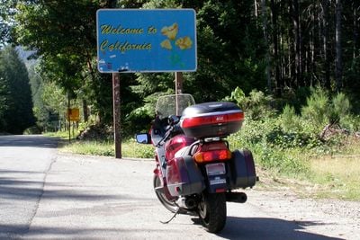
U.S. Route 199, highway in California and Oregon

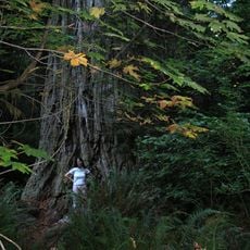
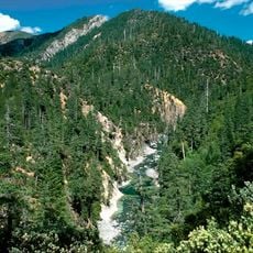
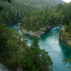
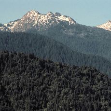
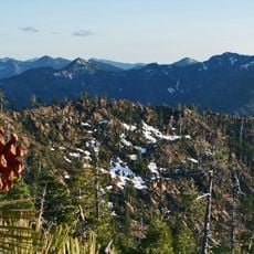
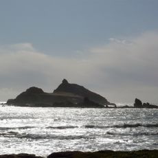
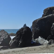
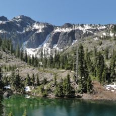
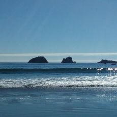
U.S. Route 199 is a highway running roughly 80 miles (130 kilometers) from near Crescent City in California to Grants Pass in Oregon, mostly through thick forests and mountainous terrain. The road follows the Smith River and its forks, curves around hills with many twists, and passes through national forest areas, recreation lands, and small communities including Hiouchi and Gasquet.

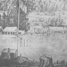
The highway began in the mid-1800s as a wagon road connecting Crescent City with Oregon, with some sections built using planks or logs for difficult terrain. In the early 1900s, the route was improved with toll roads, bridges, and later complete paving, becoming officially designated as U.S. Route 199 in 1926.

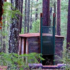
The highway has become part of local identity, linking California with Oregon through a forested mountain landscape. Small towns along the route like Gasquet maintain a quiet, grounded way of life where forestry and conservation efforts shape daily routines and community connections.

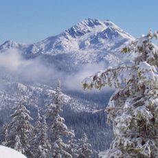
The highway has many curves and is narrow in some sections, so careful driving is required especially in bad weather or at night. Weather can change quickly here, and travelers should be prepared for varying conditions as clear skies alternate with rain and fog.

The highway was built with a long tunnel, the Collier Tunnel, completed in 1963 and running about 2,100 feet (640 meters) through Hazel View Summit. This tunnel replaced an older, much more winding route called Oregon Mountain Road that travelers previously had to take.

The community of curious travelers

AroundUs brings together thousands of curated places, local tips, and hidden gems, enriched daily by 60,000 contributors worldwide.

Start exploring
Location
Location
Inception
1926
GPS coordinates
41.99683,-123.72142
Latest update
February 17, 2026 02:00
Around this place
Redwood National and State Parks
United States of America

Redwood National and State Parks

59.1 km
Bigfoot trap
United States of America

Bigfoot trap

48 km
Jedediah Smith Redwoods State Park
United States of America

Jedediah Smith Redwoods State Park

39.5 km
Del Norte Coast Redwoods State Park
United States of America

Del Norte Coast Redwoods State Park

45.4 km
Lost Monarch
United States of America

Lost Monarch

38.2 km
Battery Point Light
United States of America

Battery Point Light

48.8 km
Harris Beach State Park
United States of America

Harris Beach State Park

49 km
Samuel H. Boardman State Scenic Corridor
United States of America

Samuel H. Boardman State Scenic Corridor

54.1 km
Kalmiopsis Wilderness
United States of America

Kalmiopsis Wilderness

37.6 km
Smith River National Recreation Area
United States of America

Smith River National Recreation Area

29.2 km
Red Buttes Wilderness
United States of America

Red Buttes Wilderness

28.4 km
Siskiyou Wilderness
United States of America

Siskiyou Wilderness

34.7 km
Applegate Lake
United States of America

Applegate Lake

50.6 km
Castle Rock National Wildlife Refuge
United States of America

Castle Rock National Wildlife Refuge

51 km
Oregon Caves Chateau
United States of America

Oregon Caves Chateau

28.3 km
Tolowa Dunes State Park
United States of America

Tolowa Dunes State Park

42.2 km
Alfred A. Loeb State Park
United States of America

Alfred A. Loeb State Park

40.7 km
Lone Ranch Beach
United States of America

Lone Ranch Beach

52.6 km
Bear Mountain
United States of America

Bear Mountain

22.7 km
Preston Peak
United States of America

Preston Peak

20.1 km
Camp Lincoln
United States of America

Camp Lincoln

39.6 km
Oregon Caves Historic District
United States of America

Oregon Caves Historic District

28.4 km
Cedar Guard Station
United States of America

Cedar Guard Station

27.1 km
Gasquet Ranger Station Historic District
United States of America

Gasquet Ranger Station Historic District

26.4 km
Crissey Field State Recreation Site

Crissey Field State Recreation Site

40.5 km
Pebble Beach
United States of America

Pebble Beach

49.6 km
Sporthaven Beach
United States of America

Sporthaven Beach

45.1 km
Harris Sate Park Campground
United States of America

Harris Sate Park Campground

49.2 km
Show the full map
Reviews
Share your experience

No review yet

Discussions
Start a discussion...

No discussion yet

« U.S. Route 199 - highway in California and Oregon » is provided by Around Us (aroundus.com). Images and texts are derived from Wikimedia project under a Creative Commons license. You are allowed to copy, distribute, and modify copies of this page, under the conditions set by the license, as long as this note is clearly visible.

Discover hidden gems everywhere you go!

From secret cafés to breathtaking viewpoints, skip the crowded tourist spots and find places that match your style. Our app makes it easy with voice search, smart filtering, route optimization, and insider tips from travelers worldwide. Download now for the complete mobile experience.

Around Us App Screenshot

A unique approach to discovering new places

Le Figaro

All the places worth exploring

France Info

A tailor-made excursion in just a few clicks

20 Minutes

Around Us
Travel Guide & Maps
Download

Send to your phone

QR Code
1

Open the camera app on your mobile.

2

Point at the QR code with your camera. A notification will appear.

3

Tap the notification to open the link.