Enable Location

We need your location to show you interesting places around you

Discover nearby places

Find interesting locations and hidden gems around you

Precise directions

Get accurate directions and distances to places

Your location is never shared with other users. It's only used when you tap the location button.

Log in to your account

Start exploring — it's free

Trusted by 62,408 travelers worldwide

Continue with Google
Continue with Apple
or

We will send you a code to connect

By continuing, you accept our Terms and Conditions and our Privacy Policy

Check your inbox

We've sent a pincode in your inbox. Please enter the code below.

John C. Boyle Reservoir

John C. Boyle Reservoir, artificial impoundment in the U.S. state of Oregon

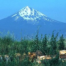
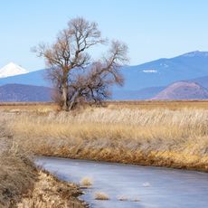
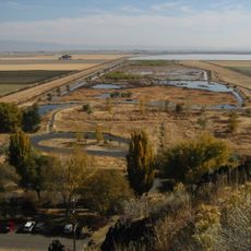
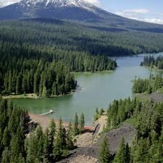
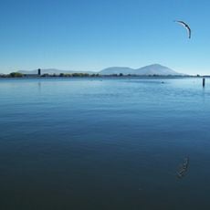
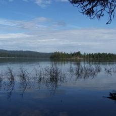
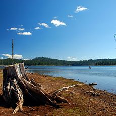
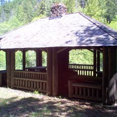
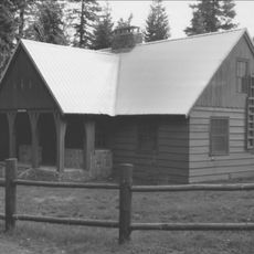
John C. Boyle Reservoir is a man-made lake on the Klamath River in Oregon created by a dam, covering about 381 acres with depths reaching 45 feet (14 meters). Forested areas surround the water, and the site included recreational facilities such as a campground, boat ramp, and fishing pier at the Topsy Recreation Site.

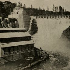
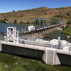
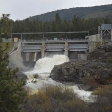
The dam and reservoir were built in the 1950s to generate hydroelectric power and renamed in 1962 after John C. Boyle, a leader at the power company that owned the facility. In recent years, efforts have focused on removing the dam to restore natural river flow and allow fish such as salmon to return to their historic spawning areas.

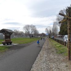
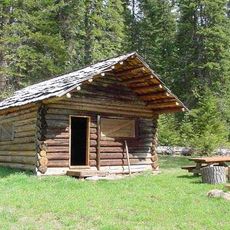
The reservoir has long been part of the local community's outdoor traditions, serving as a gathering place for families and anglers who valued the land and water. The site represented a way of life centered on fishing, camping, and spending time in nature with others.

Access to the site is via Oregon Route 66 near Klamath Falls and Keno, where visitors can fish, boat, and picnic along the shore. Check current conditions before visiting, as water levels shift and some areas may be restricted due to ongoing restoration work.

The reservoir is undergoing a transformation as the dam is being removed to restore the river to its natural flow and allow salmon and steelhead to return to their historic spawning grounds. This makes it a rare example of river restoration where visitors can witness ecological recovery in real time.

The community of curious travelers

AroundUs brings together thousands of curated places, local tips, and hidden gems, enriched daily by 60,000 contributors worldwide.

Start exploring
Location
GPS coordinates
42.14000,-122.03400
Latest update
February 9, 2026 07:46
Around this place
Mount McLoughlin
United States of America

Mount McLoughlin

41.1 km
Lower Klamath National Wildlife Refuge
United States of America

Lower Klamath National Wildlife Refuge

35.1 km
Copco Lake
United States of America

Copco Lake

28.6 km
Link River Dam
United States of America

Link River Dam

21.8 km
Tule Lake National Wildlife Refuge
United States of America

Tule Lake National Wildlife Refuge

52.9 km
OC&E Woods Line State Trail
United States of America

OC&E Woods Line State Trail

24.4 km
Fish Lake
United States of America

Fish Lake

37 km
John C. Boyle Dam
United States of America

John C. Boyle Dam

2.2 km
Lake Ewauna
United States of America

Lake Ewauna

22.6 km
Mountain Lakes Wilderness
United States of America

Mountain Lakes Wilderness

24 km
Howard Prairie Lake
United States of America

Howard Prairie Lake

29.5 km
Soda Mountain Wilderness
United States of America

Soda Mountain Wilderness

37.2 km
Bear Valley National Wildlife Refuge
United States of America

Bear Valley National Wildlife Refuge

14.9 km
Upper Klamath National Wildlife Refuge
United States of America

Upper Klamath National Wildlife Refuge

41 km
Fourmile Lake
United States of America

Fourmile Lake

40.5 km
Klamath Basin National Wildlife Refuge Complex
United States of America

Klamath Basin National Wildlife Refuge Complex

44.3 km
Tub Springs State Wayside
United States of America

Tub Springs State Wayside

33.4 km
Hyatt Reservoir
United States of America

Hyatt Reservoir

35 km
Baldwin Hotel
United States of America

Baldwin Hotel

22.3 km
Willow Prairie Cabin
United States of America

Willow Prairie Cabin

41.9 km
Dead Indian Soda Springs
United States of America

Dead Indian Soda Springs

40.3 km
Lake of the Woods Ranger Station
United States of America

Lake of the Woods Ranger Station

31.7 km
Klamath Falls City Hall
United States of America

Klamath Falls City Hall

22.8 km
Nils Ahlstrom House
United States of America

Nils Ahlstrom House

32.2 km
Blackburn Sanitarium
United States of America

Blackburn Sanitarium

24 km
Judge Henry L. Benson House
United States of America

Judge Henry L. Benson House

22.5 km
Richardson–Ulrich House
United States of America

Richardson–Ulrich House

22 km
Klamath County Museum
United States of America

Klamath County Museum

23.5 km
Show the full map
« John C. Boyle Reservoir - artificial impoundment in the U.S. state of Oregon » is provided by Around Us (aroundus.com). Images and texts are derived from Wikimedia project under a Creative Commons license. You are allowed to copy, distribute, and modify copies of this page, under the conditions set by the license, as long as this note is clearly visible.

Discover hidden gems everywhere you go!

From secret cafés to breathtaking viewpoints, skip the crowded tourist spots and find places that match your style. Our app makes it easy with voice search, smart filtering, route optimization, and insider tips from travelers worldwide. Download now for the complete mobile experience.

Around Us App Screenshot

A unique approach to discovering new places

Le Figaro

All the places worth exploring

France Info

A tailor-made excursion in just a few clicks

20 Minutes

Around Us
Travel Guide & Maps
Download

Send to your phone

QR Code
1

Open the camera app on your mobile.

2

Point at the QR code with your camera. A notification will appear.

3

Tap the notification to open the link.