Chest opened
+${chestReward.xp} XP
Explorer
NOUVEAU ×${chestReward.collectible.quantity}
tapez pour fermer
Chest locked

Open chests in the app

Around Us is built for your phone — chests unlock when you walk, explore and capture nearby places.

Enable Location

We need your location to show you interesting places around you

Discover nearby places

Find interesting locations and hidden gems around you

Precise directions

Get accurate directions and distances to places

Your location is never shared with other users. It's only used when you tap the location button.

Chiloquin

Log in to your account

Start exploring — it's free

Trusted by 72,890 travelers worldwide

Continue with Google
Continue with Apple
or

We will send you a code to connect

By continuing, you accept our Terms and Conditions and our Privacy Policy

Check your inbox

We've sent a pincode in your inbox. Please enter the code below.

Discussion Reviews 2 Photos
19.3k Popularity

Chiloquin, city in Oregon, USA

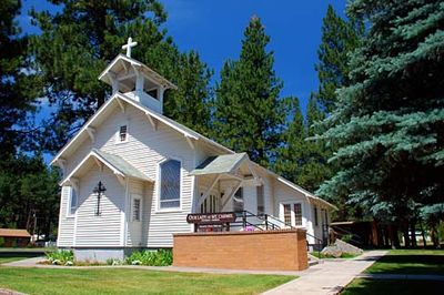
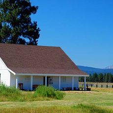
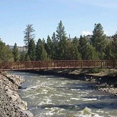
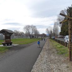
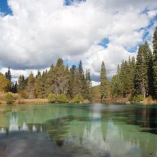
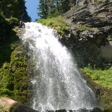
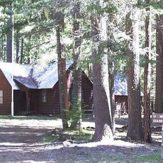
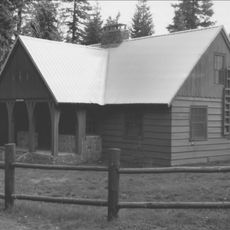
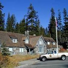
Chiloquin is a small city in Klamath County, Oregon, situated near rivers and lakes in an open landscape. The town features simple wooden structures housing local shops and cafes, functioning as a base for exploring surrounding national forests and waterways.

The area was originally home to the Klamath people before settlers arrived in the region. This native heritage shaped the cultural foundation that continues to influence the town today.

The town carries the name of the Klamath people who have lived in this region for generations. Their traditions and stories continue to shape local identity and are celebrated through community gatherings.

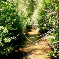
The town has limited services due to its small size, so visitors should plan ahead for any specific needs. The best time to visit is spring and summer when the weather is mild and the landscape is full of green vegetation.

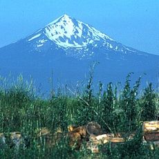
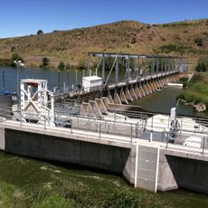
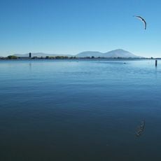
Many visitors overlook that this place serves as an excellent base for observing wildlife in their natural habitat, including birds and deer. The proximity to multiple lakes makes it possible to combine wildlife watching with water activities like fishing and boating.

The community of curious travelers

AroundUs brings together thousands of curated places, local tips, and hidden gems, enriched daily by 60,000 contributors worldwide.

Start exploring
Location
Inception
1926
Elevation above the sea
1,280 m
GPS coordinates
42.57500,-121.86417
Latest update
February 16, 2026 22:40
Around this place
Mount McLoughlin
United States of America

Mount McLoughlin

39.8 km
Train Mountain Railroad
United States of America

Train Mountain Railroad

2.9 km
Mount Scott
United States of America

Mount Scott

40.7 km
Fort Klamath
United States of America

Fort Klamath

15.8 km
Fremont-Winema National Forest
United States of America

Fremont-Winema National Forest

29 km
Link River Dam
United States of America

Link River Dam

38.3 km
Sky Lakes Wilderness
United States of America

Sky Lakes Wilderness

30.5 km
OC&E Woods Line State Trail
United States of America

OC&E Woods Line State Trail

41.9 km
Collier Memorial State Park
United States of America

Collier Memorial State Park

7.7 km
Sun Pass State Forest
United States of America

Sun Pass State Forest

18.1 km
Jackson F. Kimball State Recreation Site
United States of America

Jackson F. Kimball State Recreation Site

20.5 km
Lake Ewauna
United States of America

Lake Ewauna

40.9 km
Mountain Lakes Wilderness
United States of America

Mountain Lakes Wilderness

31.7 km
Upper Klamath National Wildlife Refuge
United States of America

Upper Klamath National Wildlife Refuge

16.4 km
Union Peak
United States of America

Union Peak

41 km
Fourmile Lake
United States of America

Fourmile Lake

34.2 km
Baldwin Hotel
United States of America

Baldwin Hotel

40 km
Plaikni Falls
United States of America

Plaikni Falls

40.2 km
Imnaha Guard Station
United States of America

Imnaha Guard Station

40.8 km
Lake of the Woods Ranger Station
United States of America

Lake of the Woods Ranger Station

36.4 km
Klamath Falls City Hall
United States of America

Klamath Falls City Hall

39.7 km
Blackburn Sanitarium
United States of America

Blackburn Sanitarium

38.8 km
Judge Henry L. Benson House
United States of America

Judge Henry L. Benson House

39.7 km
Honeymoon Creek Snow-Survey Cabin
United States of America

Honeymoon Creek Snow-Survey Cabin

29.2 km
Richardson–Ulrich House
United States of America

Richardson–Ulrich House

39.6 km
Castle Crest Wildflower Trail
United States of America

Castle Crest Wildflower Trail

42 km
Klamath County Museum
United States of America

Klamath County Museum

39.2 km
Steel Visitor Center
United States of America

Steel Visitor Center

42.1 km
Show the full map
Reviews
Share your experience

No review yet

Discussions
Start a discussion...

No discussion yet

« Chiloquin - city in Oregon, USA » is provided by Around Us (aroundus.com). Images and texts are derived from Wikimedia project under a Creative Commons license. You are allowed to copy, distribute, and modify copies of this page, under the conditions set by the license, as long as this note is clearly visible.

Discover hidden gems everywhere you go!

From secret cafés to breathtaking viewpoints, skip the crowded tourist spots and find places that match your style. Our app makes it easy with voice search, smart filtering, route optimization, and insider tips from travelers worldwide. Download now for the complete mobile experience.

Around Us App Screenshot

A unique approach to discovering new places

Le Figaro

All the places worth exploring

France Info

A tailor-made excursion in just a few clicks

20 Minutes

Around Us
Travel Guide & Maps
Download

Send to your phone

QR Code
1

Open the camera app on your mobile.

2

Point at the QR code with your camera. A notification will appear.

3

Tap the notification to open the link.