Enable Location

We need your location to show you interesting places around you

Discover nearby places

Find interesting locations and hidden gems around you

Precise directions

Get accurate directions and distances to places

Your location is never shared with other users. It's only used when you tap the location button.

Log in to your account

Start exploring — it's free

Trusted by 65,429 travelers worldwide

Continue with Google
Continue with Apple
or

We will send you a code to connect

By continuing, you accept our Terms and Conditions and our Privacy Policy

Check your inbox

We've sent a pincode in your inbox. Please enter the code below.

Pixieland
Discussion Reviews Photo
5.6k Popularity

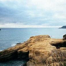
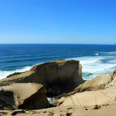
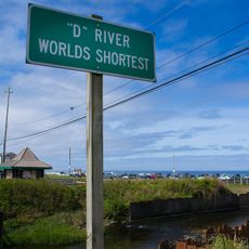
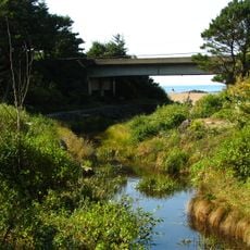
Pixieland, Family amusement park in Otis Junction, Oregon

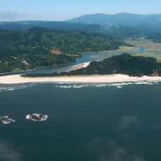
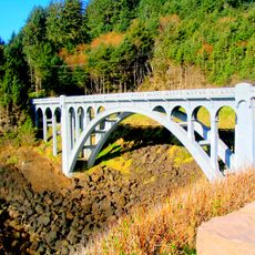
Pixieland was an amusement park near Lincoln City, Oregon, spread across a large property with rides such as a log flume, bumper cars, and a narrow-gauge train that circled the grounds. The park also had several food stands, including the Darigold Cheese Barn, a Fisher Scones outlet, and the Franz Bread Rest Hut.

The park opened in June 1969, funded through public stock offerings, and was dedicated by Governor Tom McCall at a ceremony marking its launch. It was built and run by people with backgrounds in the entertainment industry, which shaped the way the grounds were laid out and programmed.

The Blue Bell Opera House and the Main Street Arcade were two gathering spots inside the park where families spent time between rides. The overall layout was built around the idea of a small town, with named streets and themed areas that gave the place a distinct character.

The grounds were spread out, so comfortable shoes and enough time to walk between different areas made for a better visit. Picking up a map at the entrance helped visitors figure out the layout before heading in.

Paul Newman visited the park in 1971 while the film 'Sometimes a Great Notion' was being shot nearby, which was an unusual connection to Hollywood for a regional park in the Pacific Northwest. The film used several locations in the area, making the park part of a broader moment in local film history.

The community of curious travelers

AroundUs brings together thousands of curated places, local tips, and hidden gems, enriched daily by 60,000 contributors worldwide.

Start exploring
Location
GPS coordinates
45.02050,-123.96500
Latest update
March 3, 2026 10:08
Around this place
Devils Punch Bowl State Natural Area
United States of America

Devils Punch Bowl State Natural Area

31.6 km
Cape Kiwanda State Natural Area
United States of America

Cape Kiwanda State Natural Area

21.8 km
Beverly Beach State Park
United States of America

Beverly Beach State Park

33.2 km
Cascade Head
United States of America

Cascade Head

29.5 km
Chinook Winds Casino
United States of America

Chinook Winds Casino

4.3 km
Whale Watching Center
United States of America

Whale Watching Center

24.6 km
Devils Punchbowl State Natural Area
United States of America

Devils Punchbowl State Natural Area

31.4 km
Fort Yamhill
United States of America

Fort Yamhill

31.5 km
H. B. Van Duzer Forest State Scenic Corridor
United States of America

H. B. Van Duzer Forest State Scenic Corridor

13 km
Boiler Bay State Scenic Viewpoint
United States of America

Boiler Bay State Scenic Viewpoint

22.8 km
Devil's Lake State Recreation Area
United States of America

Devil's Lake State Recreation Area

6.7 km
Bob Straub State Park
United States of America

Bob Straub State Park

18.1 km
Siletz Bay National Wildlife Refuge
United States of America

Siletz Bay National Wildlife Refuge

13.7 km
Salmon River
United States of America

Salmon River

10 km
D River State Recreation Site
United States of America

D River State Recreation Site

7.3 km
Neskowin Beach State Recreation Site
United States of America

Neskowin Beach State Recreation Site

9.2 km
Nestucca Bay National Wildlife Refuge
United States of America

Nestucca Bay National Wildlife Refuge

17 km
Devil's Punchbowl
United States of America

Devil's Punchbowl

31.5 km
Otter Crest State Scenic Viewpoint
United States of America

Otter Crest State Scenic Viewpoint

30 km
Roads End State Recreation Site
United States of America

Roads End State Recreation Site

3.8 km
Rocky Creek State Scenic Viewpoint
United States of America

Rocky Creek State Scenic Viewpoint

27.9 km
Fogarty Creek State Recreation Area
United States of America

Fogarty Creek State Recreation Area

20.8 km
Gleneden Beach State Recreation Site
United States of America

Gleneden Beach State Recreation Site

17 km
Depoe Bay Bridge
United States of America

Depoe Bay Bridge

24.6 km
Drift Creek Bridge
United States of America

Drift Creek Bridge

6.9 km
Rocky Creek Bridge
United States of America

Rocky Creek Bridge

28.2 km
Neskowin Beach
United States of America

Neskowin Beach

9.3 km
Whale Research EcoExcursions
United States of America

Whale Research EcoExcursions

24.8 km
Show the full map
Reviews
Share your experience

No review yet

Discussions
Start a discussion...

No discussion yet

« Pixieland - Family amusement park in Otis Junction, Oregon » is provided by Around Us (aroundus.com). Images and texts are derived from Wikimedia project under a Creative Commons license. You are allowed to copy, distribute, and modify copies of this page, under the conditions set by the license, as long as this note is clearly visible.

Discover hidden gems everywhere you go!

From secret cafés to breathtaking viewpoints, skip the crowded tourist spots and find places that match your style. Our app makes it easy with voice search, smart filtering, route optimization, and insider tips from travelers worldwide. Download now for the complete mobile experience.

Around Us App Screenshot

A unique approach to discovering new places

Le Figaro

All the places worth exploring

France Info

A tailor-made excursion in just a few clicks

20 Minutes

Around Us
Travel Guide & Maps
Download

Send to your phone

QR Code
1

Open the camera app on your mobile.

2

Point at the QR code with your camera. A notification will appear.

3

Tap the notification to open the link.