Chest opened
+${chestReward.xp} XP
Explorer
NOUVEAU ×${chestReward.collectible.quantity}
tapez pour fermer
Chest locked

Open chests in the app

Around Us is built for your phone — chests unlock when you walk, explore and capture nearby places.

Enable Location

We need your location to show you interesting places around you

Discover nearby places

Find interesting locations and hidden gems around you

Precise directions

Get accurate directions and distances to places

Your location is never shared with other users. It's only used when you tap the location button.

Christmas Valley

Log in to your account

Start exploring — it's free

Trusted by 72,989 travelers worldwide

Continue with Google
Continue with Apple
or

We will send you a code to connect

By continuing, you accept our Terms and Conditions and our Privacy Policy

Check your inbox

We've sent a pincode in your inbox. Please enter the code below.

Discussion Reviews 1 Photos
26.3k Popularity

Christmas Valley, Unincorporated community in Lake County, Oregon.

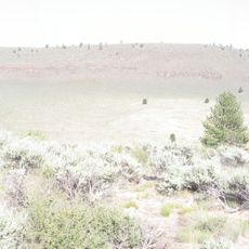
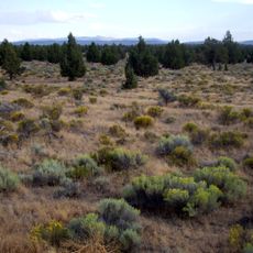
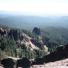
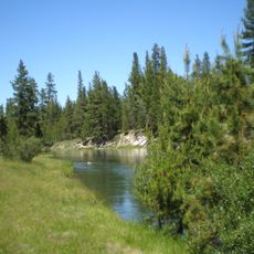
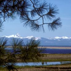
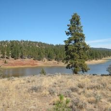
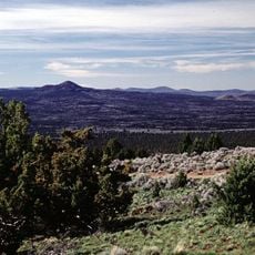
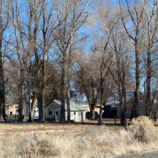
Christmas Valley is a rural community situated at about 1,300 feet (400 meters) elevation in southeastern Oregon's high-desert region, surrounded by working farms and open grassland. The settlement spreads across a relatively flat landscape defined by agricultural land, with views of distant natural formations and desert terrain.

The name comes from Christmas Lake and pioneer Peter Christman, who herded cattle across these lands in the 1800s. What began as grazing grounds gradually became a settled community as more farmers moved to the area.

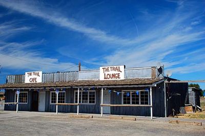
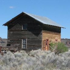
The community roots itself in ranching and farming, with the rodeo grounds serving as a gathering place for local celebrations and events. Daily agricultural work shapes the pace and character of life here.

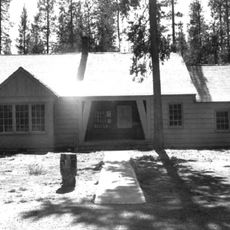
The community has a grocery store, a few dining options, motel accommodations, and a nine-hole golf course run by the local recreation district. Services are modest but cover the basic needs of travelers passing through or staying for a short time.

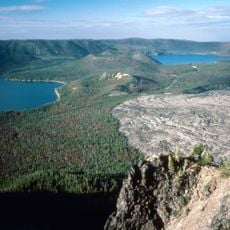
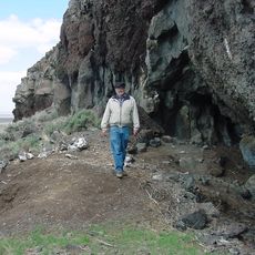
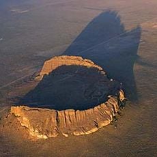
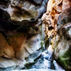
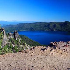
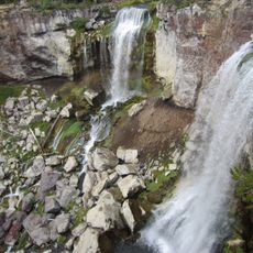
Nearby sand dunes and a lava field with four small craters reveal the region's volcanic geology in striking ways that most visitors overlook. These geological features tell the story of ancient geological activity that shaped the landscape.

The community of curious travelers

AroundUs brings together thousands of curated places, local tips, and hidden gems, enriched daily by 60,000 contributors worldwide.

Start exploring
Location
Elevation above the sea
1,317 m
GPS coordinates
43.23640,-120.63600
Latest update
December 20, 2025 15:22
Around this place
Newberry Volcano
United States of America

Newberry Volcano

71 km
Paisley Caves
United States of America

Paisley Caves

53.3 km
Newberry National Volcanic Monument
United States of America

Newberry National Volcanic Monument

71.2 km
Lava River Cave
United States of America

Lava River Cave

94.2 km
Fort Rock
United States of America

Fort Rock

38.6 km
Fort Rock Cave
United States of America

Fort Rock Cave

40.9 km
Hole-in-the-Ground
United States of America

Hole-in-the-Ground

49.1 km
Crack in the Ground
United States of America

Crack in the Ground

10.2 km
Oregon Badlands Wilderness
United States of America

Oregon Badlands Wilderness

91 km
Summer Lake Hot Springs
United States of America

Summer Lake Hot Springs

56.9 km
Fremont-Winema National Forest
United States of America

Fremont-Winema National Forest

95.3 km
Fossil Lake
United States of America

Fossil Lake

15.4 km
Lost Forest Research Natural Area
United States of America

Lost Forest Research Natural Area

29.5 km
Summer Lake Wildlife Area
United States of America

Summer Lake Wildlife Area

33.3 km
Gearhart Mountain Wilderness
United States of America

Gearhart Mountain Wilderness

82.6 km
Pine Mountain Observatory
United States of America

Pine Mountain Observatory

66.5 km
Picture Rock Pass Petroglyphs Site
United States of America

Picture Rock Pass Petroglyphs Site

24.9 km
La Pine State Park
United States of America

La Pine State Park

93.9 km
Fort Rock Valley Historical Homestead Museum
United States of America

Fort Rock Valley Historical Homestead Museum

36.8 km
Paulina Peak
United States of America

Paulina Peak

71 km
Klamath Marsh National Wildlife Refuge
United States of America

Klamath Marsh National Wildlife Refuge

85.1 km
Cabin Lake Guard Station
United States of America

Cabin Lake Guard Station

44.4 km
Paulina Falls
United States of America

Paulina Falls

74.4 km
Chickahominy Reservoir
United States of America

Chickahominy Reservoir

89.5 km
Antelope Flat Reservoir
United States of America

Antelope Flat Reservoir

87.7 km
Paulina Lake Guard Station
United States of America

Paulina Lake Guard Station

74 km
East Lava Field
United States of America

East Lava Field

27.4 km
Ed Eskelin Ranch
United States of America

Ed Eskelin Ranch

22.4 km
Show the full map
Reviews
Share your experience

No review yet

Discussions
Start a discussion...

No discussion yet

« Christmas Valley - Unincorporated community in Lake County, Oregon » is provided by Around Us (aroundus.com). Images and texts are derived from Wikimedia project under a Creative Commons license. You are allowed to copy, distribute, and modify copies of this page, under the conditions set by the license, as long as this note is clearly visible.

Discover hidden gems everywhere you go!

From secret cafés to breathtaking viewpoints, skip the crowded tourist spots and find places that match your style. Our app makes it easy with voice search, smart filtering, route optimization, and insider tips from travelers worldwide. Download now for the complete mobile experience.

Around Us App Screenshot

A unique approach to discovering new places

Le Figaro

All the places worth exploring

France Info

A tailor-made excursion in just a few clicks

20 Minutes

Around Us
Travel Guide & Maps
Download

Send to your phone

QR Code
1

Open the camera app on your mobile.

2

Point at the QR code with your camera. A notification will appear.

3

Tap the notification to open the link.