Crystal Peak

Log in to your account

AroundUs is a community-driven map of interesting places, built by curious explorers like you. It grows with every review, story, and photo you share.
Connect to save your favorite spots, contribute locations, and create personalized routes.
By continuing, you accept our Terms and Conditions and our Privacy Policy
Add to collection
Map
Suggest a change
Share

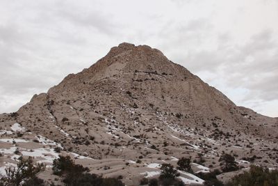
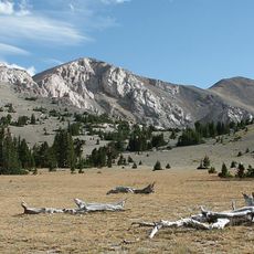
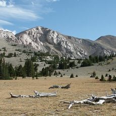
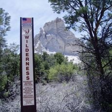
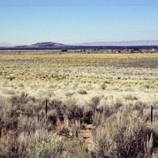
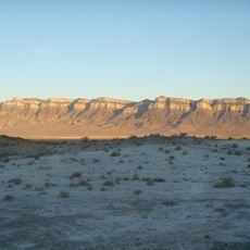
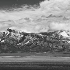
Crystal Peak, Mountain peak in Millard County, Utah.
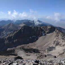
Crystal Peak stands as a prominent geological formation within the Wah Wah Mountains of western Utah, reaching an elevation of 2,370 meters.

The mountain contains significant Middle Ordovician period dolomite deposits, dating back approximately 471 to 458 million years when marine environments dominated the region.

Geological researchers and earth scientists frequently visit the peak to study its sedimentary carbonate rock formations and ancient marine fossil collections.
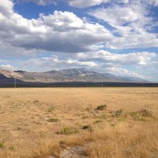
Visitors can access the mountain area throughout the year, though no established trails lead to the summit, requiring careful navigation through unmarked terrain.

The peak features varying thicknesses of dolomite layers, from 61 feet in Tule Valley to 92 feet at the Desert Range Experiment Station.

Location: Millard County

Address: Crystal Peak, Utah, USA

GPS coordinates: 38.79111,-113.60000

Latest update: March 8, 2025 17:29

Natural wonders of the American West

The western United States protects some of North America's most diverse natural landscapes. From the layered canyons of Canyonlands in Utah to the white gypsum dunes of White Sands in New Mexico, this region spans multiple climate zones and geological formations. Visitors find national parks, Pueblo archaeological sites and natural phenomena that document millions of years of Earth's history.The collection includes the ruins of Mesa Verde, where Ancestral Pueblo communities built cliff dwellings into sandstone alcoves from the 6th century until the late 1200s. Dinosaur National Monument preserves one of the world's most significant fossil beds, with more than 1,500 exposed dinosaur bones. Colorado's Great Sand Dunes rise to 750 feet (229 meters), making them the tallest dunes in North America. Carlsbad Caverns extends through 30 miles (48 kilometers) of underground passages with more than 120 known caves.The region's geology appears in the 2,000-foot (610-meter) depths of the Black Canyon of the Gunnison and the petrified tree trunks in Petrified Forest that date back more than 200 million years. Monument Valley presents sandstone formations rising 400 to 1,000 feet (122 to 305 meters) above the valley floor. Utah's Mystic Hot Springs feeds natural mineral pools at temperatures around 160 to 180 degrees Fahrenheit (71 to 82 degrees Celsius). Wolf Creek ski area records an average annual snowfall of 465 inches (11.4 meters).

Around this place
Show the full map Show the full map

Reviews

Visited this place? Tap the stars to rate it and share your experience / photos with the community! Try now! You can cancel it anytime.

« Crystal Peak - Mountain peak in Millard County, Utah » is provided by Around Us (aroundus.com). Images and texts are derived from Wikimedia project under a Creative Commons license. You are allowed to copy, distribute, and modify copies of this page, under the conditions set by the license, as long as this note is clearly visible.

Discover hidden gems everywhere you go!

From secret cafés to breathtaking viewpoints, skip the crowded tourist spots and find places that match your style. Our app makes it easy with voice search, smart filtering, route optimization, and insider tips from travelers worldwide. Download now for the complete mobile experience.

Around Us App Screenshot

A unique approach to discovering new places

Le Figaro

All the places worth exploring

France Info

A tailor-made excursion in just a few clicks

20 Minutes