Chest opened
+${chestReward.xp} XP
Explorer
NOUVEAU ×${chestReward.collectible.quantity}
tapez pour fermer
Chest locked

Open chests in the app

Around Us is built for your phone — chests unlock when you walk, explore and capture nearby places.

Enable Location

We need your location to show you interesting places around you

Discover nearby places

Find interesting locations and hidden gems around you

Precise directions

Get accurate directions and distances to places

Your location is never shared with other users. It's only used when you tap the location button.

Hanford Reach National Monument

Log in to your account

Start exploring — it's free

Trusted by 73,083 travelers worldwide

Continue with Google
Continue with Apple
or

We will send you a code to connect

By continuing, you accept our Terms and Conditions and our Privacy Policy

Check your inbox

We've sent a pincode in your inbox. Please enter the code below.

Hanford Reach National Monument
Discussion Reviews 1 Photos
14.1k Popularity

Hanford Reach National Monument, National Monument in Benton County, United States.

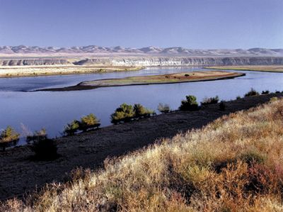
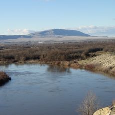
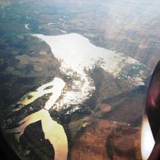
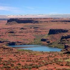
Hanford Reach National Monument spans about 196,000 acres along the Columbia River, featuring desert landscapes and white bluffs across eastern Washington. An unobstructed section of river flows freely here without dams, creating a rare natural corridor through an otherwise engineered landscape.

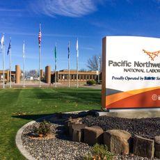
This land served as a security zone for the Hanford Nuclear Reservation during World War II and the Cold War, where weapons-grade plutonium was manufactured. After nuclear production ended, the site was protected to preserve its natural features and river ecosystem.

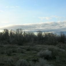
The Wanapum and Yakama Nation have harvested salmon and gathered plants here for generations through seasonal camps. Traces of these practices remain visible across the land today, connecting visitors to a long tradition of resource use.

You can explore the area on hiking trails, boat ramps, and viewing areas, though some sections remain closed for wildlife protection. Check local access rules before visiting, as entry conditions change with the seasons and conservation needs.

The monument protects the last free-flowing, non-tidal stretch of the Columbia River in the United States, running unimpeded through protected lands. This rare open river section shows visitors what the waterway looked like before dams transformed most of its course.

The community of curious travelers

AroundUs brings together thousands of curated places, local tips, and hidden gems, enriched daily by 60,000 contributors worldwide.

Start exploring
Location
Inception
2000
GPS coordinates
46.58330,-119.51700
Latest update
December 7, 2025 20:23
Around this place
Pacific Northwest National Laboratory
United States of America

Pacific Northwest National Laboratory

32.5 km
B Reactor
United States of America

B Reactor

11.2 km
Gold Coast Historic District
United States of America

Gold Coast Historic District

37 km
Rattlesnake Mountain
United States of America

Rattlesnake Mountain

21 km
Potholes State Park
United States of America

Potholes State Park

45.9 km
Wanapum Dam
United States of America

Wanapum Dam

47.5 km
Potholes Reservoir
United States of America

Potholes Reservoir

47.7 km
Priest Rapids Dam
United States of America

Priest Rapids Dam

30.7 km
Drumheller Channels National Natural Landmark
United States of America

Drumheller Channels National Natural Landmark

50 km
Blue Bridge
United States of America

Blue Bridge

49.5 km
Abraham Lincoln
United States of America

Abraham Lincoln

45.6 km
Columbia River Washington Temple
United States of America

Columbia River Washington Temple

43.8 km
Columbia National Wildlife Refuge
United States of America

Columbia National Wildlife Refuge

29.9 km
Bateman Island
United States of America

Bateman Island

43.8 km
Beverly Railroad Bridge
United States of America

Beverly Railroad Bridge

42.9 km
Priest Rapids
United States of America

Priest Rapids

39.6 km
Interstate 182 Bridge
United States of America

Interstate 182 Bridge

41.2 km
Vernita Bridge
United States of America

Vernita Bridge

17.8 km
REACH Museum
United States of America

REACH Museum

45 km
Wanapum Lake
United States of America

Wanapum Lake

47.4 km
Benton City – Kiona Bridge
United States of America

Benton City – Kiona Bridge

36.9 km
United States of America

Badger Mountain Centennial Preserve

41.6 km
Columbia River Exhibition of History, Science, and Technology
United States of America

Columbia River Exhibition of History, Science, and Technology

39.3 km
Canada

Sentinel Gap

40.3 km
Compass High School
United States of America

Compass High School

47.6 km
J. W. Carey House
United States of America

J. W. Carey House

47.8 km
2800 Polar Way
United States of America

2800 Polar Way

32 km
USS Triton Submarine
United States of America

USS Triton Submarine

32.3 km
Show the full map
Reviews
Share your experience

No review yet

Discussions
Start a discussion...

No discussion yet

« Hanford Reach National Monument - National Monument in Benton County, United States » is provided by Around Us (aroundus.com). Images and texts are derived from Wikimedia project under a Creative Commons license. You are allowed to copy, distribute, and modify copies of this page, under the conditions set by the license, as long as this note is clearly visible.

Discover hidden gems everywhere you go!

From secret cafés to breathtaking viewpoints, skip the crowded tourist spots and find places that match your style. Our app makes it easy with voice search, smart filtering, route optimization, and insider tips from travelers worldwide. Download now for the complete mobile experience.

Around Us App Screenshot

A unique approach to discovering new places

Le Figaro

All the places worth exploring

France Info

A tailor-made excursion in just a few clicks

20 Minutes

Around Us
Travel Guide & Maps
Download

Send to your phone

QR Code
1

Open the camera app on your mobile.

2

Point at the QR code with your camera. A notification will appear.

3

Tap the notification to open the link.