Enable Location

We need your location to show you interesting places around you

Discover nearby places

Find interesting locations and hidden gems around you

Precise directions

Get accurate directions and distances to places

Your location is never shared with other users. It's only used when you tap the location button.

Ritzville

Log in to your account

Start exploring — it's free

Trusted by 63,517 travelers worldwide

Continue with Google
Continue with Apple
or

We will send you a code to connect

By continuing, you accept our Terms and Conditions and our Privacy Policy

Check your inbox

We've sent a pincode in your inbox. Please enter the code below.

Discussion Reviews 1 Photos
16.1k Popularity

Ritzville, small city, county seat of Adams County, Washington, USA

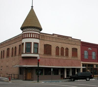
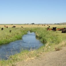
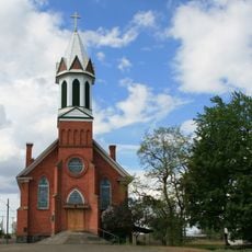
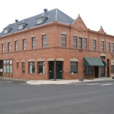
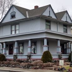
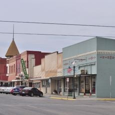
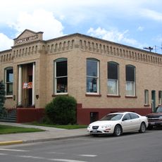
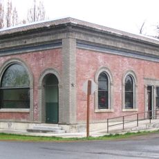
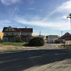
Ritzville is a small city in Adams County, Washington, located in the middle of the state's eastern wheat-growing region. The downtown district spans about three blocks and features brick buildings constructed between 1889 and 1920, including the railroad depot, a historic hotel, and the 1907 Carnegie Library.

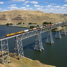
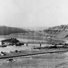
Philip Ritz, a farmer, settled the area in 1878 and helped build the Northern Pacific Railway, which transformed the region. The town was officially laid out in 1880 by the railroad company, after which it quickly grew into a major wheat and freight shipping center.

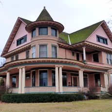
The town's name comes from Philip Ritz, the farmer and railroad builder who shaped the early settlement. Visitors can still see the influence of German-Russian immigrants who arrived in the late 1800s and left their mark on the community's character.

The city is easy to reach by car and sits along the main road running through the center, providing access to other areas in the surrounding region. Lodging options are limited, so visitors should plan ahead if they need overnight accommodation.

The Carnegie Library survived heavy volcanic ash from Mount St. Helens falling on its roof in 1980 and has served the community for over a century. This resilience makes it a symbol of how the town weathered natural disaster.

The community of curious travelers

AroundUs brings together thousands of curated places, local tips, and hidden gems, enriched daily by 60,000 contributors worldwide.

Start exploring
Location
Inception
1880
Elevation above the sea
554 m
GPS coordinates
47.12640,-118.37700
Latest update
February 19, 2026 22:40
Around this place
Palouse Falls
United States of America

Palouse Falls

52.8 km
Marmes Rockshelter
United States of America

Marmes Rockshelter

58.5 km
Palouse Falls State Park
United States of America

Palouse Falls State Park

52.5 km
Potholes Reservoir
United States of America

Potholes Reservoir

71.2 km
Drumheller Channels National Natural Landmark
United States of America

Drumheller Channels National Natural Landmark

64.4 km
Crab Creek
United States of America

Crab Creek

34.8 km
Turnbull National Wildlife Refuge
United States of America

Turnbull National Wildlife Refuge

69.6 km
Columbia Plateau State Park Trail
United States of America

Columbia Plateau State Park Trail

55.3 km
Abraham Lincoln
United States of America

Abraham Lincoln

60.3 km
Little Goose Dam
United States of America

Little Goose Dam

65.7 km
Lower Monumental Dam
United States of America

Lower Monumental Dam

64 km
Snake River Bridge
United States of America

Snake River Bridge

60.9 km
Mary Queen of Heaven Roman Catholic Church
United States of America

Mary Queen of Heaven Roman Catholic Church

36.2 km
Joso High Bridge
United States of America

Joso High Bridge

60.4 km
Rock Creek
United States of America

Rock Creek

48 km
Riparia Bridge
United States of America

Riparia Bridge

65.2 km
Harrington Bank Block & Opera House
United States of America

Harrington Bank Block & Opera House

40.4 km
Dr. Frank R. Burroughs House
United States of America

Dr. Frank R. Burroughs House

492 m
Nelson H. Greene House
United States of America

Nelson H. Greene House

402 m
Ritzville Historic District
United States of America

Ritzville Historic District

161 m
Ritzville Carnegie Library
United States of America

Ritzville Carnegie Library

366 m
Bank of Starbuck
United States of America

Bank of Starbuck

70.2 km
Grant County Fairgrounds
United States of America

Grant County Fairgrounds

70.4 km
Lyons Ferry State Park
United States of America

Lyons Ferry State Park

57.2 km
Skydive West Plains
United States of America

Skydive West Plains

7.6 km
Seivers Brothers Ranchhouse and Barn
United States of America

Seivers Brothers Ranchhouse and Barn

25.8 km
Moses Lake Museum & Art Center
United States of America

Moses Lake Museum & Art Center

68 km
Ritz Theatre
United States of America

Ritz Theatre

256 m
Show the full map
Reviews
Share your experience

No review yet

Discussions
Start a discussion...

No discussion yet

« Ritzville - small city, county seat of Adams County, Washington, USA » is provided by Around Us (aroundus.com). Images and texts are derived from Wikimedia project under a Creative Commons license. You are allowed to copy, distribute, and modify copies of this page, under the conditions set by the license, as long as this note is clearly visible.

Discover hidden gems everywhere you go!

From secret cafés to breathtaking viewpoints, skip the crowded tourist spots and find places that match your style. Our app makes it easy with voice search, smart filtering, route optimization, and insider tips from travelers worldwide. Download now for the complete mobile experience.

Around Us App Screenshot

A unique approach to discovering new places

Le Figaro

All the places worth exploring

France Info

A tailor-made excursion in just a few clicks

20 Minutes

Around Us
Travel Guide & Maps
Download

Send to your phone

QR Code
1

Open the camera app on your mobile.

2

Point at the QR code with your camera. A notification will appear.

3

Tap the notification to open the link.