Enable Location

We need your location to show you interesting places around you

Discover nearby places

Find interesting locations and hidden gems around you

Precise directions

Get accurate directions and distances to places

Your location is never shared with other users. It's only used when you tap the location button.

Log in to your account

Start exploring — it's free

Trusted by 62,603 travelers worldwide

Continue with Google
Continue with Apple
or

We will send you a code to connect

By continuing, you accept our Terms and Conditions and our Privacy Policy

Check your inbox

We've sent a pincode in your inbox. Please enter the code below.

Mystic Lake

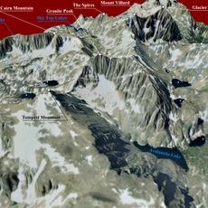
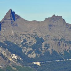
Mystic Lake, lake of Stillwater County, Montana, United States of America

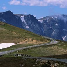
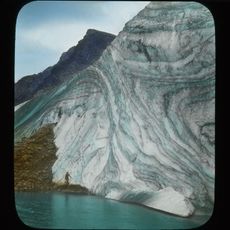
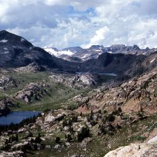
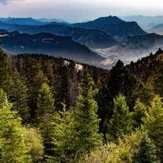
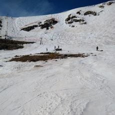
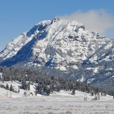
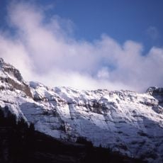
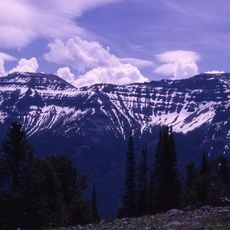
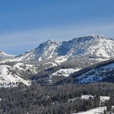
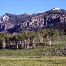
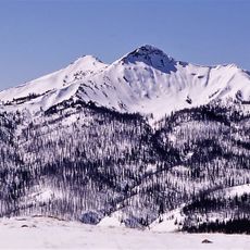
Mystic Lake is a deep mountain reservoir in the Beartooth Range, reaching over 300 feet (90 m) in depth and stretching about 2 miles in length, surrounded by Lodgepole Pine and Aspen forests. The lake sits within Custer National Forest and is influenced by a small hydroelectric dam, whose remains are still visible today.

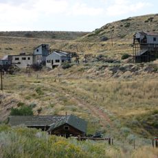
In the 1920s and 1930s, Montana Power Company built a 400-foot (120 m) dam to increase water storage, transforming the area. A landslide damaged the structure in 1984, and it was removed the following year, after which the region largely returned to its natural state.

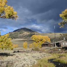
The lake's name reflects the sense of mystery that many visitors feel in the mountain quiet. The area is primarily used for hiking, fishing, and wildlife watching, with local anglers traditionally trying their luck near the shallow shores and small islands.

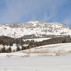
The lake is accessible from May through October, though the access road may be rough during shoulder seasons and parking is available at the trailhead. Bring plenty of water and hike early morning or late afternoon to avoid midday heat, especially over rocky sections where footing can be unreliable.

A striking feature is that visitors here have the rare opportunity to see a working small hydroelectric installation amid untouched mountain landscape. The ruins of the original 1924 dam stand as silent witnesses to industrial history, while nature around them has largely remained unchanged since its destruction.

The community of curious travelers

AroundUs brings together thousands of curated places, local tips, and hidden gems, enriched daily by 60,000 contributors worldwide.

Start exploring
GPS coordinates
45.22278,-109.78278
Latest update
February 9, 2026 08:23
Around this place
Beartooth Highway
United States of America

Beartooth Highway

37.8 km
Granite Peak
United States of America

Granite Peak

6.7 km
Grasshopper Glacier
United States of America

Grasshopper Glacier

12.7 km
Absaroka-Beartooth Wilderness
United States of America

Absaroka-Beartooth Wilderness

18.1 km
Pilot Peak
United States of America

Pilot Peak

28.5 km
Lamar Buffalo Ranch
United States of America

Lamar Buffalo Ranch

50.9 km
Druid Peak
United States of America

Druid Peak

47.2 km
Mount Wood
United States of America

Mount Wood

6.3 km
Beartooth Basin Summer Ski Area
United States of America

Beartooth Basin Summer Ski Area

38.8 km
Greycliff Prairie Dog Town State Park
United States of America

Greycliff Prairie Dog Town State Park

59.8 km
Northeast Entrance Station
United States of America

Northeast Entrance Station

30.2 km
Abiathar Peak
United States of America

Abiathar Peak

33.8 km
Barronette Peak
United States of America

Barronette Peak

36.6 km
The Thunderer
United States of America

The Thunderer

41.6 km
Mount Norris
United States of America

Mount Norris

45.9 km
Mount Hornaday
United States of America

Mount Hornaday

42.1 km
Smith Mine Historic District
United States of America

Smith Mine Historic District

47.5 km
Saddle Mountain
United States of America

Saddle Mountain

59.3 km
Bearcreek Bank
United States of America

Bearcreek Bank

49.5 km
Oliver H. Hovda House
United States of America

Oliver H. Hovda House

42.7 km
Calvary Episcopal Church
United States of America

Calvary Episcopal Church

42.1 km
Clay Butte Lookout
United States of America

Clay Butte Lookout

33.3 km
St. Olaf Lutheran Church
United States of America

St. Olaf Lutheran Church

40.6 km
Immanuel Lutheran Church (Absarokee)
United States of America

Immanuel Lutheran Church (Absarokee)

42 km
Hurricane Mesa
United States of America

Hurricane Mesa

41.9 km
Tower Suspension Bridge
United States of America

Tower Suspension Bridge

59.8 km
Beartooth Mountain Baptist Church (Red Lodge)
United States of America

Beartooth Mountain Baptist Church (Red Lodge)

42 km
Hoodoo Basin
United States of America

Hoodoo Basin

56.8 km
Show the full map
« Mystic Lake - lake of Stillwater County, Montana, United States of America » is provided by Around Us (aroundus.com). Images and texts are derived from Wikimedia project under a Creative Commons license. You are allowed to copy, distribute, and modify copies of this page, under the conditions set by the license, as long as this note is clearly visible.

Discover hidden gems everywhere you go!

From secret cafés to breathtaking viewpoints, skip the crowded tourist spots and find places that match your style. Our app makes it easy with voice search, smart filtering, route optimization, and insider tips from travelers worldwide. Download now for the complete mobile experience.

Around Us App Screenshot

A unique approach to discovering new places

Le Figaro

All the places worth exploring

France Info

A tailor-made excursion in just a few clicks

20 Minutes

Around Us
Travel Guide & Maps
Download

Send to your phone

QR Code
1

Open the camera app on your mobile.

2

Point at the QR code with your camera. A notification will appear.

3

Tap the notification to open the link.