Kenora District, Administrative district in Ontario, Canada
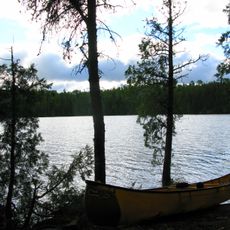
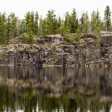
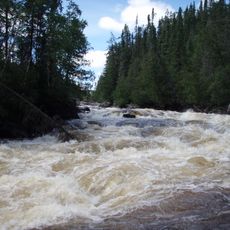
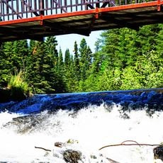
Kenora District is an administrative region in northwestern Ontario spanning vast forested land with countless lakes. The landscape shifts between dense coniferous forests, wetlands, and numerous waterways that crisscross the territory.
The district was created in 1907 from territories that previously belonged to other administrative areas, and later received additional northern lands. These expansions shaped the territory over several decades.
Indigenous communities in the region maintain hunting and fishing practices adapted to the lakes and forests. These activities shape daily life in many northern towns today.
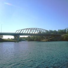
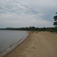
Most visitors use Kenora as a base for outdoor activities such as canoeing, fishing, and camping throughout the region. The area is best explored by car or boat since communities are spread far apart.
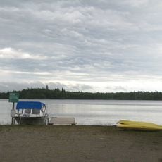
The region contains a remarkable concentration of wetlands and lakes that form one of the purest ecosystems in the area. These water landscapes are unusually vast compared to what many visitors expect and define the character of the land.
Location: Ontario
Inception: 1907
Capital city: Kenora
Shares border with: Division No. 23, Thunder Bay District
Website: http://kdsb.on.ca
GPS coordinates: 49.76667,-94.48333
Latest update: December 24, 2025 16:12
Nipigon River Bridge
459 kmPolar Bear Provincial Park
955.8 km
Pimachiowin Aki
142.1 km
Fort Saint Charles
57.6 kmEast English River Provincial Park
215.4 km
Wabakimi Provincial Park
359.4 km
Husky the Muskie
1.1 km
Woodland Caribou Provincial Park
141.3 kmNorthwest Angle State Forest
60.6 kmTurtle River-White Otter Lake Provincial Park
175.8 kmBlue Lake Provincial Park
69.1 km
Nagagamisis Provincial Park
702.6 kmGarden Island State Recreation Area
71 kmWabigoon Lake
128.3 kmLake of the Woods Provincial Park
82.9 km
Sioux Narrows Bridge
48.2 kmSt. Raphael Provincial Park
278.1 kmOpasquia Provincial Park
429.7 kmRushing River Provincial Park
20.2 kmEagle-Dogtooth Provincial Park
54.9 kmPipestone River Provincial Park
394.7 km
Aaron Provincial Park
131.4 kmOtoskwin-Attawapiskat River Provincial Park
552.5 km
Sandbar Lake Provincial Park
211.9 kmLake Nipigon Provincial Park
458.9 kmCaliper Lake Provincial Park
88.8 kmWest English River Provincial Park
85.5 km
Ojibway Provincial Park
170.5 kmVisited this place? Tap the stars to rate it and share your experience / photos with the community! Try now! You can cancel it anytime.
Discover hidden gems everywhere you go!
From secret cafés to breathtaking viewpoints, skip the crowded tourist spots and find places that match your style. Our app makes it easy with voice search, smart filtering, route optimization, and insider tips from travelers worldwide. Download now for the complete mobile experience.
A unique approach to discovering new places❞
— Le Figaro
All the places worth exploring❞
— France Info
A tailor-made excursion in just a few clicks❞
— 20 Minutes