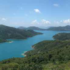
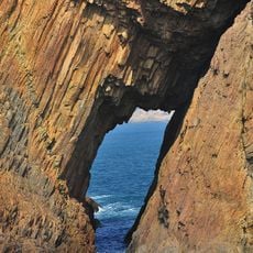
Sai Wan Shan, Mountain summit in Sai Kung District, Hong Kong.
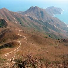
Sai Wan Shan is a peak in Sai Kung East Country Park that rises approximately 314 meters above sea level. The hillsides feature natural vegetation and open slopes that define the landscape of the ascent.
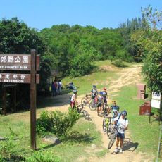
These mountain paths developed over centuries as local routes connecting villages across the Sai Kung Peninsula. Today they are integrated into modern trail networks, including the MacLehose Trail Stage 2.
The name Sai Wan Shan comes from Sai Wan, the beach at its foot. Hikers on MacLehose Trail Stage 2 pass the M23 and M25 distance posts, where the Agriculture, Fisheries and Conservation Department built pavilions for rest. The ridge walk links Sai Wan, Sai Wan Road at Sai Wan Ting, and Long Ke.
Access is available through multiple marked trails, with the main route beginning from the Sai Kung town transportation hub. Hikers should stay on marked paths and wear appropriate footwear for the sloped terrain and climbing sections.
The best panorama is not at the 314 m trigonometrical station on the top, where shrubs block the east, but at a viewpoint between distance posts M025 and M026 just north of it. From there the four Tai Long Wan beaches — Sai Wan, Tung Wan, Tai Wan and Ham Tin Wan — appear in one sweep, with Sharp Peak, Mi Fan Teng, Tung Wan Shan and Tai Mun Shan behind them.
The community of curious travelers
AroundUs brings together thousands of curated places, local tips, and hidden gems, enriched daily by 94,004 contributors worldwide.