Enable Location

We need your location to show you interesting places around you

Discover nearby places

Find interesting locations and hidden gems around you

Precise directions

Get accurate directions and distances to places

Your location is never shared with other users. It's only used when you tap the location button.

Pic des Spijeoles

Log in to your account

Start exploring — it's free

Trusted by 61,914 travelers worldwide

Continue with Google
Continue with Apple
or

We will send you a code to connect

By continuing, you accept our Terms and Conditions and our Privacy Policy

Check your inbox

We've sent a pincode in your inbox. Please enter the code below.

Pic des Spijeoles

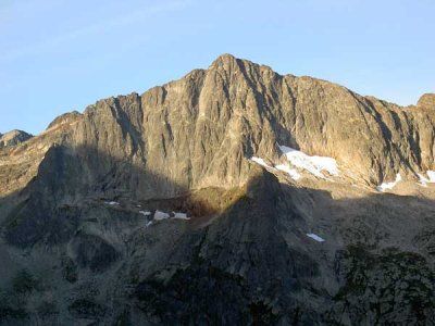
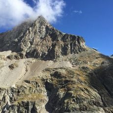
Pic des Spijeoles, Mountain peak in the Pyrenees range, France.

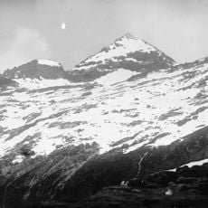
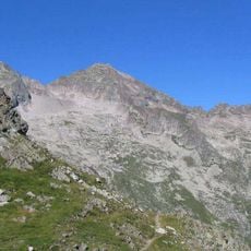
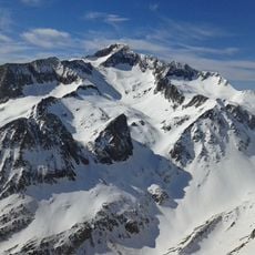
Pic des Spijeoles is a mountain peak in the Pyrenees that sits on the border between Haute-Garonne and Hautes-Pyrénées departments. The mountain displays distinct vegetation zones, ranging from meadows at lower elevations to bare alpine rock near the summit.

The peak was first climbed on June 30, 1880 by Henry Russell and guide Firmin Barrau. This ascent established the standard routes used by mountaineers today.

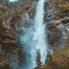
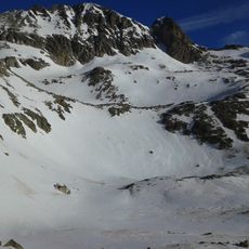
The name comes from the Gascon language and refers to the small streams that flow down the slopes. You can spot these water sources along the route and understand why locals chose this name for the peak.

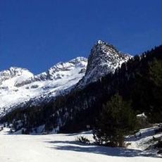
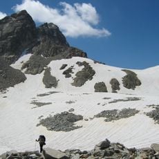
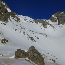
The hike from Granges d'Astau is demanding and requires good physical preparation. Many mountaineers split the route over two days and stay at Refuge d'Espingo to pace themselves and acclimate to the altitude.

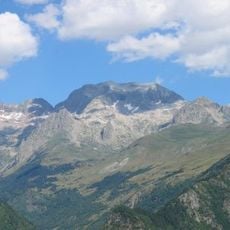
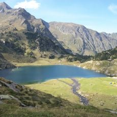
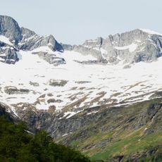
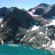
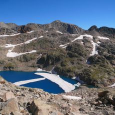
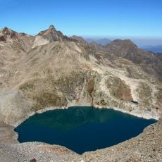
The route passes a glacial lake and opens onto panoramic views across the Luchon Valley. The location on the departmental boundary makes the summit a special place to observe geological and climatic differences between the two mountain regions.

The community of curious travelers

AroundUs brings together thousands of curated places, local tips, and hidden gems, enriched daily by 60,000 contributors worldwide.

Start exploring
Location
Elevation above the sea
3,065 m
GPS coordinates
42.71012,0.48482
Latest update
December 14, 2025 20:03
« Pic des Spijeoles - Mountain peak in the Pyrenees range, France » is provided by Around Us (aroundus.com). Images and texts are derived from Wikimedia project under a Creative Commons license. You are allowed to copy, distribute, and modify copies of this page, under the conditions set by the license, as long as this note is clearly visible.

Discover hidden gems everywhere you go!

From secret cafés to breathtaking viewpoints, skip the crowded tourist spots and find places that match your style. Our app makes it easy with voice search, smart filtering, route optimization, and insider tips from travelers worldwide. Download now for the complete mobile experience.

Around Us App Screenshot

A unique approach to discovering new places

Le Figaro

All the places worth exploring

France Info

A tailor-made excursion in just a few clicks

20 Minutes

Around Us
Travel Guide & Maps
Download

Send to your phone

QR Code
1

Open the camera app on your mobile.

2

Point at the QR code with your camera. A notification will appear.

3

Tap the notification to open the link.