Enable Location

We need your location to show you interesting places around you

Discover nearby places

Find interesting locations and hidden gems around you

Precise directions

Get accurate directions and distances to places

Your location is never shared with other users. It's only used when you tap the location button.

Cherrapunji

Log in to your account

Start exploring — it's free

Trusted by 61,464 travelers worldwide

Continue with Google
Continue with Apple
or

We will send you a code to connect

By continuing, you accept our Terms and Conditions and our Privacy Policy

Check your inbox

We've sent a pincode in your inbox. Please enter the code below.

Cherrapunji

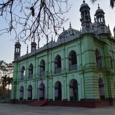
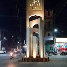
Cherrapunji, Traditional capital in East Khasi Hills district, India

Description

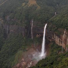
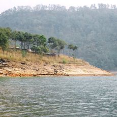
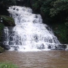
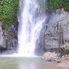
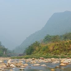
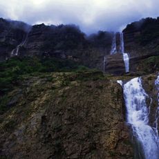
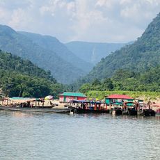
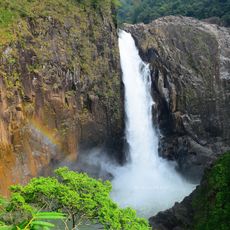
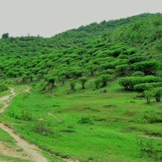
Cherrapunji is a traditional capital in East Khasi Hills district, India, set on a plateau with steep slopes dropping into forested valleys. The area features numerous waterfalls tumbling over rock faces while dense greenery covers the hillsides and narrow paths wind through the vegetation.

History

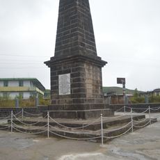
British colonial officer David Scott reached the area in the 1820s after conflicts with local leader Tirot Sing Syiem, who resisted expansion. The settlement later served as an administrative post before the role of district capital moved to nearby Shillong.

Culture

The name comes from the local Khasi language meaning land of oranges, though today betel palms and living root bridges shape the landscape instead. Visitors often see women wearing traditional Jainsem garments while men wear woven Jymphong shawls, both of which appear at local festivals and in daily life.

Practical

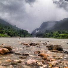
Waterproof clothing and sturdy footwear are advisable during most months as frequent rain makes paths slippery and mist reduces visibility. The winter months from November to February usually offer drier conditions and clearer views across the surrounding valleys.

Did you know?

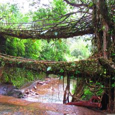
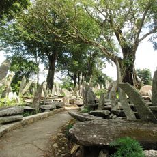
Local communities have shaped living root bridges from rubber tree roots over generations by guiding them across streams and letting them grow until they formed load-bearing crossings. These structures can become several centuries old and support dozens of people at once while growing even stronger during heavy rains.

Elevation above the sea
1,484 m
GPS coordinates
25.27773,91.72924
Latest update
December 12, 2025 20:31

AroundUs brings together thousands of curated places, local tips, and hidden gems, enriched daily by 60,000 contributors worldwide. Discover all places nearby (East Khasi Hills district).

« Cherrapunji - Traditional capital in East Khasi Hills district, India » is provided by Around Us (aroundus.com). Images and texts are derived from Wikimedia project under a Creative Commons license. You are allowed to copy, distribute, and modify copies of this page, under the conditions set by the license, as long as this note is clearly visible.

Discover hidden gems everywhere you go!

From secret cafés to breathtaking viewpoints, skip the crowded tourist spots and find places that match your style. Our app makes it easy with voice search, smart filtering, route optimization, and insider tips from travelers worldwide. Download now for the complete mobile experience.

Around Us App Screenshot

A unique approach to discovering new places

Le Figaro

All the places worth exploring

France Info

A tailor-made excursion in just a few clicks

20 Minutes

Around Us
Travel Guide & Maps
Download

Send to your phone

QR Code
1

Open the camera app on your mobile.

2

Point at the QR code with your camera. A notification will appear.

3

Tap the notification to open the link.