Enable Location

We need your location to show you interesting places around you

Discover nearby places

Find interesting locations and hidden gems around you

Precise directions

Get accurate directions and distances to places

Your location is never shared with other users. It's only used when you tap the location button.

Log in to your account

Start exploring — it's free

Trusted by 68,095 travelers worldwide

Continue with Google
Continue with Apple
or

We will send you a code to connect

By continuing, you accept our Terms and Conditions and our Privacy Policy

Check your inbox

We've sent a pincode in your inbox. Please enter the code below.

Kodad mandal
Discussion Reviews Photo
3.4k Popularity

Kodad mandal, Administrative division in Suryapet district, India

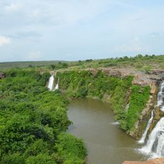
Kodad mandal is an administrative division within Suryapet district in Telangana, lying along the Paler river with a landscape that borders Andhra Pradesh. The territory contains a central town surrounded by villages, creating a mix of urban and rural spaces.

The mandal was originally administered as part of Nalgonda district until October 2016, when it became incorporated into the newly established Suryapet district. This administrative reorganization reshaped local governance and management structures.

Telugu is the everyday language spoken throughout the settlements, shaping daily interactions and local traditions. This linguistic identity connects people across the town and surrounding villages in shared cultural practices.

Kodad town serves as the administrative hub where government services and public facilities are concentrated for the entire mandal. The central location makes it the logical starting point for understanding or navigating the broader region.

The mandal sits as a transitional zone between two states, with the Paler river marking both a physical and administrative boundary. This border location creates distinct dynamics in how settlements connect and interact with neighboring Andhra Pradesh.

The community of curious travelers

AroundUs brings together thousands of curated places, local tips, and hidden gems, enriched daily by 60,000 contributors worldwide.

Start exploring
Capital city
Kodad
GPS coordinates
16.99778,79.96528
Latest update
December 12, 2025 07:59
Reviews
Share your experience

No review yet

Discussions
Start a discussion...

No discussion yet

« Kodad mandal - Administrative division in Suryapet district, India » is provided by Around Us (aroundus.com). Images and texts are derived from Wikimedia project under a Creative Commons license. You are allowed to copy, distribute, and modify copies of this page, under the conditions set by the license, as long as this note is clearly visible.

Discover hidden gems everywhere you go!

From secret cafés to breathtaking viewpoints, skip the crowded tourist spots and find places that match your style. Our app makes it easy with voice search, smart filtering, route optimization, and insider tips from travelers worldwide. Download now for the complete mobile experience.

Around Us App Screenshot

A unique approach to discovering new places

Le Figaro

All the places worth exploring

France Info

A tailor-made excursion in just a few clicks

20 Minutes

Around Us
Travel Guide & Maps
Download

Send to your phone

QR Code
1

Open the camera app on your mobile.

2

Point at the QR code with your camera. A notification will appear.

3

Tap the notification to open the link.