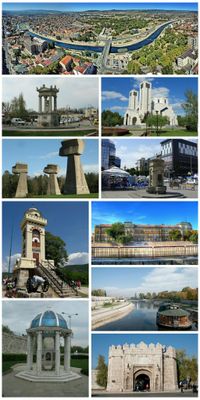
Niš, Regional capital in southeastern Serbia.
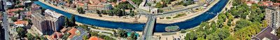
Niš is a regional capital in southeastern Serbia that extends along the Nišava River and comprises four city municipalities. The urban core sits at a crossroads of major land routes linking central Europe with the Aegean and serves as a central transport junction for the region.
Constantine the Great was born in ancient Naissus in the 3rd century and developed the settlement into a major military and commercial center of the Roman Empire. In the 19th century the area witnessed fierce battles during the First Serbian Uprising and later solidified its role as a regional seat.
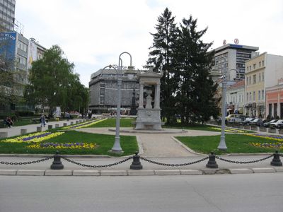
The name derives from Roman Naissus and recalls the ancient roots of the region. Today several districts merge into a single urban area where parks, markets and courtyards shape everyday routines and give the place its own rhythm.
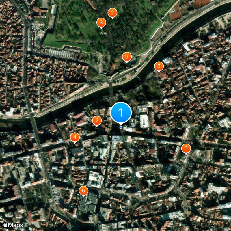
An extensive bus network with 13 lines connects all districts between roughly 5 in the morning and midnight. The lines converge at the central terminal near the fortress where travelers can transfer according to their destination.
The Skull Tower contains 952 human skulls embedded in its walls after the Battle of Čegar in 1809. The structure was raised as a sign of Ottoman authority but later reinterpreted as a monument to Serbian struggle for freedom.
Location: Palilula City Municipality
Location: Crveni Krst City Municipality
Location: Medijana City Municipality
Location: Pantelej City Municipality
Elevation above the sea: 195 m
Website: http://ni.rs
GPS coordinates: 43.32113,21.89592
Latest update: December 14, 2025 23:29
Resolute
6108.3 km
Cambridge Bay
6788.1 km
Kugluktuk
7151.5 km
Beechey Island
6036.3 km
Acasta Gneiss
7411.7 km
Aklavik
7471.7 km
Délı̨nę
7589.8 km
Midnight Sun Mosque
7439.4 km
Paulatuk
7187.8 km
Ivvavik National Park
7384 km
Tulita
7662.3 km
Vuntut National Park
7520 km
Aulavik National Park
6693.7 km
Aurora College
7440.1 km
Colville Lake
7456 km
Pingo Canadian Landmark
7322.4 km
Qausuittuq National Park
6140.8 km
Bloody Fall
7165.4 km
Ovayok Territorial Park
6774.4 km
Church of Our Lady of Good Hope
7581.5 km
Kugluk/Bloody Falls Territorial Park
7165.8 km
Saoyú-ʔehdacho
7534 km
Nanuit Itillinga National Wildlife Area
6127.7 km
Cambridge Bay LORAN Tower
6787.3 kmKomakuk Beach
7382.3 km
Herschel Island-Qikiqtaruk Territorial Park
7373 km
Kendall Island Migratory Bird Sanctuary
7354.9 km
The Ramparts
7587.2 kmVisited this place? Tap the stars to rate it and share your experience / photos with the community! Try now! You can cancel it anytime.
Discover hidden gems everywhere you go!
From secret cafés to breathtaking viewpoints, skip the crowded tourist spots and find places that match your style. Our app makes it easy with voice search, smart filtering, route optimization, and insider tips from travelers worldwide. Download now for the complete mobile experience.
A unique approach to discovering new places❞
— Le Figaro
All the places worth exploring❞
— France Info
A tailor-made excursion in just a few clicks❞
— 20 Minutes