Enable Location

We need your location to show you interesting places around you

Discover nearby places

Find interesting locations and hidden gems around you

Precise directions

Get accurate directions and distances to places

Your location is never shared with other users. It's only used when you tap the location button.

Vyshny Volochyok Waterway

Log in to your account

Start exploring — it's free

Trusted by 62,839 travelers worldwide

Continue with Google
Continue with Apple
or

We will send you a code to connect

By continuing, you accept our Terms and Conditions and our Privacy Policy

Check your inbox

We've sent a pincode in your inbox. Please enter the code below.

Vyshny Volochyok Waterway, Canal system in Vyshny Volochyok, Russia.

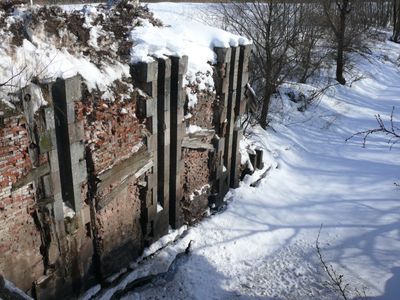
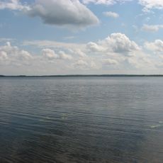
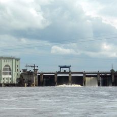
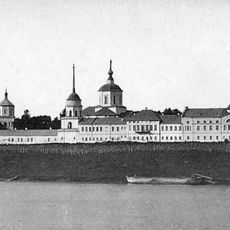
The Vyshny Volochyok Waterway is a canal network with reservoirs that links two river systems and runs through the town. The system consists of man-made channels, lakes, and engineering structures that manage water flow between different regions.

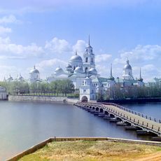
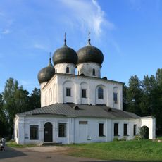
The waterway was built in the early 1700s as an ambitious project connecting two major river basins artificially for the first time. This achievement later created a trade corridor that transformed the economic development of the entire region.

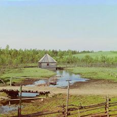
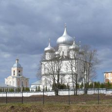
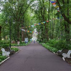
The town's name comes directly from this waterway, which shaped its entire existence and character. The canals and locks remain woven into daily life, influencing how locals and visitors move through the streets and experience the landscape.

The best time to explore is during warmer months when the weather allows for walks along the waterway and through the town. Many parts of the system are freely accessible, though some areas may require local guides or special permission to visit.

The system was innovative in using movable lock gates that could raise and lower vessels between different water levels. This engineering solution was remarkable for its time and allowed the entire network to operate without external power sources.

The community of curious travelers

AroundUs brings together thousands of curated places, local tips, and hidden gems, enriched daily by 60,000 contributors worldwide.

Start exploring
Location
GPS coordinates
57.58450,34.55425
Latest update
December 7, 2025 19:28
Around this place
Seliger
Russian Federation

Seliger

98.6 km
Volga source
Russian Federation

Volga source

130.4 km
Stolobny Island
Russian Federation

Stolobny Island

97.6 km
Church of the Transfiguration on Ilyina Street
Russian Federation

Church of the Transfiguration on Ilyina Street

218.2 km
Rurikovo Gorodische
Russian Federation

Rurikovo Gorodische

216.9 km
Valday Iversky Monastery
Russian Federation

Valday Iversky Monastery

86.8 km
Staraya Ladoga Fortress
Russian Federation

Staraya Ladoga Fortress

298.5 km
Volkhov Hydroelectric Station
Russian Federation

Volkhov Hydroelectric Station

289 km
Yuriev Monastery
Russian Federation

Yuriev Monastery

217.2 km
Tikhvin Assumption Monastery
Russian Federation

Tikhvin Assumption Monastery

237.9 km
Church of Saint George
Russian Federation

Church of Saint George

217.3 km
Valdaysky National Park
Russian Federation

Valdaysky National Park

88.9 km
St. George's Church, Staraya Ladoga
Russian Federation

St. George's Church, Staraya Ladoga

298.4 km
Church of Saint Theodore Stratelates on the Brook, Veliky Novgorod
Russian Federation

Church of Saint Theodore Stratelates on the Brook, Veliky Novgorod

218.6 km
Khutyn Monastery
Russian Federation

Khutyn Monastery

216.8 km
Annunciation Church on Market Place, Veliky Novgorod
Russian Federation

Annunciation Church on Market Place, Veliky Novgorod

218.6 km
Saint Nicholas Church on Lipno Island
Russian Federation

Saint Nicholas Church on Lipno Island

212.1 km
Saint Nicholas Cathedral, Novgorod
Russian Federation

Saint Nicholas Cathedral, Novgorod

218.8 km
Borisoglebsky Monastery
Russian Federation

Borisoglebsky Monastery

65.9 km
Staraya Ladoga mounds
Russian Federation

Staraya Ladoga mounds

299.8 km
Znamenskoye-Rayok
Russian Federation

Znamenskoye-Rayok

81.8 km
Vasilyovo
Russian Federation

Vasilyovo

59.7 km
Staraya Russa resort
Russian Federation

Staraya Russa resort

194.4 km
Denkmal für Wiktor Zoi
Russian Federation

Denkmal für Wiktor Zoi

114.9 km
Tver River Terminal
Russian Federation

Tver River Terminal

114.8 km
Katholikon of the Antoniev Monastery
Russian Federation

Katholikon of the Antoniev Monastery

219.8 km
Afanasiy Nikitin Monument
Russian Federation

Afanasiy Nikitin Monument

114.1 km
Otroch Uspensky Monastery
Russian Federation

Otroch Uspensky Monastery

114.8 km
Show the full map
« Vyshny Volochyok Waterway - Canal system in Vyshny Volochyok, Russia » is provided by Around Us (aroundus.com). Images and texts are derived from Wikimedia project under a Creative Commons license. You are allowed to copy, distribute, and modify copies of this page, under the conditions set by the license, as long as this note is clearly visible.

Discover hidden gems everywhere you go!

From secret cafés to breathtaking viewpoints, skip the crowded tourist spots and find places that match your style. Our app makes it easy with voice search, smart filtering, route optimization, and insider tips from travelers worldwide. Download now for the complete mobile experience.

Around Us App Screenshot

A unique approach to discovering new places

Le Figaro

All the places worth exploring

France Info

A tailor-made excursion in just a few clicks

20 Minutes

Around Us
Travel Guide & Maps
Download

Send to your phone

QR Code
1

Open the camera app on your mobile.

2

Point at the QR code with your camera. A notification will appear.

3

Tap the notification to open the link.