Ľubovnianska vrchovina, Mountain range in eastern Slovakia
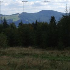
Lublauer Gebirge (Ľubovnianska vrchovina) is a flysch range of the Outer Eastern Carpathians on the Slovak-Polish border, built of Magura Unit sandstone. Its main ridge runs about 25 km from Eliášovka (1,023 m) over Vabec saddle, Oší Wierch and Szeroki Wierch to the Poprad bend near Leluchów. Spruce plantations cover most slopes, with beech-fir stands and large meadows around Litmanová, Jarabina and Kremná.
The range is built of Carpathian flysch of the Magura unit, with limestone outcrops appearing at Szczob, at the Jarzębina gorge on the Mały Lipnik stream and near the village of Údol. In Polish regional geography the area was long counted as part of the Beskid Sądecki following Jerzy Kondracki's 1994 division; only in the 2018 national physical-geographical regionalisation was it separated as the Pogórze Popradzkie mesoregion.
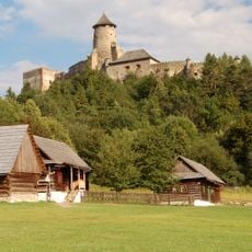
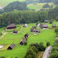
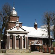
The range takes its name from the town of Ľubovňa, which Slovak geography places outside the region itself, in the neighbouring Spišsko-šarišské medzihorí. The most visited sites are the Ľubovňa Castle and its open-air museum, and the pilgrimage church of the Virgin Mary of Litmanová on the Zvir clearing. Cattle and sheep still graze the large, unfragmented meadows around Litmanová, Jarabina and Kremná.
Marked trails provide access from Bardejov and nearby settlements, with summer and early fall offering the most comfortable hiking conditions. The terrain varies from gentle slopes to steeper paths, so plan your route according to your fitness level.
The range's highest point is Eliášovka at 1,023 m on the Slovak-Polish border, not the 900 m the old text implied. The main ridge runs from Eliášovka over Medvedelica, the Vabec saddle, Široký vrch and the Sulín saddle to Sliboň, roughly 25 km in a straight line.
The community of curious travelers
AroundUs brings together thousands of curated places, local tips, and hidden gems, enriched daily by 94,140 contributors worldwide.