Enable Location

We need your location to show you interesting places around you

Discover nearby places

Find interesting locations and hidden gems around you

Precise directions

Get accurate directions and distances to places

Your location is never shared with other users. It's only used when you tap the location button.

Charles City County

Log in to your account

Start exploring — it's free

Trusted by 61,977 travelers worldwide

Continue with Google
Continue with Apple
or

We will send you a code to connect

By continuing, you accept our Terms and Conditions and our Privacy Policy

Check your inbox

We've sent a pincode in your inbox. Please enter the code below.

Charles City County, Colonial county in Tidewater Virginia, US

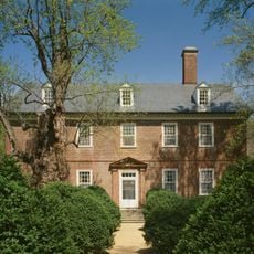
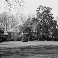
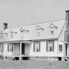
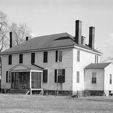
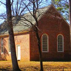
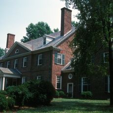
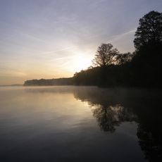
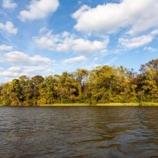
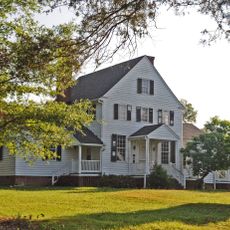
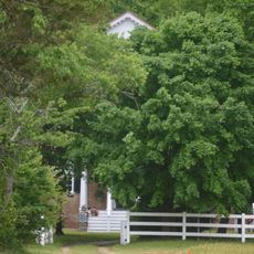
Charles City County sits between Richmond and Jamestown, with the James River forming its southern boundary and the Chickahominy River along its eastern side. The land consists of river valleys and rural fields dotted with colonial-era plantation homes and historic roadways.

The Virginia Company founded Charles Cittie in 1619 as one of the first four boroughs and named it after Prince Charles before it became a royal colony in 1624. The settlement experienced major transformations over the following centuries, including conflicts and shifts in the colonial economy.

The Chickahominy, Paspahegh, and Weanoc peoples lived here for centuries before English arrival, and their descendants continue to maintain cultural traditions in the region today. Walking through the area, you can find museums and community events that honor these connections.

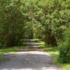
The area is accessible via Route 5 and the Virginia Capital Trail, which connect different sites throughout the county. Planning ahead helps when visiting multiple plantations and museums, as they are spread out and have varying hours.

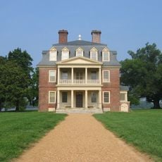
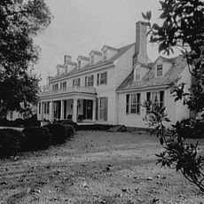
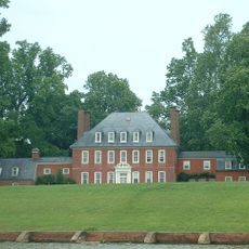
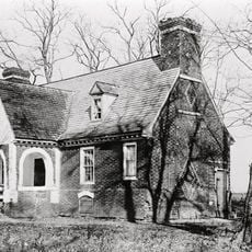
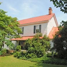
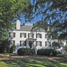
Two U.S. presidents were born in plantation homes that still stand in this county: William Henry Harrison was born at Berkeley Plantation and John Tyler at Greenway Plantation. These two houses are unusual survivors and open to the public for tours.

The community of curious travelers

AroundUs brings together thousands of curated places, local tips, and hidden gems, enriched daily by 60,000 contributors worldwide.

Start exploring
Location
Inception
1634
Capital city
Charles City
Shares border with
Henrico County, Prince George County, New Kent County, James City County, Surry County, Chesterfield County, Hopewell
GPS coordinates
37.35000,-77.06000
Latest update
December 17, 2025 10:47
Around this place
Shirley Plantation
United States of America

Shirley Plantation

16.3 km
Berkeley Plantation
United States of America

Berkeley Plantation

11.2 km
Sherwood Forest Plantation
United States of America

Sherwood Forest Plantation

4.5 km
Westover Plantation
United States of America

Westover Plantation

10.2 km
Flowerdew Hundred Plantation
United States of America

Flowerdew Hundred Plantation

7.2 km
Lower Brandon Plantation
United States of America

Lower Brandon Plantation

11.9 km
Benjamin Harrison Memorial Bridge
United States of America

Benjamin Harrison Memorial Bridge

14.9 km
Malvern Hill
United States of America

Malvern Hill

16.9 km
Greenway Plantation
United States of America

Greenway Plantation

3.7 km
United States of America

Fort Pocahontas

7.6 km
United States of America

Belle Air Plantation

359 m
Weyanoke, Virginia
United States of America

Weyanoke, Virginia

6.5 km
Merchant's Hope
United States of America

Merchant's Hope

15.8 km
United States of America

Upper Brandon Plantation

8.4 km
Evelynton
United States of America

Evelynton

8.6 km
James River National Wildlife Refuge
United States of America

James River National Wildlife Refuge

11 km
Piney Grove at Southall's Plantation
United States of America

Piney Grove at Southall's Plantation

7.7 km
Presquile National Wildlife Refuge
United States of America

Presquile National Wildlife Refuge

17.8 km
Glendale National Cemetery
United States of America

Glendale National Cemetery

18.2 km
Upper Shirley
United States of America

Upper Shirley

17.4 km
Woodburn (Charles City, Virginia)
United States of America

Woodburn (Charles City, Virginia)

4.5 km
Edgewood Plantation and Harrison's Mill
United States of America

Edgewood Plantation and Harrison's Mill

11.4 km
United States of America

Crawfords State Forest

11.2 km
Fort Powhatan
United States of America

Fort Powhatan

9 km
United States of America

Dogham, Doggams

15.4 km
United States of America

Judith Stewart Dresser Bridge

18.9 km
Aberdeen
United States of America

Aberdeen

15.7 km
Evergreen
United States of America

Evergreen

17.3 km
Show the full map
« Charles City County - Colonial county in Tidewater Virginia, US » is provided by Around Us (aroundus.com). Images and texts are derived from Wikimedia project under a Creative Commons license. You are allowed to copy, distribute, and modify copies of this page, under the conditions set by the license, as long as this note is clearly visible.

Discover hidden gems everywhere you go!

From secret cafés to breathtaking viewpoints, skip the crowded tourist spots and find places that match your style. Our app makes it easy with voice search, smart filtering, route optimization, and insider tips from travelers worldwide. Download now for the complete mobile experience.

Around Us App Screenshot

A unique approach to discovering new places

Le Figaro

All the places worth exploring

France Info

A tailor-made excursion in just a few clicks

20 Minutes

Around Us
Travel Guide & Maps
Download

Send to your phone

QR Code
1

Open the camera app on your mobile.

2

Point at the QR code with your camera. A notification will appear.

3

Tap the notification to open the link.