Ireland presents a range of natural landscapes and historic sites spread across the entire country. This collection guides you to coastal cliffs, mountain ranges, medieval castles, and lighthouses that reflect Ireland's history and natural environment. You will explore places like Glendalough Valley with its lakes and early monastic settlements, the steep cliffs of Slieve League, and the island communities of the Aran Islands.
The route includes national parks such as Glenveagh and Connemara, where you can walk and experience the raw character of the Irish landscape. Historic sites like Skellig Michael, an early medieval monastic settlement on an island, and the Loughcrew Cairns from the Stone Age reveal stories from different periods. Gardens like Birr Castle and Dereen show how people have shaped this landscape over centuries.
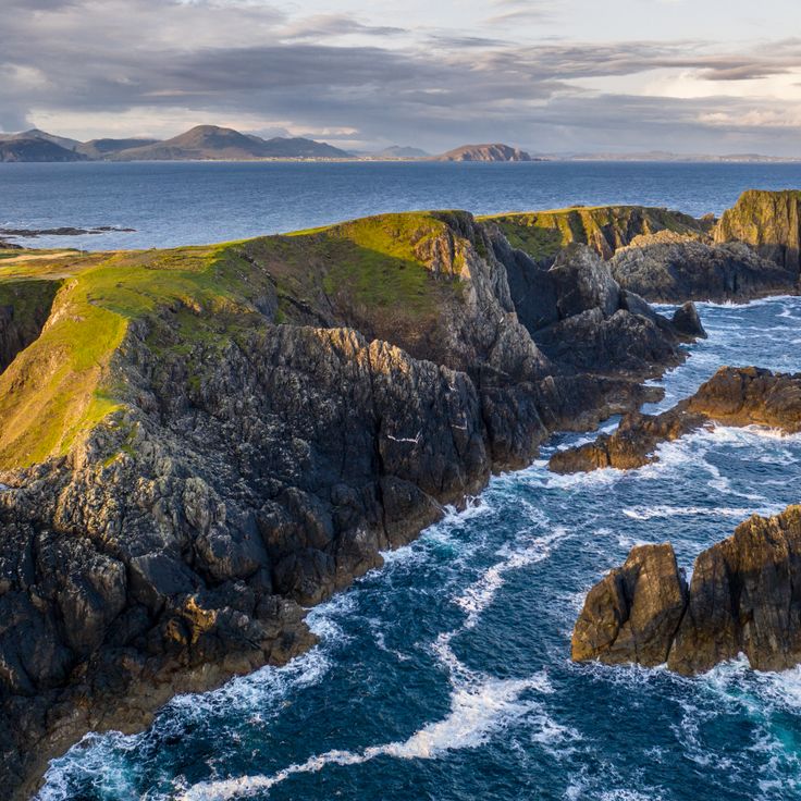
From the steep cliffs at Mizen Head in the southwest to the northernmost point at Malin Head, you will find traces of nature and history everywhere. Small coastal towns like Cobh and Carlingford invite you to linger, while walking routes and trails such as the Kilkee Cliff Walk or St. Kevin's Way guide you through the countryside.
Ireland presents a range of natural landscapes and historic sites spread across the entire country. This collection guides you to coastal cliffs, mountain ranges, medieval castles, and lighthouses that reflect Ireland's history and natural environment. You will explore places like Glendalough Valley with its lakes and early monastic settlements, the steep cliffs of Slieve League, and the island communities of the Aran Islands.
The route includes national parks such as Glenveagh and Connemara, where you can walk and experience the raw character of the Irish landscape. Historic sites like Skellig Michael, an early medieval monastic settlement on an island, and the Loughcrew Cairns from the Stone Age reveal stories from different periods. Gardens like Birr Castle and Dereen show how people have shaped this landscape over centuries.
From the steep cliffs at Mizen Head in the southwest to the northernmost point at Malin Head, you will find traces of nature and history everywhere. Small coastal towns like Cobh and Carlingford invite you to linger, while walking routes and trails such as the Kilkee Cliff Walk or St. Kevin's Way guide you through the countryside.
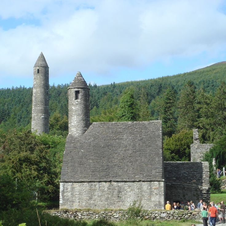
Glendalough Valley is a valley in County Wicklow that holds a medieval monastery complex from the 6th century. The monastery stands surrounded by green hills and two lakes. This valley is part of Ireland's collection of natural landscapes and historic sites, showing how the country's history is woven into its natural surroundings.
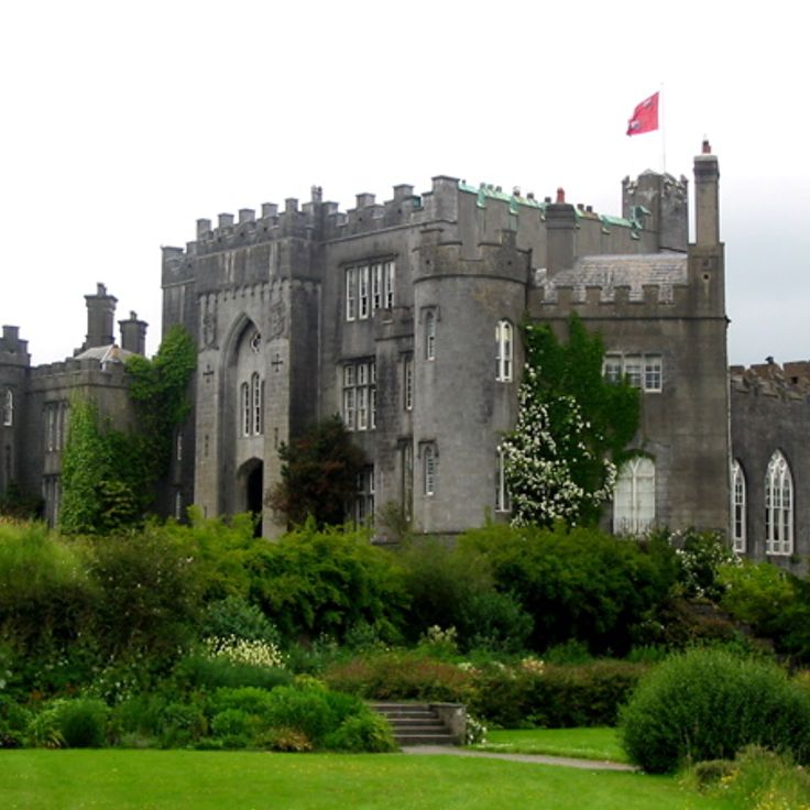
Birr Castle Gardens are part of this collection of Ireland's natural landscapes and historic sites. This botanical garden covers 120 hectares and displays exotic plant collections that have been cultivated since 1620. The gardens are also known for their scientific instruments, which reflect the long history of research and observation at this location.
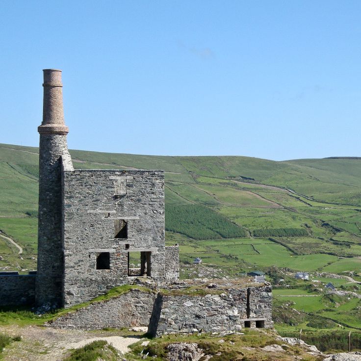
The Allihies Copper Mine Trail is a 6-kilometer walking path through historic mining sites in County Cork. This route connects Ireland's natural landscapes with the industrial heritage of 19th century copper extraction. Visitors walk among the ruins and remnants of old mines while experiencing the coastal terrain and local history of the region.
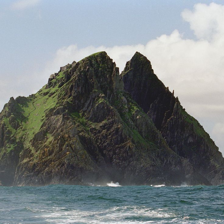
Skellig Michael is an island off the coast of County Kerry with a 6th century monastery perched on cliffs about 200 meters above the Atlantic Ocean. This site represents Ireland's blend of natural landscape and historic heritage, showcasing how people chose to build and live in one of the most isolated and dramatic coastal settings. The island stands as evidence of early medieval monastic life and remains a striking example of human settlement in harsh Atlantic conditions.
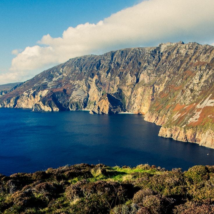
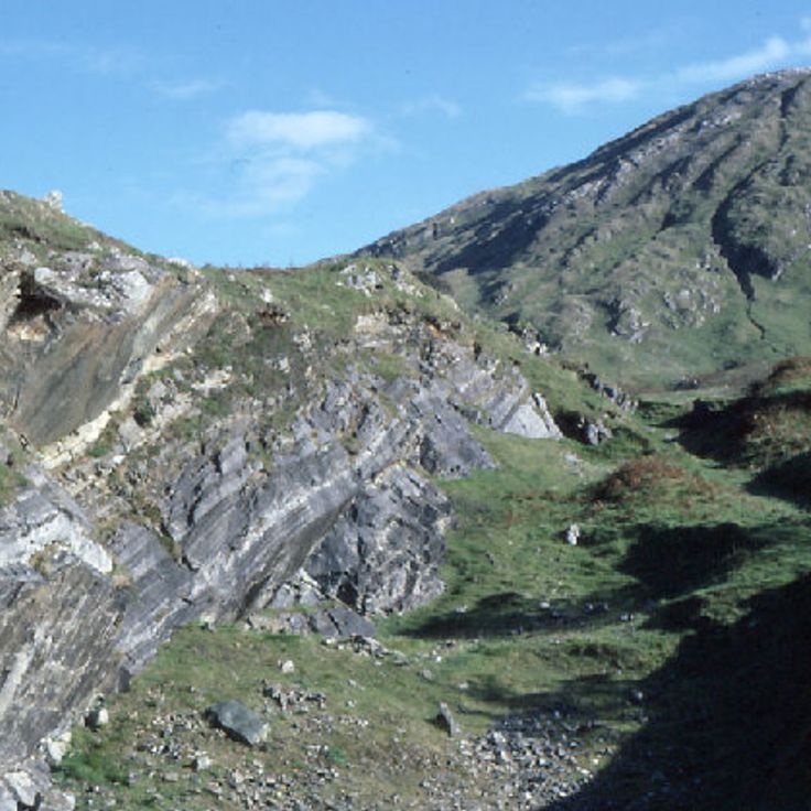
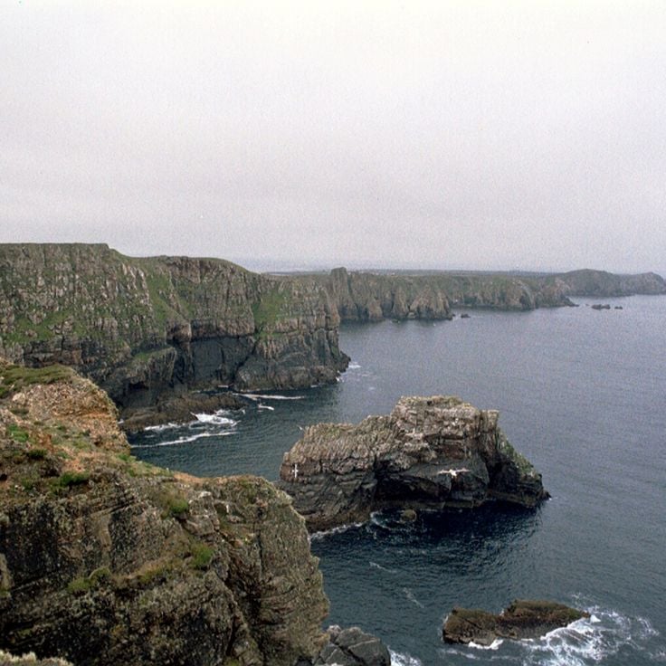
The Slieve League Cliffs are part of Ireland's natural landscapes and historic sites. These sea cliffs rise 600 meters above the Atlantic Ocean in County Donegal and offer views across Donegal Bay. The steep rock faces show the rugged beauty of the Irish west coast and invite walks along the cliff edges.
Lough Hyne is a saltwater lake in County Cork and part of this collection of Ireland's natural landscapes and historic sites. The lake contains over 300 marine species and was Europe's first underwater nature reserve. This body of water displays the diversity of Irish coastal ecosystems and draws visitors interested in exploring marine life.
The Aran Islands are an archipelago off the coast of County Galway and represent an important part of this collection of Ireland's natural landscapes and historic sites. The three islands of Inishmore, Inishmaan and Inisheer feature distinctive stone walls, ancient churches and prehistoric fortifications. They offer a glimpse into a way of life shaped by island traditions and history.
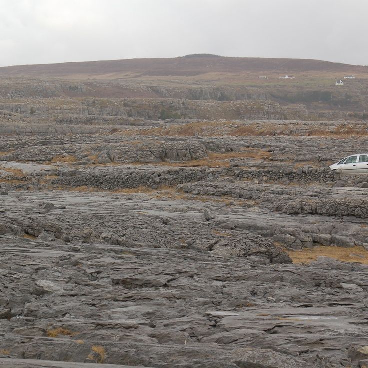
The Burren is a limestone region in County Clare that forms part of Ireland's natural landscapes and historic sites. The area supports an unusual mix of alpine, Mediterranean and arctic plant species, thriving in the crevices and sparse soils of this rocky terrain. The landscape appears bare and stony, with white limestone formations stretching across the land. It is a place for walking and exploring, where you can see how plants adapt to harsh conditions and discover ancient stone monuments scattered throughout the terrain.
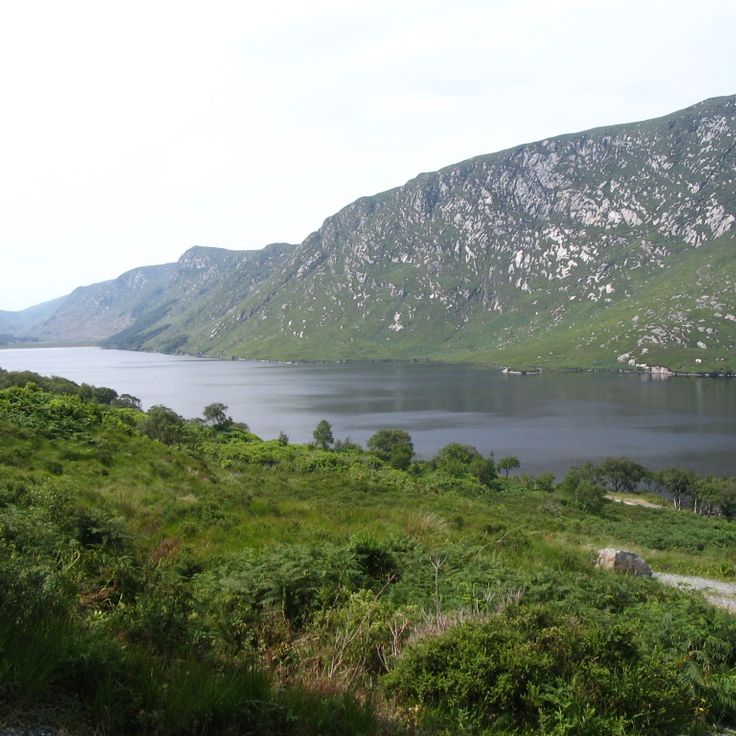
Glenveagh National Park is part of Ireland's collection of natural landscapes and historic sites. Located in County Donegal, the park covers 16000 hectares and features mountains, lakes, and forests. A Victorian castle and its gardens sit within the park grounds. Visitors come here to walk through the landscape and experience the Irish countryside.
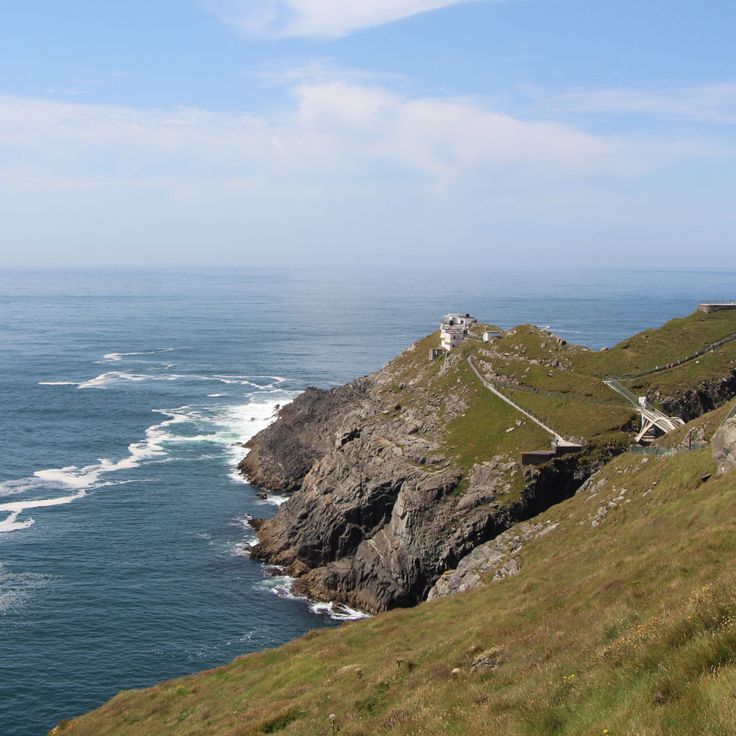
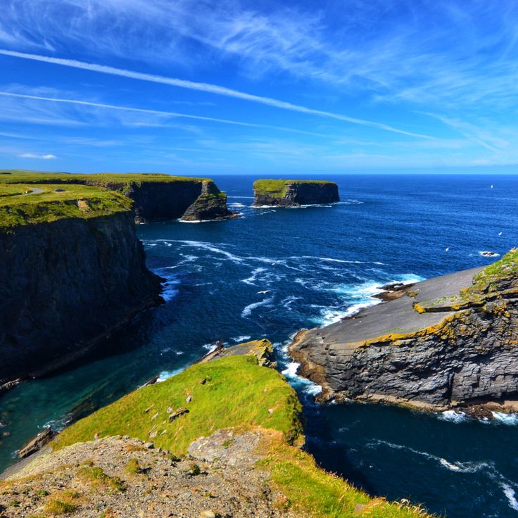
Mizen Head is a coastal promontory that rises above the sea and contributes to understanding Ireland's natural landscapes. The site houses a weather station and a maritime history museum. Visitors can observe the steep cliffs that descend toward the water and learn more about the history of ships and people who traveled these waters.
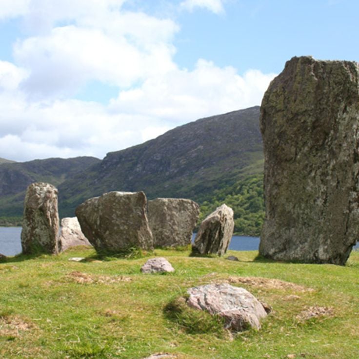
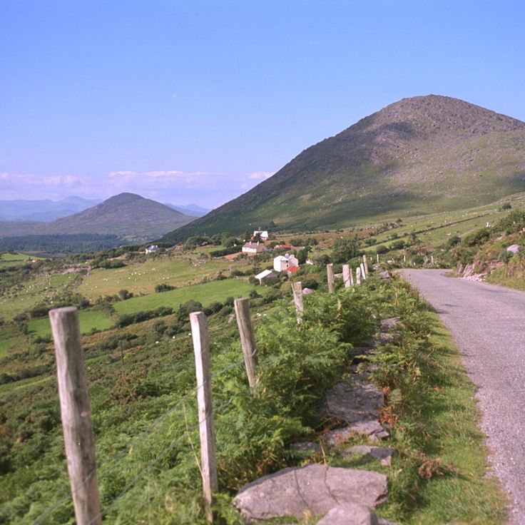
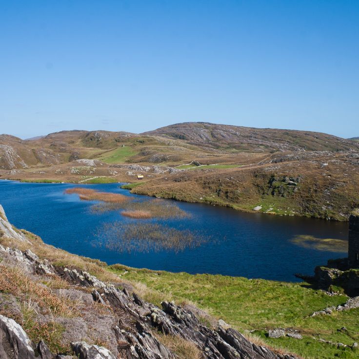
The Beara Peninsula is part of this selection of Ireland's natural landscapes and historic sites. The peninsula features Bronze Age stone circles, fishing villages, and the Healy Pass cutting through the Caha Mountains. You can walk through the terrain, explore the coastline, and discover archaeological sites from ancient times.
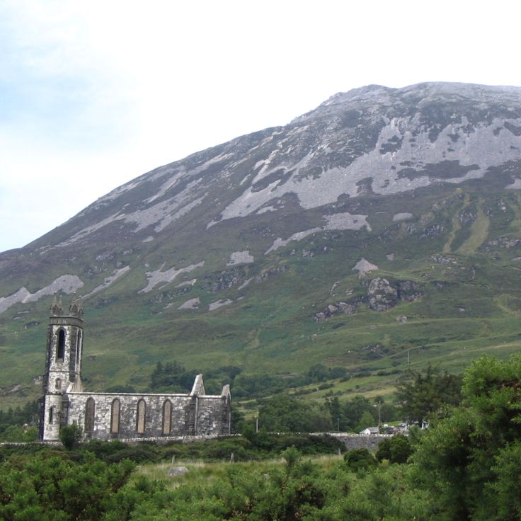
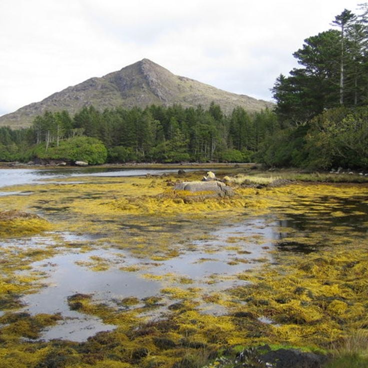
Mount Errigal is a 751-meter quartzite mountain included in this collection of Ireland's natural landscapes and historic sites. It features steep slopes and a rocky hiking trail that leads to the summit. The mountain is a popular destination for walkers and offers wide views across the landscape of County Donegal from the top.
The Dingle Peninsula represents the natural landscapes and historic layers that define this collection of Irish sites. Its sand beaches, dramatic cliffs, and Bronze Age archaeological remains show how geology and human history shape the western coast. Walking here, you encounter the raw power of Atlantic erosion and the traces of people who lived thousands of years ago.
Connemara National Park in County Galway represents the natural diversity found across Ireland's landscapes and historic sites. The park features peat bogs, granite hills, and Diamond Hill mountain. Visitors can explore hiking trails throughout the area while observing wild Connemara ponies that roam freely across the terrain.
Tory Island is part of Ireland's natural landscapes and historic sites, located off the coast of County Donegal. The island preserves Irish traditions through an active community of artists and musicians, guided by an elected king. This place demonstrates how local culture and artistic life remain rooted in remote parts of Ireland.
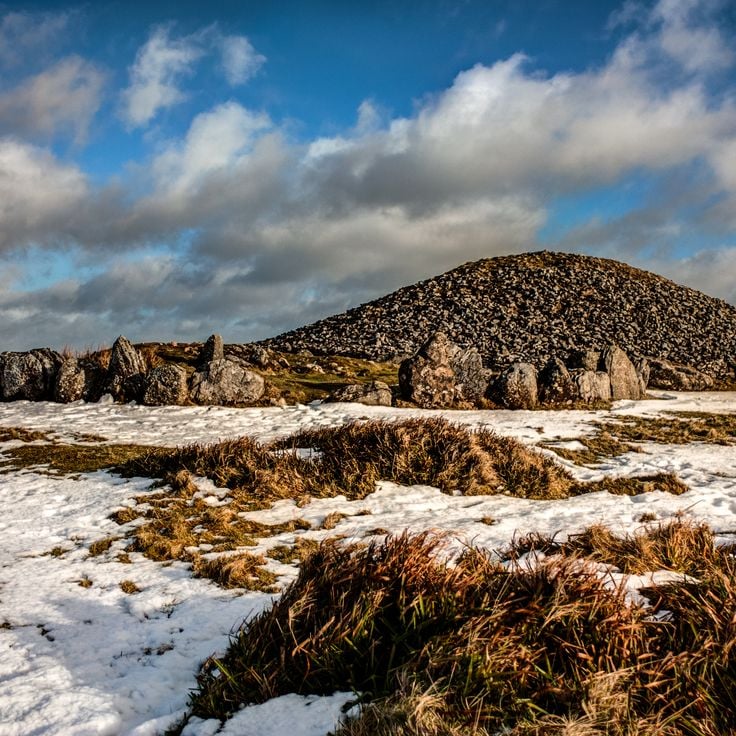
The Loughcrew Cairns are stone tombs from the Neolithic period that sit on three hills in County Meath. They are part of Ireland's collection of archaeological sites and show how people lived in early times. The tombs have astronomical markings and geometric patterns carved into the stone. These cairns help us understand the history of Ireland's natural landscapes and historic sites.
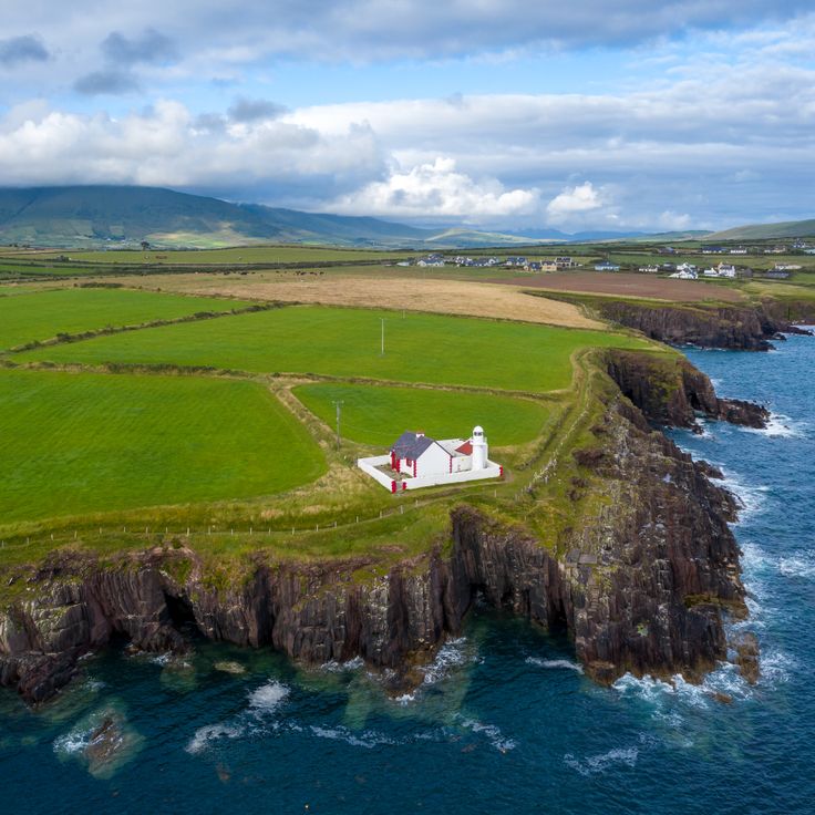
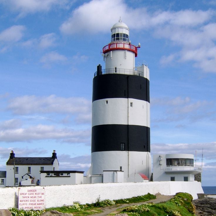
Hook Lighthouse is a 13th-century tower in County Wexford that represents Ireland's maritime heritage and historic sites. The lighthouse has guided ships through treacherous waters for centuries, helping seafarers navigate safely past dangerous passages. Inside, a museum tells the story of maritime history and shows visitors how people explored and lived with the sea.
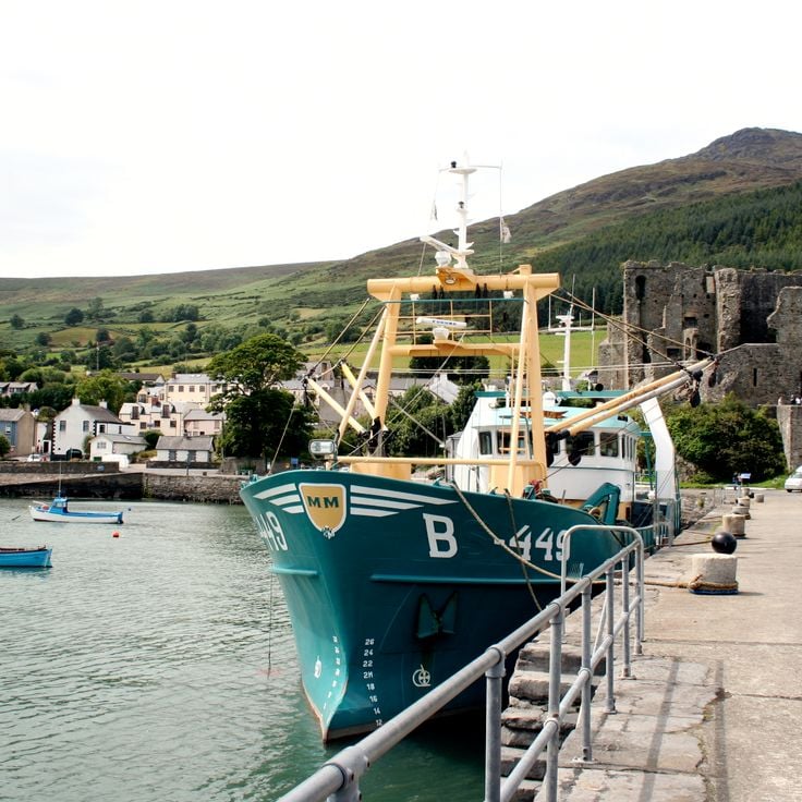
Carlingford is a small town with medieval character in County Louth. The town walls date from the 13th century and shape the appearance of the place. King John's Castle stands above the harbor, a reminder of Norman rule. Carlingford is part of Ireland's historic sites and offers visitors a window into the past.
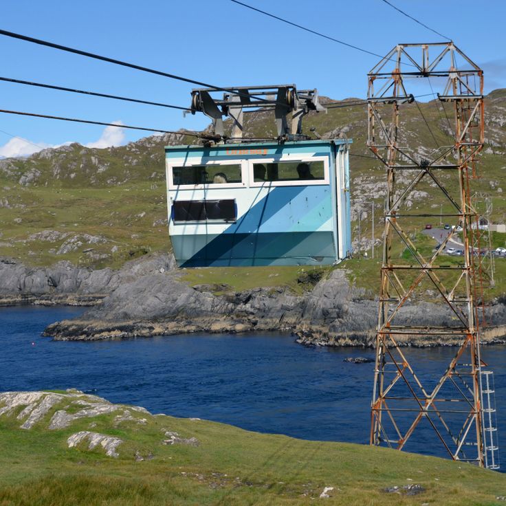
The Dursey Island Cable Car connects the Irish mainland to an island off the coast of County Cork. The journey takes about 10 minutes and crosses 250 meters of seawater. This cable car is part of Ireland's natural landscapes and historic sites, offering access to a remote island setting. It serves as a practical link for visitors wanting to explore the island.
The Kilkee Cliff Walk is a trail along Ireland's coast and part of this collection of Ireland's natural landscapes and historic sites. The path runs along cliffs that rise up to 60 meters high. Seagulls and other seabirds nest in the rock faces, and you can spot them as you walk.
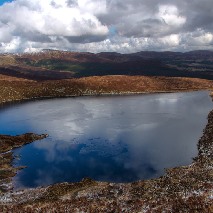
Lough Ouler is a glacial lake in this collection of Ireland's natural landscapes and historic sites. The lake sits at 600 meters elevation on the eastern side of Tonelagee Mountain in County Wicklow and forms the shape of a heart. It represents the mountain scenery that characterizes inland Ireland, part of a route covering the country's regions from coastal cliffs to archaeological sites.
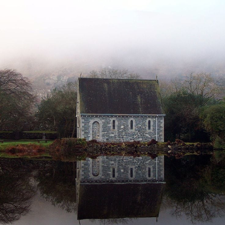
Gougane Barra is a valley in County Cork that contains a lake with an island where a monastery was built in the 6th century. This location fits within the collection of Ireland's natural landscapes and historic sites, demonstrating how medieval monasteries were established in remote and scenic settings.
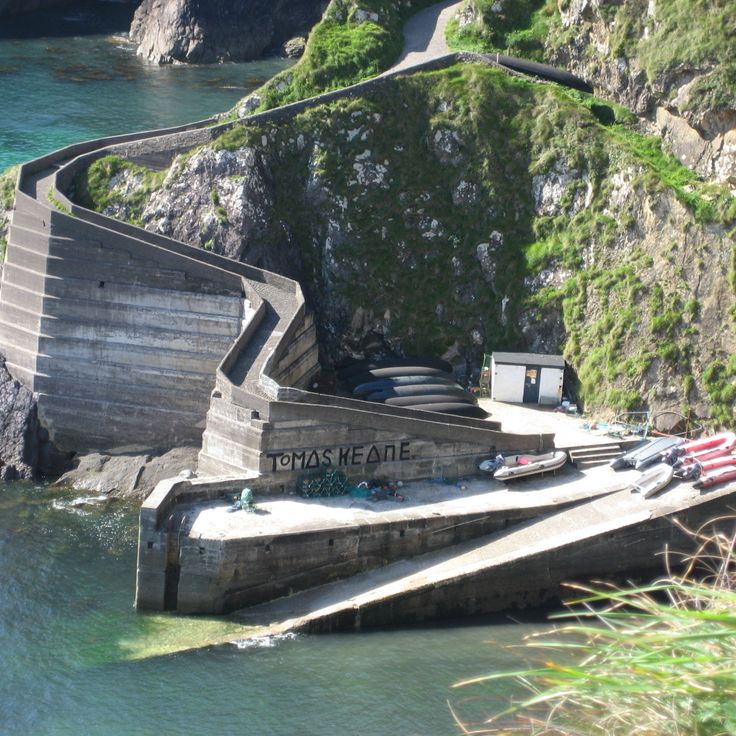
Dunquin Pier is a winding concrete dock that slopes down to the sea and serves as the departure point for ferries to the Blasket Islands. This location fits into the collection of Ireland's natural landscapes and historic sites, as it marks a key access point to one of the country's most remote and windswept island communities.
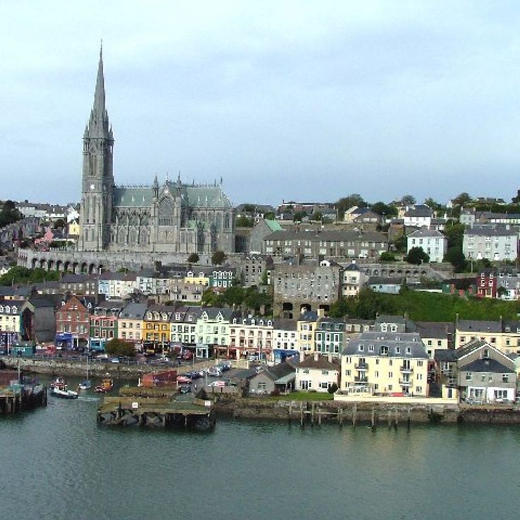
Cobh is a harbor town in County Cork and part of this collection of Ireland's natural landscapes and historic sites. The town served as the Titanic's final port of call in 1912. Walking through Cobh, you see Victorian buildings lining the waterfront and the imposing Saint Colman's Cathedral standing above the harbor. The place holds stories of maritime history and Irish emigration, with its character shaped by the sea and its architectural heritage from the 19th century.
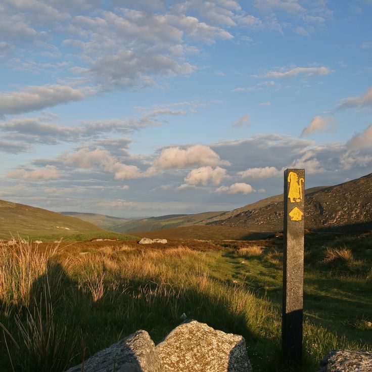
St. Kevin's Way is a walking trail in County Wicklow that follows the path of medieval pilgrims traveling through valleys and forests to the monastery at Glendalough. The route stretches approximately 30 kilometers and connects two important religious sites, offering walkers a chance to experience the spiritual history of Ireland.
Dereen Gardens in County Kerry is a subtropical garden set on a mountain slope with views over the bay. The garden hosts over 200 rare plant species from different parts of the world. Walking through the paths, visitors discover exotic plants and trees in a landscape shaped by the Irish climate and geography.
Three Castle Head is part of this collection of Ireland's natural landscapes and historic sites. The remains of three 15th century fortresses stand on a peninsula here, situated between a mountain lake and sea cliffs that rise 100 meters high. This location combines coastal geography with medieval history, showing how people built defenses in this striking landscape.
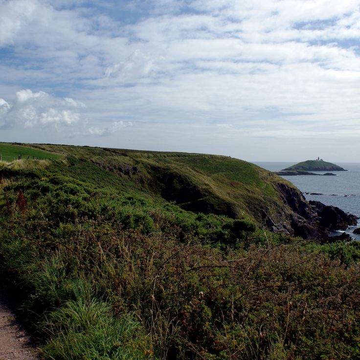
Malin Head is the northernmost point of Ireland. This location features a weather station, World War II military buildings, and rocks that jut into the sea. It fits naturally into this collection of Ireland's natural landscapes and historic sites, offering both dramatic coastal formations and traces of wartime history.
The Ballycotton Cliff Walk is a coastal path in County Cork that stretches 8 kilometers along the cliffs. Part of Ireland's natural landscapes and historic sites, it offers walkers views of the Atlantic Ocean and the lighthouse. The path displays the raw beauty of the Irish coast and passes through landscapes shaped by sea and wind.
Clare Island, located off the coast of County Mayo, represents one of Ireland's natural and historical destinations. The island features 5 kilometers of sandy beaches, cliffs reaching 462 meters high, and a lighthouse built in 1806 that stands as a reminder of maritime heritage.
Valentia Island is part of this collection of Ireland's natural landscapes and historic sites. The island holds rock formations from the Devonian period, a cable station built in 1866, and the Slate Quarry geopark. This mix of geology and industrial history offers visitors a chance to see how the land was shaped and how people once worked there.
Gleninchaquin Park is a private nature park in County Kerry and part of this collection of Ireland's natural landscapes and historic sites. The park features a 140-meter waterfall, hiking trails through the valley, and lakes formed during the Ice Age. Visitors can explore the natural surroundings on foot and discover the geological history of the area.
Glendalough Valley is a valley in County Wicklow that holds a medieval monastery complex from the 6th century. The monastery stands surrounded by green hills and two lakes. This valley is part of Ireland's collection of natural landscapes and historic sites, showing how the country's history is woven into its natural surroundings.
Birr Castle Gardens are part of this collection of Ireland's natural landscapes and historic sites. This botanical garden covers 120 hectares and displays exotic plant collections that have been cultivated since 1620. The gardens are also known for their scientific instruments, which reflect the long history of research and observation at this location.
The Allihies Copper Mine Trail is a 6-kilometer walking path through historic mining sites in County Cork. This route connects Ireland's natural landscapes with the industrial heritage of 19th century copper extraction. Visitors walk among the ruins and remnants of old mines while experiencing the coastal terrain and local history of the region.
Skellig Michael is an island off the coast of County Kerry with a 6th century monastery perched on cliffs about 200 meters above the Atlantic Ocean. This site represents Ireland's blend of natural landscape and historic heritage, showcasing how people chose to build and live in one of the most isolated and dramatic coastal settings. The island stands as evidence of early medieval monastic life and remains a striking example of human settlement in harsh Atlantic conditions.
The Slieve League Cliffs are part of Ireland's natural landscapes and historic sites. These sea cliffs rise 600 meters above the Atlantic Ocean in County Donegal and offer views across Donegal Bay. The steep rock faces show the rugged beauty of the Irish west coast and invite walks along the cliff edges.
Lough Hyne is a saltwater lake in County Cork and part of this collection of Ireland's natural landscapes and historic sites. The lake contains over 300 marine species and was Europe's first underwater nature reserve. This body of water displays the diversity of Irish coastal ecosystems and draws visitors interested in exploring marine life.
The Aran Islands are an archipelago off the coast of County Galway and represent an important part of this collection of Ireland's natural landscapes and historic sites. The three islands of Inishmore, Inishmaan and Inisheer feature distinctive stone walls, ancient churches and prehistoric fortifications. They offer a glimpse into a way of life shaped by island traditions and history.
The Burren is a limestone region in County Clare that forms part of Ireland's natural landscapes and historic sites. The area supports an unusual mix of alpine, Mediterranean and arctic plant species, thriving in the crevices and sparse soils of this rocky terrain. The landscape appears bare and stony, with white limestone formations stretching across the land. It is a place for walking and exploring, where you can see how plants adapt to harsh conditions and discover ancient stone monuments scattered throughout the terrain.
Glenveagh National Park is part of Ireland's collection of natural landscapes and historic sites. Located in County Donegal, the park covers 16000 hectares and features mountains, lakes, and forests. A Victorian castle and its gardens sit within the park grounds. Visitors come here to walk through the landscape and experience the Irish countryside.
Mizen Head is a coastal promontory that rises above the sea and contributes to understanding Ireland's natural landscapes. The site houses a weather station and a maritime history museum. Visitors can observe the steep cliffs that descend toward the water and learn more about the history of ships and people who traveled these waters.
The Beara Peninsula is part of this selection of Ireland's natural landscapes and historic sites. The peninsula features Bronze Age stone circles, fishing villages, and the Healy Pass cutting through the Caha Mountains. You can walk through the terrain, explore the coastline, and discover archaeological sites from ancient times.
Mount Errigal is a 751-meter quartzite mountain included in this collection of Ireland's natural landscapes and historic sites. It features steep slopes and a rocky hiking trail that leads to the summit. The mountain is a popular destination for walkers and offers wide views across the landscape of County Donegal from the top.
The Dingle Peninsula represents the natural landscapes and historic layers that define this collection of Irish sites. Its sand beaches, dramatic cliffs, and Bronze Age archaeological remains show how geology and human history shape the western coast. Walking here, you encounter the raw power of Atlantic erosion and the traces of people who lived thousands of years ago.
Connemara National Park in County Galway represents the natural diversity found across Ireland's landscapes and historic sites. The park features peat bogs, granite hills, and Diamond Hill mountain. Visitors can explore hiking trails throughout the area while observing wild Connemara ponies that roam freely across the terrain.
Tory Island is part of Ireland's natural landscapes and historic sites, located off the coast of County Donegal. The island preserves Irish traditions through an active community of artists and musicians, guided by an elected king. This place demonstrates how local culture and artistic life remain rooted in remote parts of Ireland.
The Loughcrew Cairns are stone tombs from the Neolithic period that sit on three hills in County Meath. They are part of Ireland's collection of archaeological sites and show how people lived in early times. The tombs have astronomical markings and geometric patterns carved into the stone. These cairns help us understand the history of Ireland's natural landscapes and historic sites.
Hook Lighthouse is a 13th-century tower in County Wexford that represents Ireland's maritime heritage and historic sites. The lighthouse has guided ships through treacherous waters for centuries, helping seafarers navigate safely past dangerous passages. Inside, a museum tells the story of maritime history and shows visitors how people explored and lived with the sea.
Carlingford is a small town with medieval character in County Louth. The town walls date from the 13th century and shape the appearance of the place. King John's Castle stands above the harbor, a reminder of Norman rule. Carlingford is part of Ireland's historic sites and offers visitors a window into the past.
The Dursey Island Cable Car connects the Irish mainland to an island off the coast of County Cork. The journey takes about 10 minutes and crosses 250 meters of seawater. This cable car is part of Ireland's natural landscapes and historic sites, offering access to a remote island setting. It serves as a practical link for visitors wanting to explore the island.
The Kilkee Cliff Walk is a trail along Ireland's coast and part of this collection of Ireland's natural landscapes and historic sites. The path runs along cliffs that rise up to 60 meters high. Seagulls and other seabirds nest in the rock faces, and you can spot them as you walk.
Lough Ouler is a glacial lake in this collection of Ireland's natural landscapes and historic sites. The lake sits at 600 meters elevation on the eastern side of Tonelagee Mountain in County Wicklow and forms the shape of a heart. It represents the mountain scenery that characterizes inland Ireland, part of a route covering the country's regions from coastal cliffs to archaeological sites.
Gougane Barra is a valley in County Cork that contains a lake with an island where a monastery was built in the 6th century. This location fits within the collection of Ireland's natural landscapes and historic sites, demonstrating how medieval monasteries were established in remote and scenic settings.
Dunquin Pier is a winding concrete dock that slopes down to the sea and serves as the departure point for ferries to the Blasket Islands. This location fits into the collection of Ireland's natural landscapes and historic sites, as it marks a key access point to one of the country's most remote and windswept island communities.
Cobh is a harbor town in County Cork and part of this collection of Ireland's natural landscapes and historic sites. The town served as the Titanic's final port of call in 1912. Walking through Cobh, you see Victorian buildings lining the waterfront and the imposing Saint Colman's Cathedral standing above the harbor. The place holds stories of maritime history and Irish emigration, with its character shaped by the sea and its architectural heritage from the 19th century.
St. Kevin's Way is a walking trail in County Wicklow that follows the path of medieval pilgrims traveling through valleys and forests to the monastery at Glendalough. The route stretches approximately 30 kilometers and connects two important religious sites, offering walkers a chance to experience the spiritual history of Ireland.
Dereen Gardens in County Kerry is a subtropical garden set on a mountain slope with views over the bay. The garden hosts over 200 rare plant species from different parts of the world. Walking through the paths, visitors discover exotic plants and trees in a landscape shaped by the Irish climate and geography.
Three Castle Head is part of this collection of Ireland's natural landscapes and historic sites. The remains of three 15th century fortresses stand on a peninsula here, situated between a mountain lake and sea cliffs that rise 100 meters high. This location combines coastal geography with medieval history, showing how people built defenses in this striking landscape.
Malin Head is the northernmost point of Ireland. This location features a weather station, World War II military buildings, and rocks that jut into the sea. It fits naturally into this collection of Ireland's natural landscapes and historic sites, offering both dramatic coastal formations and traces of wartime history.
The Ballycotton Cliff Walk is a coastal path in County Cork that stretches 8 kilometers along the cliffs. Part of Ireland's natural landscapes and historic sites, it offers walkers views of the Atlantic Ocean and the lighthouse. The path displays the raw beauty of the Irish coast and passes through landscapes shaped by sea and wind.
Clare Island, located off the coast of County Mayo, represents one of Ireland's natural and historical destinations. The island features 5 kilometers of sandy beaches, cliffs reaching 462 meters high, and a lighthouse built in 1806 that stands as a reminder of maritime heritage.
Valentia Island is part of this collection of Ireland's natural landscapes and historic sites. The island holds rock formations from the Devonian period, a cable station built in 1866, and the Slate Quarry geopark. This mix of geology and industrial history offers visitors a chance to see how the land was shaped and how people once worked there.
Gleninchaquin Park is a private nature park in County Kerry and part of this collection of Ireland's natural landscapes and historic sites. The park features a 140-meter waterfall, hiking trails through the valley, and lakes formed during the Ice Age. Visitors can explore the natural surroundings on foot and discover the geological history of the area.