Visit Norway: fjords, northern lights, and the land of the Arctic
Norway is explored through areas that change from south to north. Beyond the Arctic Circle, Tromsø becomes a place to see the Northern Lights in winter, while Nordkapp marks the northern tip of continental Europe. Further south, the Lofoten islands rise from the sea with their fishing villages and steep mountains. The Svalbard archipelago is further north and has a land of ice and snow where polar bears live.
The fjords in the west show a different side of the country. The Geirangerfjord and Sognefjord, the longest and deepest of all, cut along the coast for many miles. Mountain roads like Trollstigen wind between the rocky cliffs. Places such as Preikestolen and Trolltunga give views over valleys carved out by glaciers. Oslo, the capital, is at the bottom of another fjord, surrounded by forests and hills.
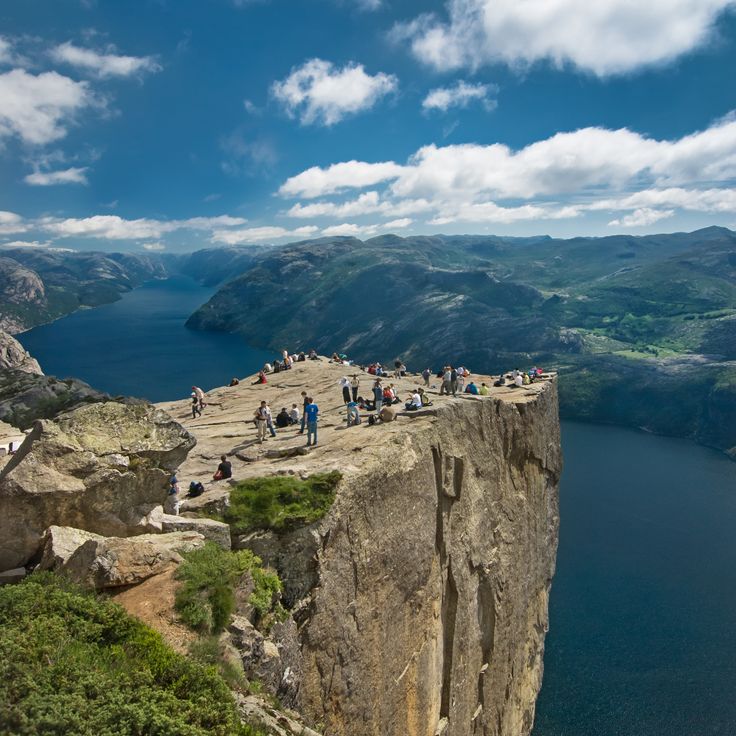
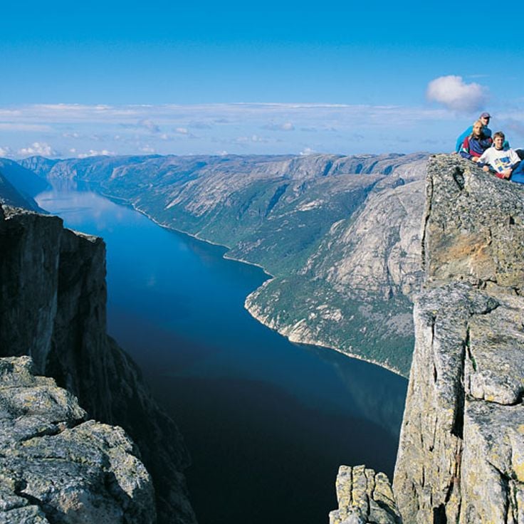
Preikestolen is a cliff that rises above the Lysefjord and offers views across deep water and mountain slopes. From the top, you can see for miles over the fjord landscape. The path leads through heath and forest, past small lakes, until it reaches the cliff edge. Once there, you see how the water far below meets the rock walls. This place shows why Norway's west is known for its fjords.
Tromsø sits north of the Arctic Circle on Norway's coast. The city is known for the northern lights in winter, which attract visitors from around the world. In summer, daylight lasts for months. Life in Tromsø mixes Arctic nature with a vibrant city culture. Restaurants and cafes line the streets, while mountains and sea offer adventure just beyond the city.
Located beyond the Arctic Circle, this island archipelago features sharp peaks, white sand beaches, and colorful fishing villages. The Lofoten Islands are part of northern Norway, where steep mountains rise directly from the sea and traditional fishing villages shape how people live. Nature here feels raw and immediate. In winter, the Northern Lights often appear over the islands, while in summer the light barely fades.
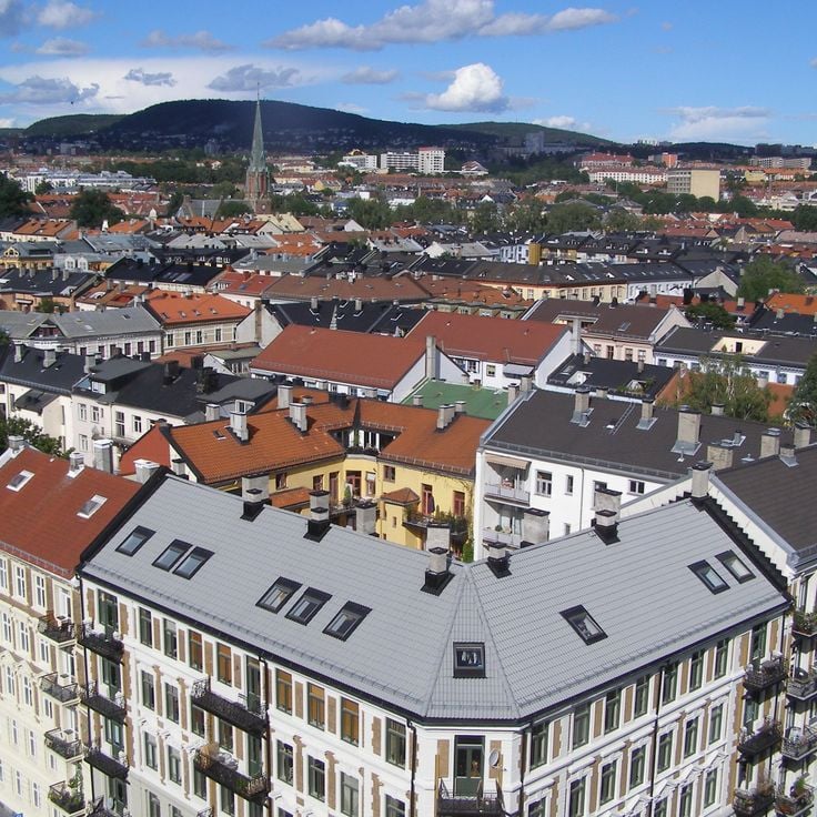
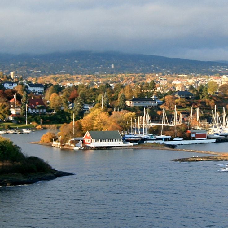
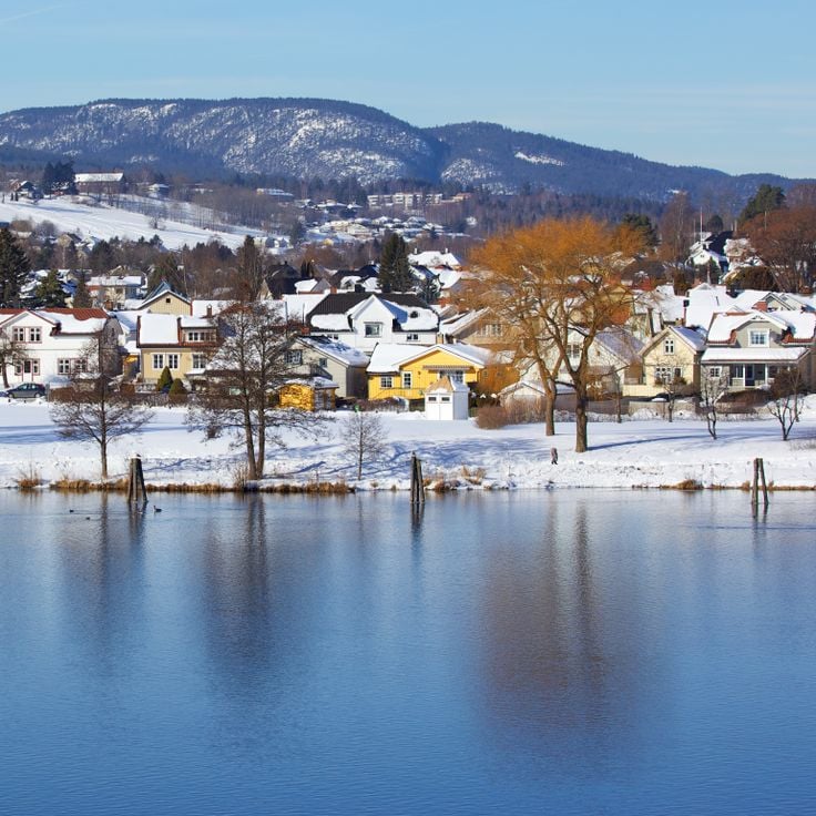
Oslo, Norway's capital, sits at the head of a fjord and brings together city life with easy access to nature. Modern architecture and world-class museums share space with nearby forests and waterways. The city reflects the character of a country that stretches from gentle southern landscapes all the way to the Arctic. Walking through Oslo, you feel the openness that defines this part of the world.
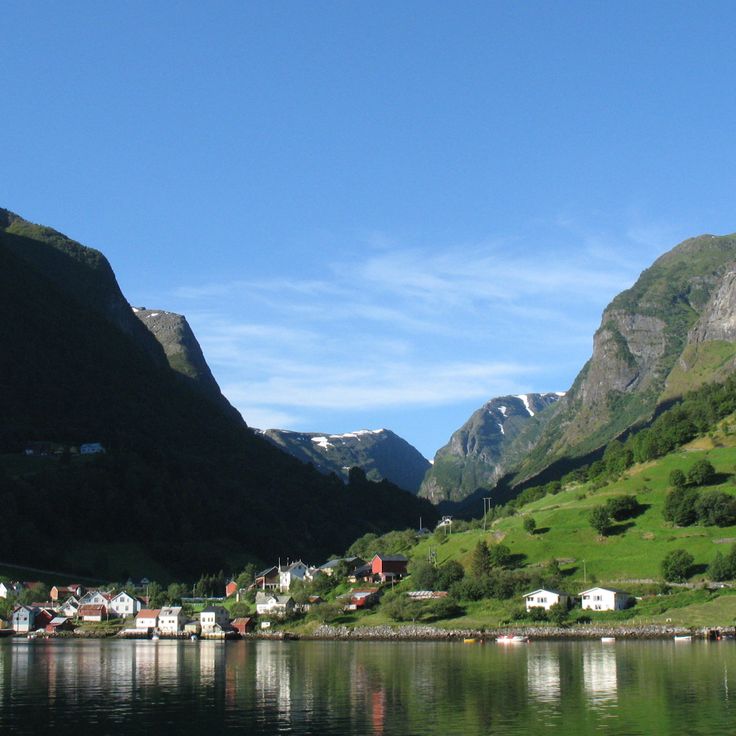
The Sognefjord is Norway's longest and deepest fjord. It stretches about 200 km inland from the coast, cutting deep into the country. Steep mountains rise directly from the water, and small villages sit along its shores. Glaciers feed the fjord with meltwater. The landscape shows how ice shaped the valley over thousands of years. You can travel by boat or walk along the shoreline paths to take in the views.
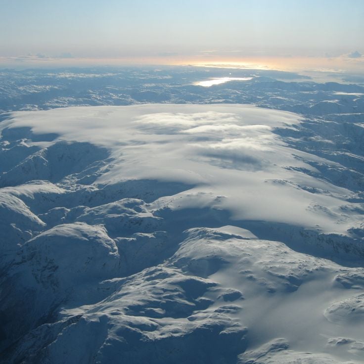
The Svalbard Archipelago lies between mainland Norway and the North Pole, featuring landscapes of glaciers, deep fjords, and Arctic terrain. This island group is one of the few places where wild polar bears live and roam freely. Svalbard extends far above the Arctic Circle and is shaped by extreme environments. The valleys carved by ancient ice and the steep mountainsides create dramatic views across these northern islands.
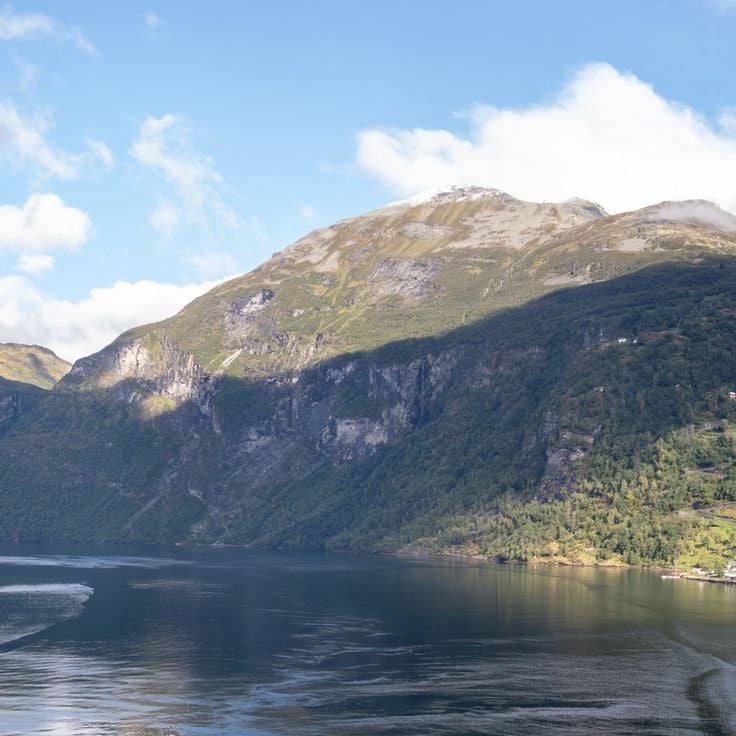
The Geirangerfjord sits in western Norway and is recognized as a UNESCO World Heritage site. This fjord cuts through mountainous terrain with steep rock walls that rise from the water. Several waterfalls cascade down the cliffs and meet the sea below. The fjord landscape was shaped by glaciers that carved out the valley over thousands of years. Visitors travel by boat through the fjord to see the surrounding landscape up close and experience the scale of the geology.
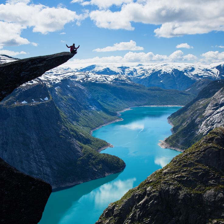
Trolltunga is a rock formation above Sorfjord in Odda that juts out about 700 meters (2,300 feet) high. The stone tongue was carved by glaciers and sits like a platform over the valley below. The hike takes about 10 to 12 hours round trip. From here you see deep valleys, the water below, and the surrounding mountains. In summer, many people come to enjoy the view and take photos. The place shows the power of nature that shaped the Norwegian mountains.
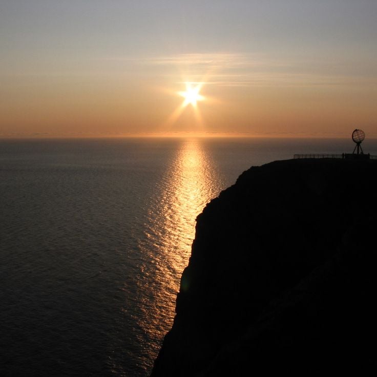
Cape North on Magerøya Island is the northernmost point of Europe you can reach by car. The cliff rises 307 meters (1,007 feet) above the Arctic Ocean and offers an open view of the arctic sea. On clear days, visitors see farther north from here than from any other place on the continent. In winter, travelers can watch the northern lights dance across the sky from this location. Cape North is a destination at the end of a long drive through Finnmark's highland, where only rocks, snow, and the sea shape the landscape.
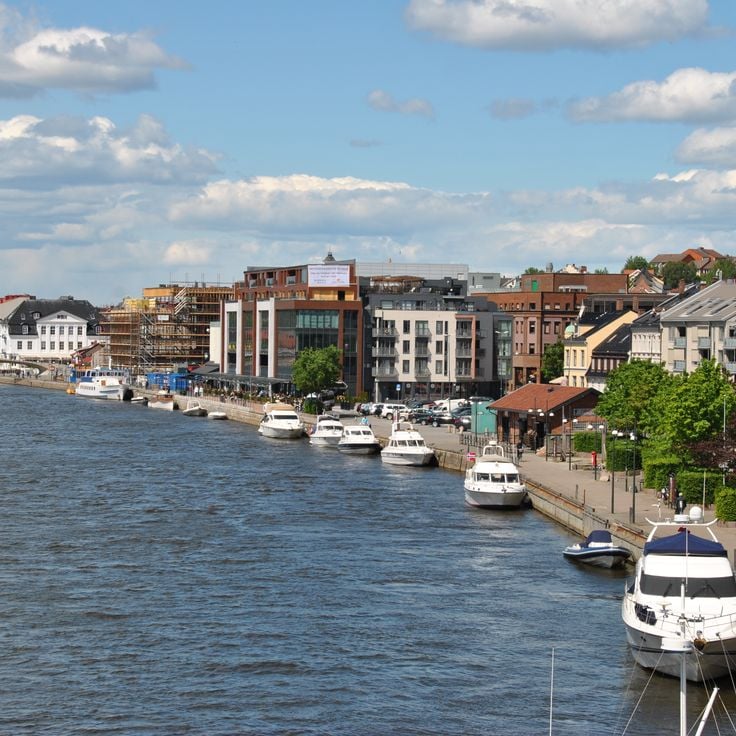
Fredrikstad is a fortified city founded in 1567 at the mouth of the Glommen River. The city displays the walls and bastions that made it an important defensive post. The old town on the island of Gamlebyen preserves the historical layout with its streets, wooden buildings, and fortress architecture spanning several centuries. Visitors can see how life unfolded in a Nordic border city. Fredrikstad was long Sweden's easternmost stronghold against Norway and played a role in the regional conflicts of its time.
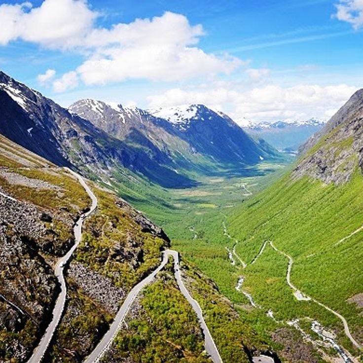
Trollstigen is a mountain road near Åndalsnes with 11 hairpin turns that wind through steep rock walls. The road offers sweeping views of glacier-carved valleys and is one of Norway's most famous driving routes. It connects the valley floor with higher elevations, cutting through dramatic mountain terrain with sheer cliffs on both sides.
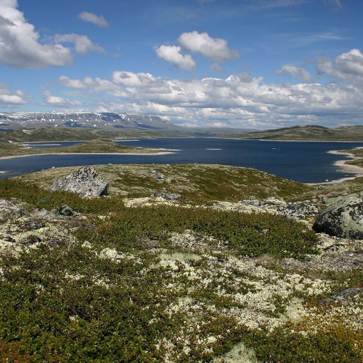
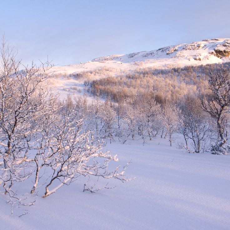
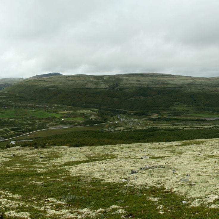
Hardangervidda is Europe's largest mountain plateau, spanning across Hordaland and Buskerud. This highland offers Arctic landscapes with vast plains, lakes, and rivers. It is home to one of the continent's largest wild reindeer populations. The plateau sits between green valleys and snow-capped mountains. Hikers find solitude and raw nature here, especially in summer and autumn. Hardangervidda connects Norway's southern fjord landscape with the northern wilderness.
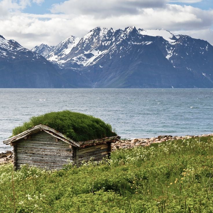
The Lyngenfjord is a fjord in the Troms og Finnmark region, marked by steep mountain ranges. High peaks rise directly from the water along its shores. In winter, this fjord offers good conditions for watching the Northern Lights. The landscape shows the raw nature of the Far North with its characteristic mountain formations and cold waters.
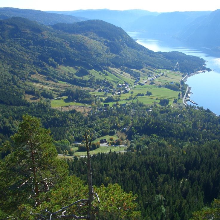
Setesdal is a valley in southeastern Norway where traditional Norwegian culture remains part of everyday life. The region features hiking trails through forests and mountains, along with small museums that showcase local crafts and heritage. Visitors will find a quieter valley away from the more famous fjords, where local traditions stay alive in the villages and among the people.
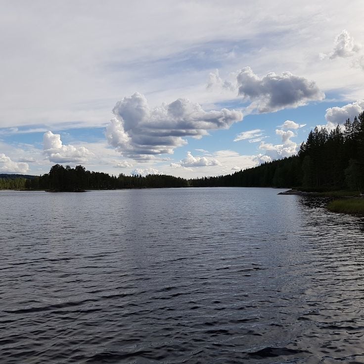
Velmunden in Oppland features a chain of connected lakes that serve as an excellent destination for canoeing and immersion in nature. The interconnected waters allow paddlers to move through forested landscapes and experience the quiet of the Norwegian wilderness. Visitors can explore the lakes at their own pace, watching the surrounding forests and hills from the water.
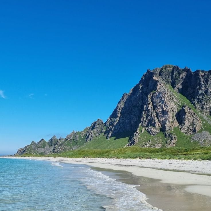
Bleik on Andøya is an Arctic beach defined by a distinctive pyramid-shaped mountain that rises from the sea. This location offers excellent opportunities for watching puffins, which nest here in large numbers, and provides chances to observe the Northern Lights during winter months. The beach combines the raw character of the far north with opportunities to experience seabirds and natural phenomena of the high Arctic.
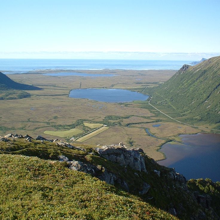
Vesterålen is an archipelago situated near the Lofoten Islands but receives fewer visitors. The landscape features rugged Arctic nature with steep mountains that drop into the sea. The waters around Vesterålen are home to whales that can be observed throughout the year. Small fishing villages dot the coastline, and the terrain feels remote and untamed.
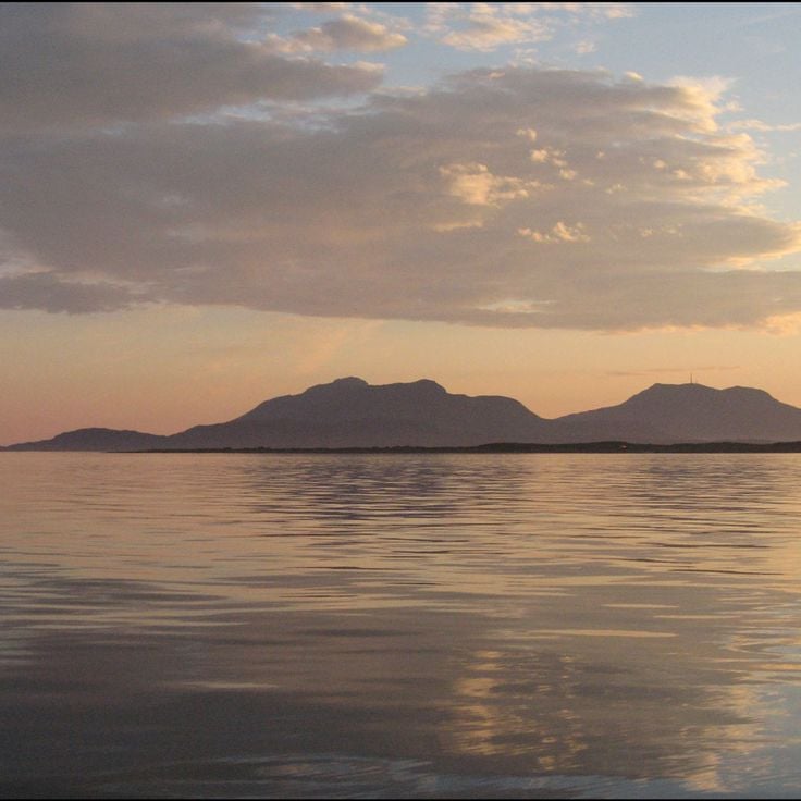
The Vega archipelago is a group of islands off the Norwegian coast recognized by UNESCO as a World Heritage site. For centuries, the life of the people here has been shaped by the farming of eider ducks. The islands show how residents live in harmony with nature and use traditional methods to benefit from the valuable down of these birds. The landscape feels rugged and untouched, marked by rocks, water, and diverse wildlife.
Femundsmarka is a national park in Sør-Trøndelag that offers wild territory for hiking, canoeing, and reindeer watching in complete isolation from civilization. The park provides genuine nature experiences far from any settlements.
Bergen is a historic port city in southwestern Norway and serves as the gateway to the region's fjords. The old town features colorful wooden buildings that are protected as a UNESCO World Heritage Site. From Bergen, visitors can explore the major fjords of the western coast, including Geirangerfjord and Sognefjord. The city sits at the end of its own fjord, surrounded by forests and hills.
Vest-Agder is a coastal region in southern Norway known for its archipelago, small fishing villages, and sheltered coves. The climate here is milder than elsewhere in the country. This region shows a different face of Norway - not the high fjords of the west, but a gentler landscape with a jagged coastline and traditional settlements shaped by fishing traditions.
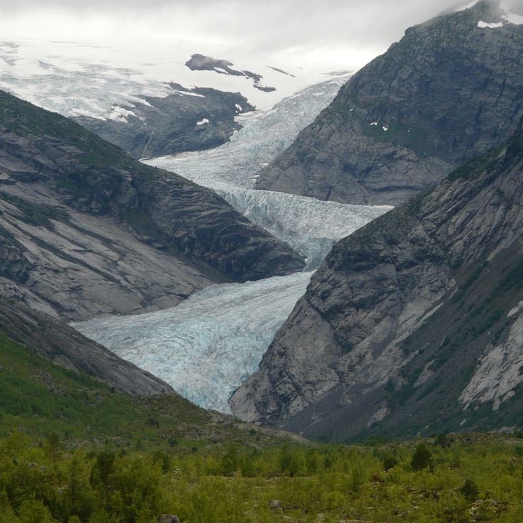
Jostedalsbreen is mainland Europe's largest glacier, nestled in a landscape of mountains and valleys. This glacier sits at the heart of a region shaped by towering peaks and deep fjords. Visitors can experience the power of nature by exploring the glacier's edges or hiking through the surrounding valleys. The ice and its meltwater have carved the land over thousands of years, creating the dramatic scenery that defines western Norway.
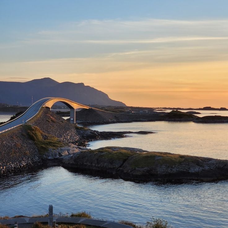
The Atlanterhavsveien connects Kristiansund and Molde across a spectacular route that passes through several islands and reefs. Eight bridges span boldly over the sea along the way. The road reveals views of rugged coastal landscapes, rocks, and open water. This route shows a different side of Norway: the dramatic west coast with its island world, where nature displays its raw power directly to travelers.
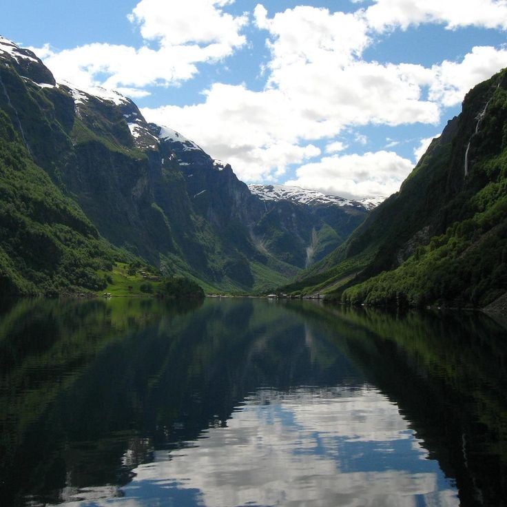
The Nærøyfjord in Flåm is a narrow fjord that has earned recognition as a UNESCO World Heritage site. Steep cliff faces rise up to 1700 meters (5,577 feet) on either side. Waterfalls cascade down from the slopes, fed by melting snow from the mountains above. The fjord shows the work of glaciers that carved these deep valleys over thousands of years. Visitors experience the raw beauty of Norway's western coast here.
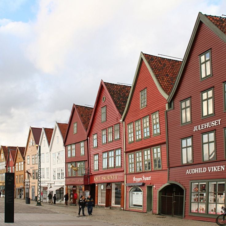
Bryggen is the old Hanseatic quarter of Bergen, where rows of wooden houses in bright colors lean toward each other along narrow streets. These buildings, many from the 14th century onward, stand as they have for hundreds of years. Inside, artisans work in small shops and studios. The wharves below once bustled with merchants trading cod and other goods. Walking here, you feel the weight of time in every weathered wooden wall and crooked doorway.
The island of Senja in northern Norway is often called Norway in miniature because it shows so much variety in a small space. The landscape shifts between steep mountains, deep fjords, and rocky coastlines. Small fishing villages dot the shores, and trails lead to viewpoints where you can see across the water and peaks. In winter, Senja is a place to watch the Northern Lights. Summer brings long daylight hours and many chances to explore the outdoors.
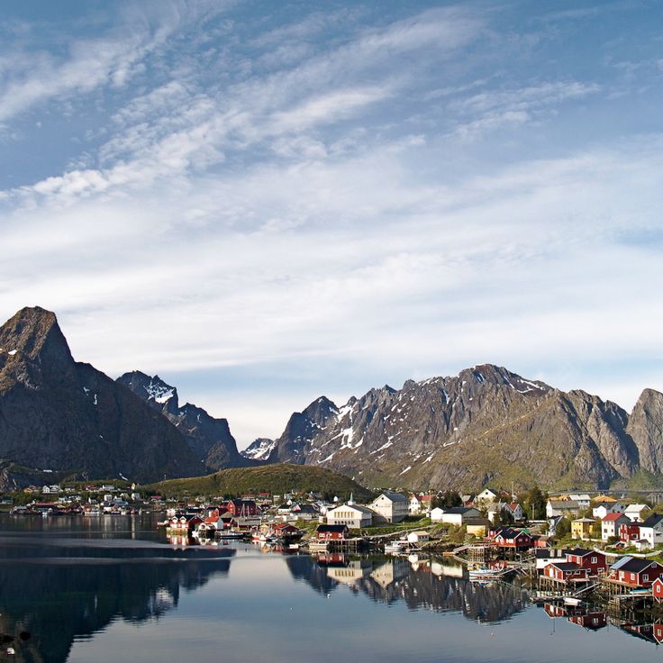
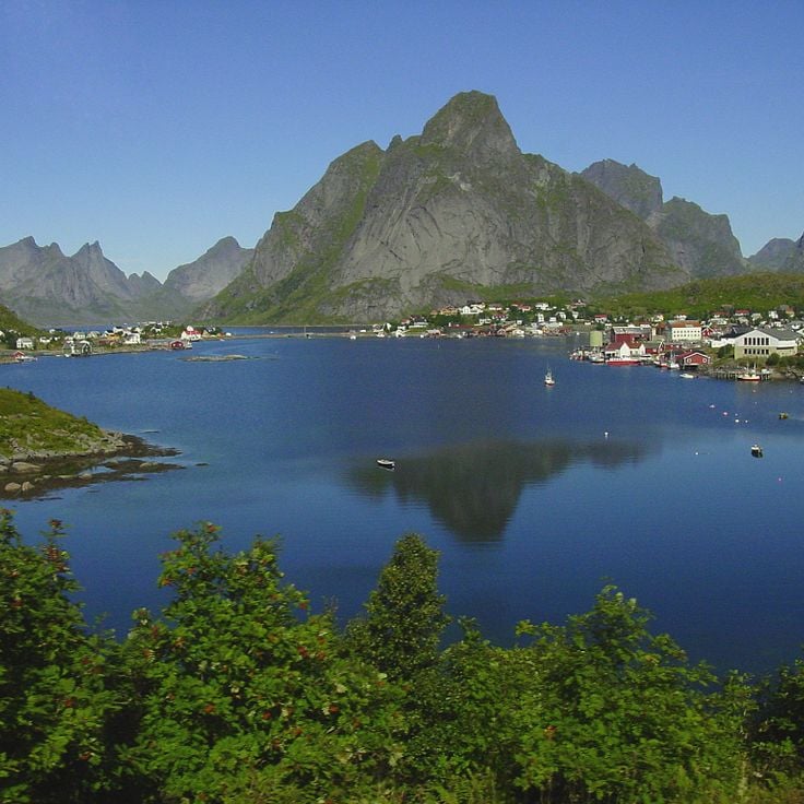
Reine is a fishing village in the Lofoten Islands where traditional red houses sit on stilts over the water. Steep mountains surround the village and reflect in the clear sea. The place shows how people have lived from fishing for generations. The landscape is raw and dramatic, with mountains rising directly from the ocean.
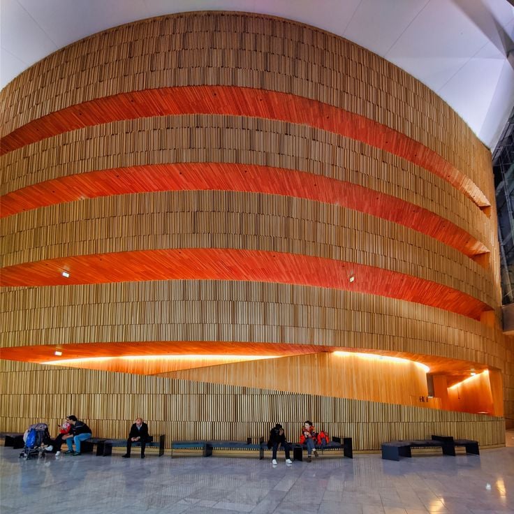
The Oslo Opera House is a contemporary building with a white marble roof that visitors can walk on. From the top, you can see the fjord and the city below. The building sits by the water in Oslo's center and represents modern Norwegian architecture.
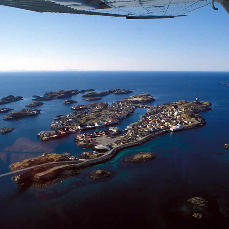
Henningsvær is a fishing village in the Lofoten Islands, spread across several small islands connected by bridges. This village is part of Norway's northern territories where the Lofoten Islands emerge from the ocean with their fishing communities and steep mountains. The village features a football field situated between the sea and the mountains, reflecting how daily life here is shaped by the dramatic landscape and maritime heritage of these remote islands.
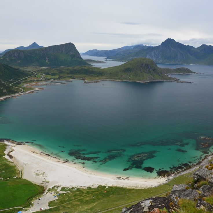
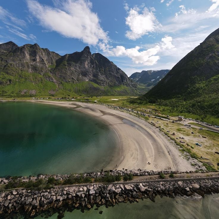
Haukland Beach is located on the Lofoten Islands, a place where white sand meets turquoise water. This beach offers views of sunsets and provides opportunities to see the Northern Lights in winter. It sits in a region known for steep mountains and fishing villages that rise from the sea.
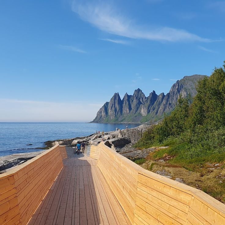
Tungeneset on Senja offers views of steep mountain peaks that rise directly from the ocean. The dramatic rock formations known as the Troll Teeth create a striking landscape. From this viewpoint, visitors can see how the mountains shape the coastline of northern Norway, with the ocean stretching below the cliffs.
Ersfjord is located on the island of Senja and sits surrounded by steep mountains that drop directly into deep blue waters. This fjord features clear water and a white sand beach at its end. It is one of the many fjords that define the Norwegian landscape and draw visitors seeking to experience the dramatic nature of the north. The tall mountain walls create an imposing backdrop for this remote location.
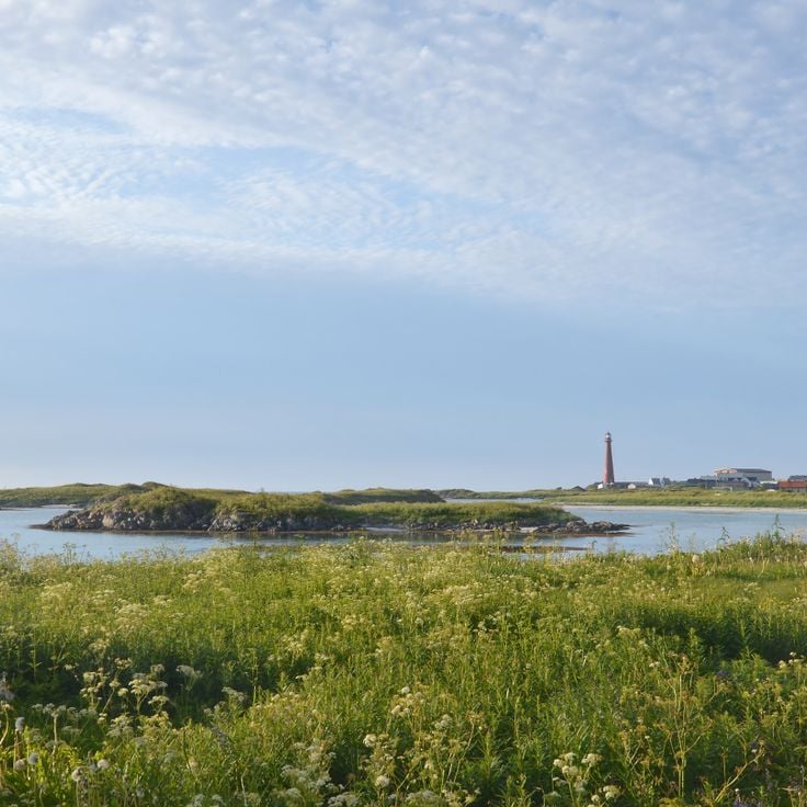
Andenes is a village at the northern tip of the Vesteralen Islands, known for whale watching. The harbor here serves as a departure point for boat trips out to sea, where you can observe whales and other marine animals. A lighthouse marks the landscape and shows how important this place has been for seafaring. The village itself feels rugged and shaped by nature, like many small settlements in northern Norway.
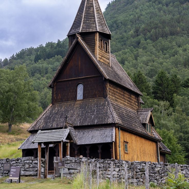
This wooden church in Solvorn is the oldest surviving timber church in Norway. Built about 900 years ago, it displays a rare blend of Christian and Viking artistic traditions. The carved decorations on its doors and walls tell the story of a time when two cultures met and mixed. The wooden building, with its dark beams, feels timeless and connects Norway's artistic heritage in a way few structures do.
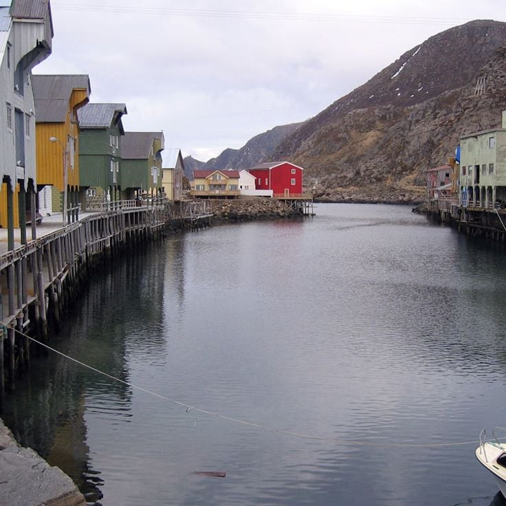
Nyksund was once a fishing village in the Vesterålen that was abandoned but has been revived by a community of artists. The village sits on stilts above the water, with colorful houses reflected in the waves. Artists have rebuilt this place and made it a destination for creative people and visitors wanting to discover the history and art of the north.
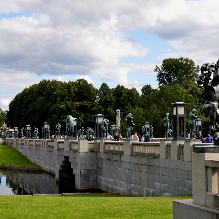
Vigeland Park in Oslo showcases sculptures by Norwegian artist Gustav Vigeland. The park contains over 200 works in bronze and granite that depict human relationships and different stages of life. The most famous sculpture is Sinnataggen, a small boy with a defiant fist. The park sits at the edge of the city and combines artwork with green space. Visitors walk through pathways lined with sculptures and find quiet spots to rest.
Bygdøy Peninsula in Oslo is where Norwegian history comes to life. Several major museums are gathered here, telling stories of Norway's past. The Maritime Museum displays Viking ships that are hundreds of years old. The Fram Museum is dedicated to polar expeditions. Visitors can understand how Norwegians conquered the seas and traveled to distant regions. The museums sit in a green setting with views of the fjord. Walking paths and nature complement the cultural visit.
Folgefonna Glacier lies near Bergen and allows visitors to ski on its slopes during the summer months. This glacier is part of Norway's varied natural landscapes, where fjords and mountain ranges extend across vast distances. The glacier offers direct access to glacial environments and shows the geological features of western Norway.
Trondheim is a harbor city on Norway's west coast and was long the religious center of the country. The city features a music museum, lively pedestrian shopping areas, and historic districts with traditional wooden warehouses built on stilts over the water. Trondheim sits at the head of a fjord that has shaped the city for centuries. The architecture tells this story through colorful wooden buildings that line the waterfront.
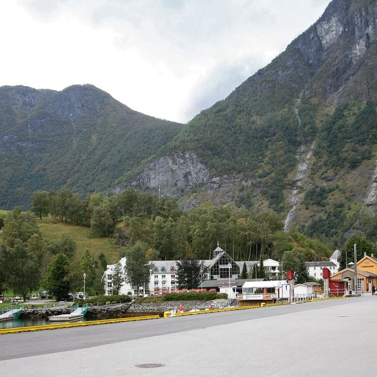
Flåm is a small village on the shore of Aurlandsfjord in Norway. The village is known for the Flåmsbana, a railway that travels through mountainous and fjord landscapes. The route connects Flåm with higher areas and passes waterfalls, tunnels, and steep mountain slopes along the way. Visitors can also take boat trips on the fjord from here or hike in the surrounding area.
The Lysefjord is a fjord with mineral landscapes, rocky massifs, small lakes, and mountain scenery offering steep views. Located near Stavanger, it embodies the western face of Norway with its glacier-carved valleys and dramatic rock faces.
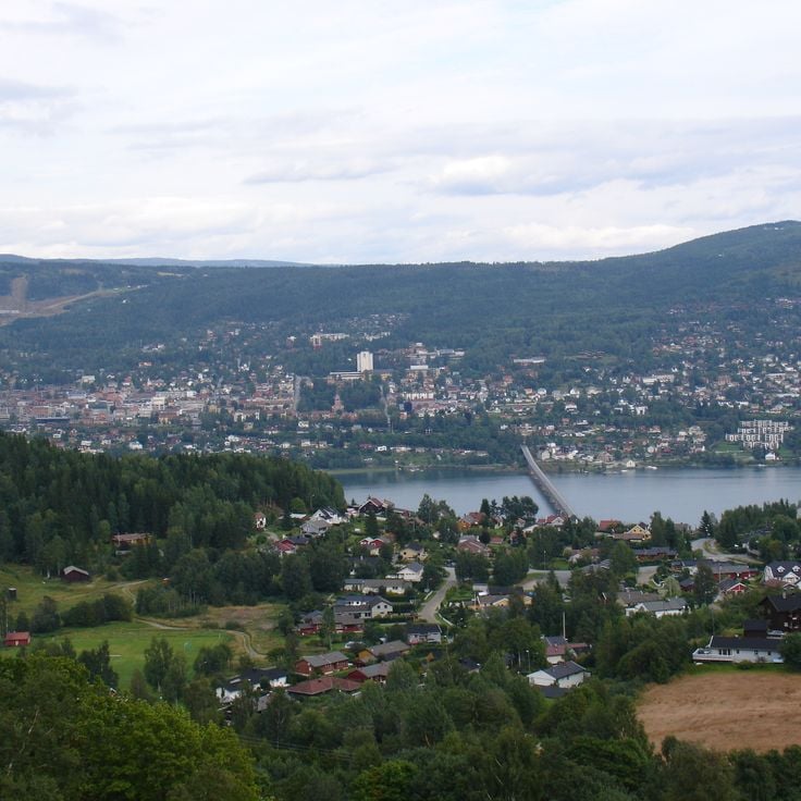
Lillehammer is a historic city in southern Norway that gained international recognition by hosting the 1994 Winter Olympics. Located on a fjord and surrounded by mountains, the city offers a window into Norwegian life across centuries. The Maihaugen open-air museum contains over 200 buildings from different regions, displaying traditional wooden houses, old crafts, and everyday objects from the past. Visitors can walk through different time periods and see how people lived in rural Norway. The Olympic venues from 1994 remain visible in the landscape. Lillehammer brings together history, sport, and nature in a place where you can experience Norwegian culture directly.
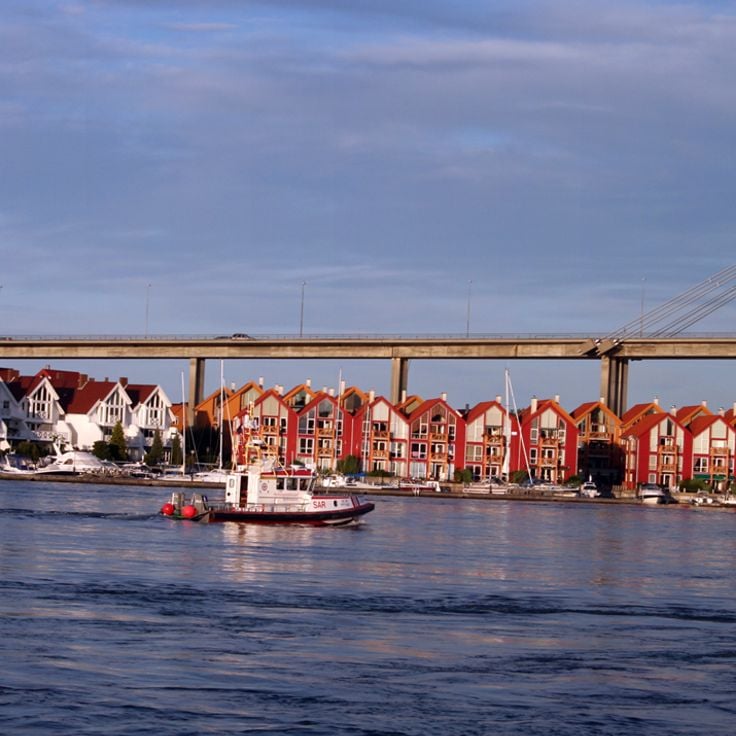
Stavanger is a coastal city on Norway's west coast where modern development has not erased its maritime character. The city transitioned from an oil industry hub to a diverse destination while keeping its working port identity. White wooden houses in the old town reflect the city's history. Museums like Stavanger Museum and the Petroleum Museum document different periods of the city's past. From here, travelers can easily access nearby fjords and hiking routes, including the path to Preikestolen.
Telemark is a region in Norway often called Norway in miniature. The region features valleys, lower mountains, and extensive forests that shape the landscape. Traditional wooden stave churches dot the area, standing as reminders of centuries past. Telemark represents the living traditions of the country, showing how people have adapted to life in this terrain.
Moskenesøy is the southernmost and most visited island of the Lofoten Islands. Steep mountains rise directly from the sea, and small fishing villages nestle in the coves. Reine, the most famous village, has red cabins lining the waterfront. The island shows how people here have lived from fishing for generations. Hiking trails cross green slopes with views of the coast and surrounding peaks.
Dovre National Park spans the Hedmark and Oppland regions and forms part of Norway's mountain landscape. The park offers walking trails through alpine terrain where moose and other wildlife roam freely in their natural habitat. Visitors experience the rugged character of Norway's interior, with steep slopes, clear streams, and wide views across the mountains.
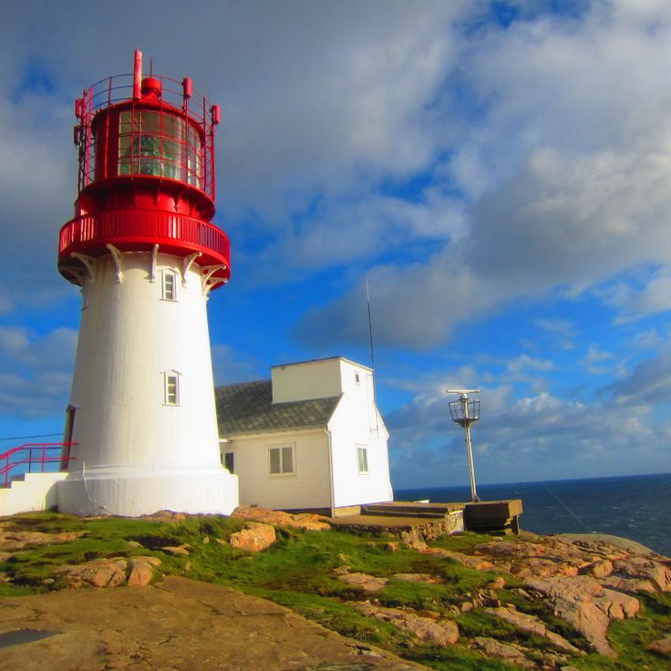
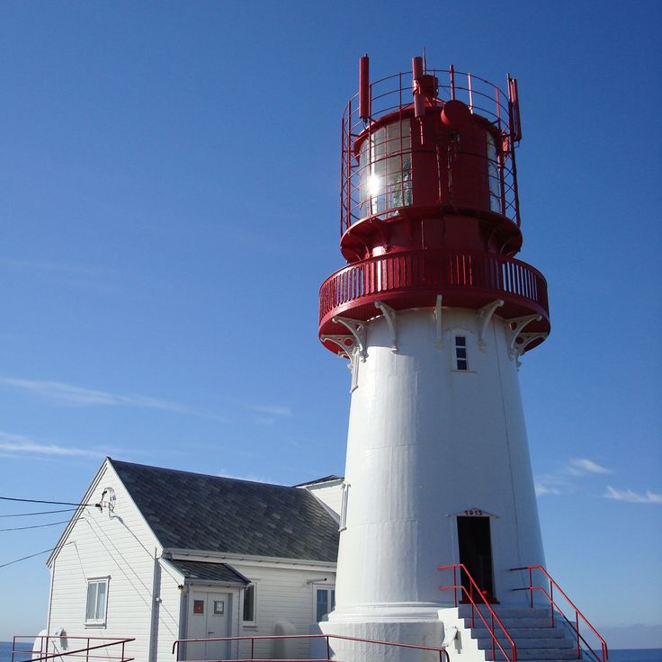
Lindesnes is a lighthouse at the southernmost tip of Norway, standing where the southern coast meets open water. From this point, visitors see raw coastal landscapes and understand why this location has guided ships for centuries. The lighthouse marks an important part of Norway's maritime history. The surrounding area shows the character of the southern Norwegian coast, with its winds and waves that shape the land before the fjords and mountains of the west begin.
Mount Floyen rises above Bergen and from its summit offers sweeping views across the city, its harbor, and the surrounding landscape. A funicular railway carries visitors to the top. Once there, you see Bergen spread around its harbor, with the colorful wooden buildings of the Bryggen district visible below and mountains beyond. On clear days, your view extends across the fjords and islands of the western coast. This mountain is part of what defines Norway: peaks like this surround the cities and fjords throughout the country.
Preikestolen is a cliff that rises above the Lysefjord and offers views across deep water and mountain slopes. From the top, you can see for miles over the fjord landscape. The path leads through heath and forest, past small lakes, until it reaches the cliff edge. Once there, you see how the water far below meets the rock walls. This place shows why Norway's west is known for its fjords.
Tromsø sits north of the Arctic Circle on Norway's coast. The city is known for the northern lights in winter, which attract visitors from around the world. In summer, daylight lasts for months. Life in Tromsø mixes Arctic nature with a vibrant city culture. Restaurants and cafes line the streets, while mountains and sea offer adventure just beyond the city.
Located beyond the Arctic Circle, this island archipelago features sharp peaks, white sand beaches, and colorful fishing villages. The Lofoten Islands are part of northern Norway, where steep mountains rise directly from the sea and traditional fishing villages shape how people live. Nature here feels raw and immediate. In winter, the Northern Lights often appear over the islands, while in summer the light barely fades.
Oslo, Norway's capital, sits at the head of a fjord and brings together city life with easy access to nature. Modern architecture and world-class museums share space with nearby forests and waterways. The city reflects the character of a country that stretches from gentle southern landscapes all the way to the Arctic. Walking through Oslo, you feel the openness that defines this part of the world.
The Sognefjord is Norway's longest and deepest fjord. It stretches about 200 km inland from the coast, cutting deep into the country. Steep mountains rise directly from the water, and small villages sit along its shores. Glaciers feed the fjord with meltwater. The landscape shows how ice shaped the valley over thousands of years. You can travel by boat or walk along the shoreline paths to take in the views.
The Svalbard Archipelago lies between mainland Norway and the North Pole, featuring landscapes of glaciers, deep fjords, and Arctic terrain. This island group is one of the few places where wild polar bears live and roam freely. Svalbard extends far above the Arctic Circle and is shaped by extreme environments. The valleys carved by ancient ice and the steep mountainsides create dramatic views across these northern islands.
The Geirangerfjord sits in western Norway and is recognized as a UNESCO World Heritage site. This fjord cuts through mountainous terrain with steep rock walls that rise from the water. Several waterfalls cascade down the cliffs and meet the sea below. The fjord landscape was shaped by glaciers that carved out the valley over thousands of years. Visitors travel by boat through the fjord to see the surrounding landscape up close and experience the scale of the geology.
Trolltunga is a rock formation above Sorfjord in Odda that juts out about 700 meters (2,300 feet) high. The stone tongue was carved by glaciers and sits like a platform over the valley below. The hike takes about 10 to 12 hours round trip. From here you see deep valleys, the water below, and the surrounding mountains. In summer, many people come to enjoy the view and take photos. The place shows the power of nature that shaped the Norwegian mountains.
Cape North on Magerøya Island is the northernmost point of Europe you can reach by car. The cliff rises 307 meters (1,007 feet) above the Arctic Ocean and offers an open view of the arctic sea. On clear days, visitors see farther north from here than from any other place on the continent. In winter, travelers can watch the northern lights dance across the sky from this location. Cape North is a destination at the end of a long drive through Finnmark's highland, where only rocks, snow, and the sea shape the landscape.
Fredrikstad is a fortified city founded in 1567 at the mouth of the Glommen River. The city displays the walls and bastions that made it an important defensive post. The old town on the island of Gamlebyen preserves the historical layout with its streets, wooden buildings, and fortress architecture spanning several centuries. Visitors can see how life unfolded in a Nordic border city. Fredrikstad was long Sweden's easternmost stronghold against Norway and played a role in the regional conflicts of its time.
Trollstigen is a mountain road near Åndalsnes with 11 hairpin turns that wind through steep rock walls. The road offers sweeping views of glacier-carved valleys and is one of Norway's most famous driving routes. It connects the valley floor with higher elevations, cutting through dramatic mountain terrain with sheer cliffs on both sides.
Hardangervidda is Europe's largest mountain plateau, spanning across Hordaland and Buskerud. This highland offers Arctic landscapes with vast plains, lakes, and rivers. It is home to one of the continent's largest wild reindeer populations. The plateau sits between green valleys and snow-capped mountains. Hikers find solitude and raw nature here, especially in summer and autumn. Hardangervidda connects Norway's southern fjord landscape with the northern wilderness.
The Lyngenfjord is a fjord in the Troms og Finnmark region, marked by steep mountain ranges. High peaks rise directly from the water along its shores. In winter, this fjord offers good conditions for watching the Northern Lights. The landscape shows the raw nature of the Far North with its characteristic mountain formations and cold waters.
Setesdal is a valley in southeastern Norway where traditional Norwegian culture remains part of everyday life. The region features hiking trails through forests and mountains, along with small museums that showcase local crafts and heritage. Visitors will find a quieter valley away from the more famous fjords, where local traditions stay alive in the villages and among the people.
Velmunden in Oppland features a chain of connected lakes that serve as an excellent destination for canoeing and immersion in nature. The interconnected waters allow paddlers to move through forested landscapes and experience the quiet of the Norwegian wilderness. Visitors can explore the lakes at their own pace, watching the surrounding forests and hills from the water.
Bleik on Andøya is an Arctic beach defined by a distinctive pyramid-shaped mountain that rises from the sea. This location offers excellent opportunities for watching puffins, which nest here in large numbers, and provides chances to observe the Northern Lights during winter months. The beach combines the raw character of the far north with opportunities to experience seabirds and natural phenomena of the high Arctic.
Vesterålen is an archipelago situated near the Lofoten Islands but receives fewer visitors. The landscape features rugged Arctic nature with steep mountains that drop into the sea. The waters around Vesterålen are home to whales that can be observed throughout the year. Small fishing villages dot the coastline, and the terrain feels remote and untamed.
The Vega archipelago is a group of islands off the Norwegian coast recognized by UNESCO as a World Heritage site. For centuries, the life of the people here has been shaped by the farming of eider ducks. The islands show how residents live in harmony with nature and use traditional methods to benefit from the valuable down of these birds. The landscape feels rugged and untouched, marked by rocks, water, and diverse wildlife.
Femundsmarka is a national park in Sør-Trøndelag that offers wild territory for hiking, canoeing, and reindeer watching in complete isolation from civilization. The park provides genuine nature experiences far from any settlements.
Bergen is a historic port city in southwestern Norway and serves as the gateway to the region's fjords. The old town features colorful wooden buildings that are protected as a UNESCO World Heritage Site. From Bergen, visitors can explore the major fjords of the western coast, including Geirangerfjord and Sognefjord. The city sits at the end of its own fjord, surrounded by forests and hills.
Vest-Agder is a coastal region in southern Norway known for its archipelago, small fishing villages, and sheltered coves. The climate here is milder than elsewhere in the country. This region shows a different face of Norway - not the high fjords of the west, but a gentler landscape with a jagged coastline and traditional settlements shaped by fishing traditions.
Jostedalsbreen is mainland Europe's largest glacier, nestled in a landscape of mountains and valleys. This glacier sits at the heart of a region shaped by towering peaks and deep fjords. Visitors can experience the power of nature by exploring the glacier's edges or hiking through the surrounding valleys. The ice and its meltwater have carved the land over thousands of years, creating the dramatic scenery that defines western Norway.
The Atlanterhavsveien connects Kristiansund and Molde across a spectacular route that passes through several islands and reefs. Eight bridges span boldly over the sea along the way. The road reveals views of rugged coastal landscapes, rocks, and open water. This route shows a different side of Norway: the dramatic west coast with its island world, where nature displays its raw power directly to travelers.
The Nærøyfjord in Flåm is a narrow fjord that has earned recognition as a UNESCO World Heritage site. Steep cliff faces rise up to 1700 meters (5,577 feet) on either side. Waterfalls cascade down from the slopes, fed by melting snow from the mountains above. The fjord shows the work of glaciers that carved these deep valleys over thousands of years. Visitors experience the raw beauty of Norway's western coast here.
Bryggen is the old Hanseatic quarter of Bergen, where rows of wooden houses in bright colors lean toward each other along narrow streets. These buildings, many from the 14th century onward, stand as they have for hundreds of years. Inside, artisans work in small shops and studios. The wharves below once bustled with merchants trading cod and other goods. Walking here, you feel the weight of time in every weathered wooden wall and crooked doorway.
The island of Senja in northern Norway is often called Norway in miniature because it shows so much variety in a small space. The landscape shifts between steep mountains, deep fjords, and rocky coastlines. Small fishing villages dot the shores, and trails lead to viewpoints where you can see across the water and peaks. In winter, Senja is a place to watch the Northern Lights. Summer brings long daylight hours and many chances to explore the outdoors.
Reine is a fishing village in the Lofoten Islands where traditional red houses sit on stilts over the water. Steep mountains surround the village and reflect in the clear sea. The place shows how people have lived from fishing for generations. The landscape is raw and dramatic, with mountains rising directly from the ocean.
The Oslo Opera House is a contemporary building with a white marble roof that visitors can walk on. From the top, you can see the fjord and the city below. The building sits by the water in Oslo's center and represents modern Norwegian architecture.
Henningsvær is a fishing village in the Lofoten Islands, spread across several small islands connected by bridges. This village is part of Norway's northern territories where the Lofoten Islands emerge from the ocean with their fishing communities and steep mountains. The village features a football field situated between the sea and the mountains, reflecting how daily life here is shaped by the dramatic landscape and maritime heritage of these remote islands.
Haukland Beach is located on the Lofoten Islands, a place where white sand meets turquoise water. This beach offers views of sunsets and provides opportunities to see the Northern Lights in winter. It sits in a region known for steep mountains and fishing villages that rise from the sea.
Tungeneset on Senja offers views of steep mountain peaks that rise directly from the ocean. The dramatic rock formations known as the Troll Teeth create a striking landscape. From this viewpoint, visitors can see how the mountains shape the coastline of northern Norway, with the ocean stretching below the cliffs.
Ersfjord is located on the island of Senja and sits surrounded by steep mountains that drop directly into deep blue waters. This fjord features clear water and a white sand beach at its end. It is one of the many fjords that define the Norwegian landscape and draw visitors seeking to experience the dramatic nature of the north. The tall mountain walls create an imposing backdrop for this remote location.
Andenes is a village at the northern tip of the Vesteralen Islands, known for whale watching. The harbor here serves as a departure point for boat trips out to sea, where you can observe whales and other marine animals. A lighthouse marks the landscape and shows how important this place has been for seafaring. The village itself feels rugged and shaped by nature, like many small settlements in northern Norway.
This wooden church in Solvorn is the oldest surviving timber church in Norway. Built about 900 years ago, it displays a rare blend of Christian and Viking artistic traditions. The carved decorations on its doors and walls tell the story of a time when two cultures met and mixed. The wooden building, with its dark beams, feels timeless and connects Norway's artistic heritage in a way few structures do.
Nyksund was once a fishing village in the Vesterålen that was abandoned but has been revived by a community of artists. The village sits on stilts above the water, with colorful houses reflected in the waves. Artists have rebuilt this place and made it a destination for creative people and visitors wanting to discover the history and art of the north.
Vigeland Park in Oslo showcases sculptures by Norwegian artist Gustav Vigeland. The park contains over 200 works in bronze and granite that depict human relationships and different stages of life. The most famous sculpture is Sinnataggen, a small boy with a defiant fist. The park sits at the edge of the city and combines artwork with green space. Visitors walk through pathways lined with sculptures and find quiet spots to rest.
Bygdøy Peninsula in Oslo is where Norwegian history comes to life. Several major museums are gathered here, telling stories of Norway's past. The Maritime Museum displays Viking ships that are hundreds of years old. The Fram Museum is dedicated to polar expeditions. Visitors can understand how Norwegians conquered the seas and traveled to distant regions. The museums sit in a green setting with views of the fjord. Walking paths and nature complement the cultural visit.
Folgefonna Glacier lies near Bergen and allows visitors to ski on its slopes during the summer months. This glacier is part of Norway's varied natural landscapes, where fjords and mountain ranges extend across vast distances. The glacier offers direct access to glacial environments and shows the geological features of western Norway.
Trondheim is a harbor city on Norway's west coast and was long the religious center of the country. The city features a music museum, lively pedestrian shopping areas, and historic districts with traditional wooden warehouses built on stilts over the water. Trondheim sits at the head of a fjord that has shaped the city for centuries. The architecture tells this story through colorful wooden buildings that line the waterfront.
Flåm is a small village on the shore of Aurlandsfjord in Norway. The village is known for the Flåmsbana, a railway that travels through mountainous and fjord landscapes. The route connects Flåm with higher areas and passes waterfalls, tunnels, and steep mountain slopes along the way. Visitors can also take boat trips on the fjord from here or hike in the surrounding area.
The Lysefjord is a fjord with mineral landscapes, rocky massifs, small lakes, and mountain scenery offering steep views. Located near Stavanger, it embodies the western face of Norway with its glacier-carved valleys and dramatic rock faces.
Lillehammer is a historic city in southern Norway that gained international recognition by hosting the 1994 Winter Olympics. Located on a fjord and surrounded by mountains, the city offers a window into Norwegian life across centuries. The Maihaugen open-air museum contains over 200 buildings from different regions, displaying traditional wooden houses, old crafts, and everyday objects from the past. Visitors can walk through different time periods and see how people lived in rural Norway. The Olympic venues from 1994 remain visible in the landscape. Lillehammer brings together history, sport, and nature in a place where you can experience Norwegian culture directly.
Stavanger is a coastal city on Norway's west coast where modern development has not erased its maritime character. The city transitioned from an oil industry hub to a diverse destination while keeping its working port identity. White wooden houses in the old town reflect the city's history. Museums like Stavanger Museum and the Petroleum Museum document different periods of the city's past. From here, travelers can easily access nearby fjords and hiking routes, including the path to Preikestolen.
Telemark is a region in Norway often called Norway in miniature. The region features valleys, lower mountains, and extensive forests that shape the landscape. Traditional wooden stave churches dot the area, standing as reminders of centuries past. Telemark represents the living traditions of the country, showing how people have adapted to life in this terrain.
Moskenesøy is the southernmost and most visited island of the Lofoten Islands. Steep mountains rise directly from the sea, and small fishing villages nestle in the coves. Reine, the most famous village, has red cabins lining the waterfront. The island shows how people here have lived from fishing for generations. Hiking trails cross green slopes with views of the coast and surrounding peaks.
Dovre National Park spans the Hedmark and Oppland regions and forms part of Norway's mountain landscape. The park offers walking trails through alpine terrain where moose and other wildlife roam freely in their natural habitat. Visitors experience the rugged character of Norway's interior, with steep slopes, clear streams, and wide views across the mountains.
Lindesnes is a lighthouse at the southernmost tip of Norway, standing where the southern coast meets open water. From this point, visitors see raw coastal landscapes and understand why this location has guided ships for centuries. The lighthouse marks an important part of Norway's maritime history. The surrounding area shows the character of the southern Norwegian coast, with its winds and waves that shape the land before the fjords and mountains of the west begin.
Mount Floyen rises above Bergen and from its summit offers sweeping views across the city, its harbor, and the surrounding landscape. A funicular railway carries visitors to the top. Once there, you see Bergen spread around its harbor, with the colorful wooden buildings of the Bryggen district visible below and mountains beyond. On clear days, your view extends across the fjords and islands of the western coast. This mountain is part of what defines Norway: peaks like this surround the cities and fjords throughout the country.