Enable Location

We need your location to show you interesting places around you

Discover nearby places

Find interesting locations and hidden gems around you

Precise directions

Get accurate directions and distances to places

Your location is never shared with other users. It's only used when you tap the location button.

Nanda Kot

Log in to your account

Start exploring — it's free

Trusted by 65,273 travelers worldwide

Continue with Google
Continue with Apple
or

We will send you a code to connect

By continuing, you accept our Terms and Conditions and our Privacy Policy

Check your inbox

We've sent a pincode in your inbox. Please enter the code below.

Nanda Kot
Discussion Reviews 1 Photos
6.3k Popularity

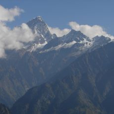
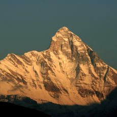
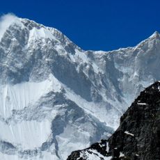
Nanda Kot, Mountain peak in Pithoragarh district, India.

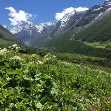
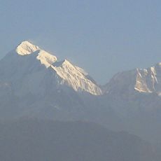
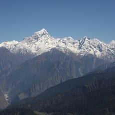
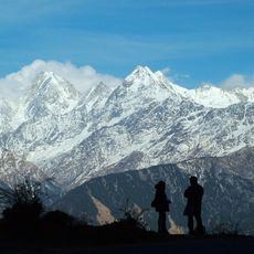
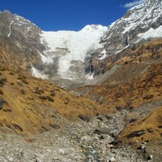
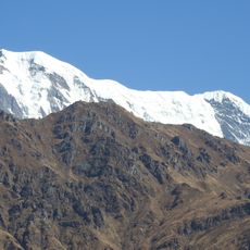
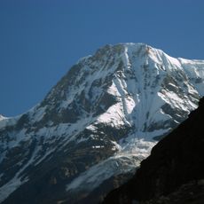
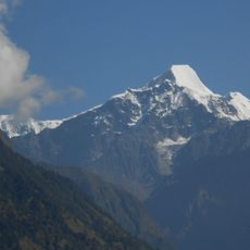
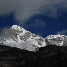
Nanda Kot is a mountain summit in the Kumaon Himalaya, in the northern Indian state of Uttarakhand, reaching 6,861 meters (22,510 feet). It stands at the boundary between the Pindar and Ghori Ganga river valleys, surrounded by glaciers and high ridges.

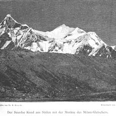
A Japanese expedition led by Yaichi Hotta made the first ascent in 1936, reaching the top via the Lawan Valley. The peak then received little attention for decades, partly because much of Uttarakhand was closed to foreign visitors for a long period.

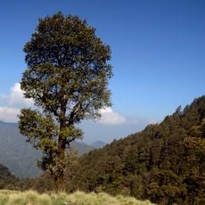
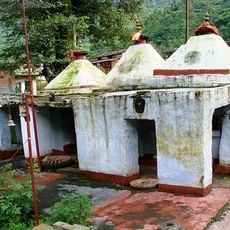
The name Nanda Kot means "fort of Nanda" in the local tradition, referring to the goddess Parvati, who is worshipped in this region under the name Nanda. Villages in the surrounding valleys still hold festivals in which the mountain is treated as a sacred place.

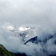
Most climbers start from Loharkhet and pass through Dhakuri Pass and Khati Village before reaching the Dwali base camp. Proper acclimatization is essential, as the altitude gain is significant and conditions near the top are fully alpine.

In the 1960s, monitoring equipment was secretly placed below the summit to observe activity across the nearby border, as part of a covert operation. The devices were eventually abandoned, and the story only became public knowledge decades after the events took place.

The community of curious travelers

AroundUs brings together thousands of curated places, local tips, and hidden gems, enriched daily by 60,000 contributors worldwide.

Start exploring
Location
Munsiari tehsil
Elevation above the sea
6,861 m
GPS coordinates
30.28108,80.06678
Latest update
March 3, 2026 22:40
Reviews
Share your experience

No review yet

Discussions
Start a discussion...

No discussion yet

« Nanda Kot - Mountain peak in Pithoragarh district, India » is provided by Around Us (aroundus.com). Images and texts are derived from Wikimedia project under a Creative Commons license. You are allowed to copy, distribute, and modify copies of this page, under the conditions set by the license, as long as this note is clearly visible.

Discover hidden gems everywhere you go!

From secret cafés to breathtaking viewpoints, skip the crowded tourist spots and find places that match your style. Our app makes it easy with voice search, smart filtering, route optimization, and insider tips from travelers worldwide. Download now for the complete mobile experience.

Around Us App Screenshot

A unique approach to discovering new places

Le Figaro

All the places worth exploring

France Info

A tailor-made excursion in just a few clicks

20 Minutes

Around Us
Travel Guide & Maps
Download

Send to your phone

QR Code
1

Open the camera app on your mobile.

2

Point at the QR code with your camera. A notification will appear.

3

Tap the notification to open the link.