Enable Location

We need your location to show you interesting places around you

Discover nearby places

Find interesting locations and hidden gems around you

Precise directions

Get accurate directions and distances to places

Your location is never shared with other users. It's only used when you tap the location button.

Changabang

Log in to your account

Start exploring — it's free

Trusted by 61,610 travelers worldwide

Continue with Google
Continue with Apple
or

We will send you a code to connect

By continuing, you accept our Terms and Conditions and our Privacy Policy

Check your inbox

We've sent a pincode in your inbox. Please enter the code below.

Changabang

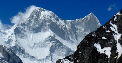
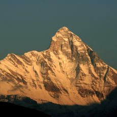
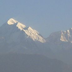
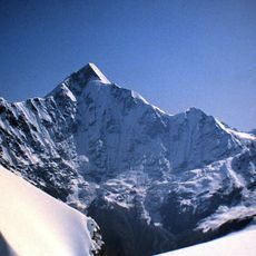
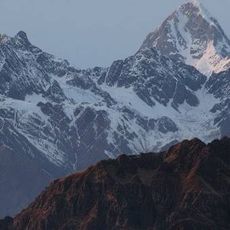
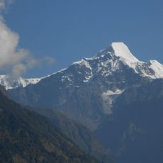
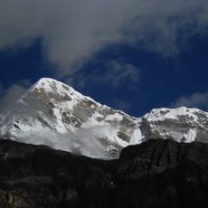
Changabang, Mountain peak in Garhwal Himalayas, India

Description

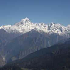
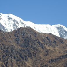
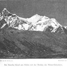
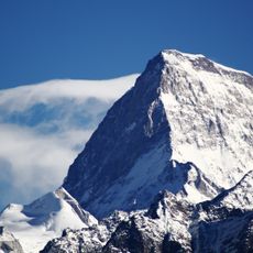
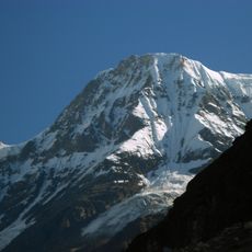
Changabang is a granite mountain in the Garhwal Himalayas reaching 6,864 meters and forming a steep northeastern barrier of the Nanda Devi Sanctuary. The peak features prominent rock faces that rise dramatically and are visible from multiple viewpoints across the surrounding region.

History

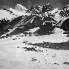
The peak was first climbed in 1974 by a team led by Lt. Col. Balwant Sandhu and Chris Bonington via the Southeast Face. This achievement opened the mountain to further exploration and climbing expeditions in the following years.

Culture

The name comes from local words describing the white granite face that catches and reflects sunlight across the surrounding valleys. Visitors can observe this bright rocky surface from various viewpoints throughout the region.

Practical

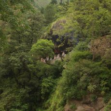
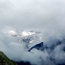
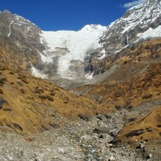
Climbers access the mountain through Upper Deodi base camp, which is reachable from Jumma and Ruing villages and best visited during June through September. The approach requires good physical fitness and climbing experience since the routes are technically demanding with significant exposure.

Did you know?

A Japanese climbing team completed the Southwest Ridge in 1976 over 33 days, establishing new standards for technical mountaineering at the time. This expedition demonstrated the high skill level and endurance needed to tackle this demanding route.

Location
Joshimath Tehsil
Elevation above the sea
6,864 m
Part of
Garhwal division
GPS coordinates
30.50044,79.92667
Latest update
December 10, 2025 15:48

AroundUs brings together thousands of curated places, local tips, and hidden gems, enriched daily by 60,000 contributors worldwide. Discover all places nearby (Joshimath Tehsil).

« Changabang - Mountain peak in Garhwal Himalayas, India » is provided by Around Us (aroundus.com). Images and texts are derived from Wikimedia project under a Creative Commons license. You are allowed to copy, distribute, and modify copies of this page, under the conditions set by the license, as long as this note is clearly visible.

Discover hidden gems everywhere you go!

From secret cafés to breathtaking viewpoints, skip the crowded tourist spots and find places that match your style. Our app makes it easy with voice search, smart filtering, route optimization, and insider tips from travelers worldwide. Download now for the complete mobile experience.

Around Us App Screenshot

A unique approach to discovering new places

Le Figaro

All the places worth exploring

France Info

A tailor-made excursion in just a few clicks

20 Minutes

Around Us
Travel Guide & Maps
Download

Send to your phone

QR Code
1

Open the camera app on your mobile.

2

Point at the QR code with your camera. A notification will appear.

3

Tap the notification to open the link.