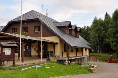
Modrava, Mountain village in Klatovy District, Czech Republic.
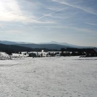
Modrava is a mountain village in the Klatovy District situated at approximately 985 meters elevation in the Bohemian Forest region near the German border. The settlement spreads across a forested landscape and serves as a base for hiking and skiing routes through the surrounding woodlands.
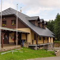
The village first appeared in written records in 1614 and took shape during the 18th century as a settlement focused on hunting and fishing in the forest. This foundation as a working landscape community continues to influence the character of the area.
The community has deep ties to forestry and seasonal tourism that shape how residents and visitors experience this mountain region. Life here follows the rhythm of the seasons, with winter bringing skiers to the trails and summer drawing hikers into the surrounding forests.
The location becomes a hub for cross-country skiing in winter, particularly the popular Sumava Highway trail, while summer draws walkers to marked forest routes. Visitors should prepare for changing weather and terrain that varies considerably from season to season.
The Vydra River originates within the village, making it the starting point for a significant river system in the region. The waters flow onward to form connections with other waterways that shape the landscape downstream.
The community of curious travelers
AroundUs brings together thousands of curated places, local tips, and hidden gems, enriched daily by 60,000 contributors worldwide.