Pumapunku, Archaeological site near Tiwanaku, Bolivia
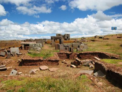
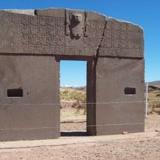
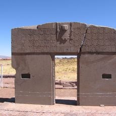
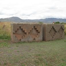
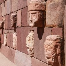
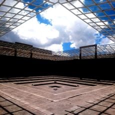
Pumapunku is a set of stone platforms and terraces within the Tiwanaku archaeological area in Bolivia, known for blocks shaped with right angles and channels that fit together without binding material. The ruins cover an area roughly 167 meters (548 feet) wide and 117 meters (384 feet) long on the high plateau at around 3900 meters (12,800 feet) in altitude.
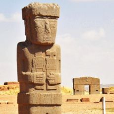
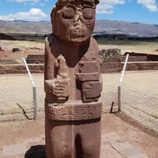
The complex took shape between 536 and 600 CE as part of a religious center built by the Tiwanaku civilization, which came before the Inca. Centuries later the site fell into decline, and many stones were moved or repurposed by later inhabitants of the region.
The site takes its name from Aymara and Quechua words meaning 'Gate of the Puma,' which points to the role of the animal in Andean spiritual life. Visitors today see stone blocks carved with channels and recesses that likely held religious meaning for those who came here for ceremonies.
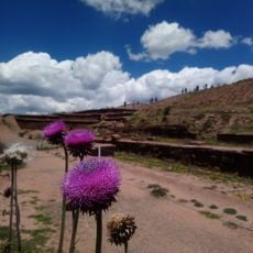
The site sits on a windy plateau where the thin air makes walking more tiring than at lower elevations. Visitors should bring layered clothing because the temperature can shift sharply during the day, and sun protection is important due to the intense radiation at this altitude.
The stone blocks are held together with bronze clamps made from copper, arsenic and nickel, an alloy rarely seen in pre-Columbian construction. This fastening method recalls techniques used in ancient Egypt and other Mediterranean cultures, raising questions about early technical knowledge.
The community of curious travelers
AroundUs brings together thousands of curated places, local tips, and hidden gems, enriched daily by 60,000 contributors worldwide.