Chest opened
+${chestReward.xp} XP
Explorer
NOUVEAU ×${chestReward.collectible.quantity}
tapez pour fermer
Chest locked

Open chests in the app

Around Us is built for your phone — chests unlock when you walk, explore and capture nearby places.

Enable Location

We need your location to show you interesting places around you

Discover nearby places

Find interesting locations and hidden gems around you

Precise directions

Get accurate directions and distances to places

Your location is never shared with other users. It's only used when you tap the location button.

Aleutian Range

Log in to your account

Start exploring — it's free

Trusted by 72,886 travelers worldwide

Continue with Google
Continue with Apple
or

We will send you a code to connect

By continuing, you accept our Terms and Conditions and our Privacy Policy

Check your inbox

We've sent a pincode in your inbox. Please enter the code below.

Aleutian Range
Discussion Reviews 1 Photos
15k Popularity

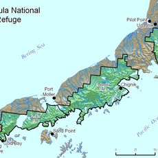
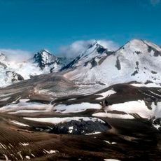
Aleutian Range, Mountain range in Southwest Alaska, United States.

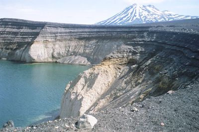
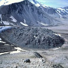
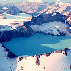
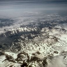
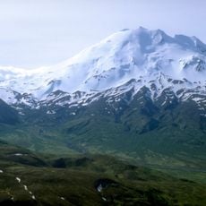
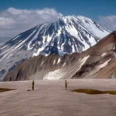
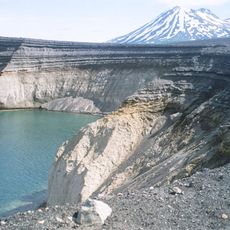
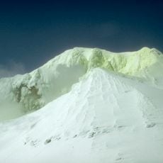
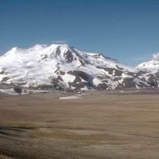
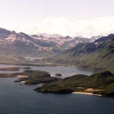
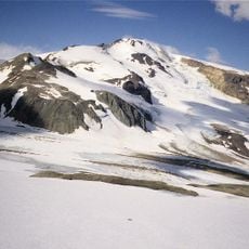
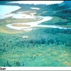
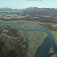
The Aleutian Range is a mountain chain in southwest Alaska defined by volcanic peaks and glaciated valleys that extend across the region. The landscape is marked by snow-covered summits and deep gorges that shape the terrain of this remote area.

The range formed through tectonic movements that created this mountainous terrain over geological time. Volcanic activity has continually reshaped the landscape and remains an active geological process in the region.

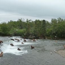
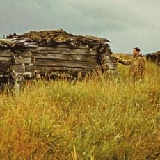
The Aleut people established settlements near the range, developing specialized techniques for survival in this demanding environment over many generations.

Access to this range requires small aircraft or boats due to the remote location and lack of roads. Plan visits during warmer months when weather conditions are more stable for travel and exploration.

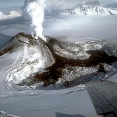
Mount Redoubt remains one of North America's most active volcanoes and has erupted multiple times in recent decades. This geological feature makes the range particularly notable for those interested in volcanic processes.

The community of curious travelers

AroundUs brings together thousands of curated places, local tips, and hidden gems, enriched daily by 60,000 contributors worldwide.

Start exploring
Location
Elevation above the sea
3,108 m
GPS coordinates
57.07000,-156.99000
Latest update
December 7, 2025 19:32
Around this place
Novarupta
United States of America

Novarupta

172 km
Mount Katmai
United States of America

Mount Katmai

180.9 km
Brooks Falls
United States of America

Brooks Falls

179.9 km
Mount Aniakchak
United States of America

Mount Aniakchak

76.1 km
Aniakchak National Monument and Preserve
United States of America

Aniakchak National Monument and Preserve

70.3 km
Kodiak National Wildlife Refuge
United States of America

Kodiak National Wildlife Refuge

197.5 km
Mount Veniaminof
United States of America

Mount Veniaminof

176.2 km
Fure's Cabin
United States of America

Fure's Cabin

200.8 km
Mount Chiginagak
United States of America

Mount Chiginagak

7.1 km
Mount Griggs
United States of America

Mount Griggs

181.9 km
Alaska Peninsula National Wildlife Refuge
United States of America

Alaska Peninsula National Wildlife Refuge

171.5 km
Ukinrek Maars
United States of America

Ukinrek Maars

89.5 km
Trident Volcano
United States of America

Trident Volcano

171.6 km
Naknek River
United States of America

Naknek River

180.3 km
Becharof National Wildlife Refuge
United States of America

Becharof National Wildlife Refuge

112.6 km
Mount Martin
United States of America

Mount Martin

156.3 km
Mount Mageik
United States of America

Mount Mageik

162.4 km
Amalik Bay Archeological District
United States of America

Amalik Bay Archeological District

190.8 km
Old Savonoski Site
United States of America

Old Savonoski Site

188.9 km
Snowy Mountain
United States of America

Snowy Mountain

196.4 km
Brooks River Archeological District
United States of America

Brooks River Archeological District

179.6 km
Ugashik River
United States of America

Ugashik River

58.7 km
Elevation of Holy Cross Church
United States of America

Elevation of Holy Cross Church

183.2 km
Brooks Camp Boat House
United States of America

Brooks Camp Boat House

180.5 km
Brooks River Historic Ranger Station
United States of America

Brooks River Historic Ranger Station

180.5 km
St. John the Baptist Chapel
United States of America

St. John the Baptist Chapel

184.6 km
St. Nicholas Church
United States of America

St. Nicholas Church

40.9 km
Savonoski River
United States of America

Savonoski River

208.6 km
Show the full map
Reviews
Share your experience

No review yet

Discussions
Start a discussion...

No discussion yet

« Aleutian Range - Mountain range in Southwest Alaska, United States » is provided by Around Us (aroundus.com). Images and texts are derived from Wikimedia project under a Creative Commons license. You are allowed to copy, distribute, and modify copies of this page, under the conditions set by the license, as long as this note is clearly visible.

Discover hidden gems everywhere you go!

From secret cafés to breathtaking viewpoints, skip the crowded tourist spots and find places that match your style. Our app makes it easy with voice search, smart filtering, route optimization, and insider tips from travelers worldwide. Download now for the complete mobile experience.

Around Us App Screenshot

A unique approach to discovering new places

Le Figaro

All the places worth exploring

France Info

A tailor-made excursion in just a few clicks

20 Minutes

Around Us
Travel Guide & Maps
Download

Send to your phone

QR Code
1

Open the camera app on your mobile.

2

Point at the QR code with your camera. A notification will appear.

3

Tap the notification to open the link.