Chest opened
+${chestReward.xp} XP
Explorer
NOUVEAU ×${chestReward.collectible.quantity}
tapez pour fermer
Chest locked

Open chests in the app

Around Us is built for your phone — chests unlock when you walk, explore and capture nearby places.

Enable Location

We need your location to show you interesting places around you

Discover nearby places

Find interesting locations and hidden gems around you

Precise directions

Get accurate directions and distances to places

Your location is never shared with other users. It's only used when you tap the location button.

Point Barrow

Log in to your account

Start exploring — it's free

Trusted by 72,988 travelers worldwide

Continue with Google
Continue with Apple
or

We will send you a code to connect

By continuing, you accept our Terms and Conditions and our Privacy Policy

Check your inbox

We've sent a pincode in your inbox. Please enter the code below.

Point Barrow
Discussion Reviews 2 Photos
47.1k Popularity

Point Barrow, Northernmost headland in North Slope Borough, United States

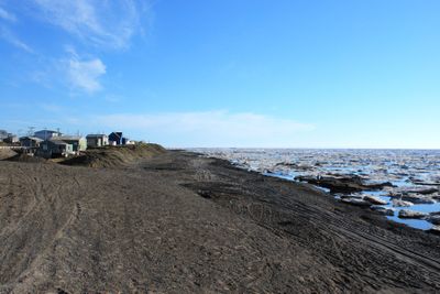
Point Barrow is a headland that extends into the Arctic Ocean and divides two major seas. The Chukchi Sea lies to the west while the Beaufort Sea stretches to the east of this geographic divide.

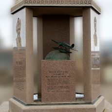
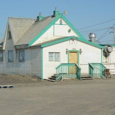
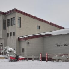
The cape was named in 1826 by Frederick William Beechey after Sir John Barrow, though the Inupiat had long called it Nuvuk. Settlements in the area date back several centuries.

The Inupiat people have lived here for thousands of years and continue to shape the community through their traditions and hunting practices. Their cultural connection to these waters remains central to daily life today.

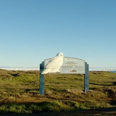
The location is remote and requires careful planning for any visit, as extreme weather conditions occur throughout the year. Warm clothing and preparation for rapid weather changes are essential.

The area experiences 65 consecutive days without sunrise beginning in November, creating extended periods of complete darkness. This extreme phenomenon shapes the rhythm of life at this northernmost point.

The community of curious travelers

AroundUs brings together thousands of curated places, local tips, and hidden gems, enriched daily by 60,000 contributors worldwide.

Start exploring
GPS coordinates
71.39194,-156.36111
Latest update
December 14, 2025 19:38
Around this place
Arctic National Wildlife Refuge
United States of America

Arctic National Wildlife Refuge

568.1 km
Mount Isto
United States of America

Mount Isto

529.3 km
Rogers-Post Site
United States of America

Rogers-Post Site

36 km
Point Barrow Long Range Radar Site
United States of America

Point Barrow Long Range Radar Site

12.2 km
Gates of the Arctic Wilderness
United States of America

Gates of the Arctic Wilderness

387.7 km
Mount Igikpak
United States of America

Mount Igikpak

446.3 km
Arrigetch Peaks
United States of America

Arrigetch Peaks

450.3 km
Point Barrow Refuge Station
United States of America

Point Barrow Refuge Station

18 km
Leffingwell Camp Site
United States of America

Leffingwell Camp Site

400.2 km
Noatak Wilderness
United States of America

Noatak Wilderness

390.1 km
Kanuti National Wildlife Refuge
United States of America

Kanuti National Wildlife Refuge

582.4 km
John River
United States of America

John River

469.9 km
Selawik National Wildlife Refuge
United States of America

Selawik National Wildlife Refuge

546.7 km
Birnirk Site
United States of America

Birnirk Site

18.4 km
North Fork Koyukuk River
United States of America

North Fork Koyukuk River

487.4 km
Selawik River
United States of America

Selawik River

550.3 km
Chamisso Wilderness
United States of America

Chamisso Wilderness

615.2 km
Gallagher Flint Station Archeological Site
United States of America

Gallagher Flint Station Archeological Site

364 km
Onion Portage Archeological District
United States of America

Onion Portage Archeological District

484.1 km
Itkillik River
United States of America

Itkillik River

323.4 km
Squirrel River
United States of America

Squirrel River

494.1 km
Walker Lake
United States of America

Walker Lake

481.2 km
Iñupiat Heritage Center
United States of America

Iñupiat Heritage Center

17.4 km
Kanuti River
United States of America

Kanuti River

606.5 km
Peters Glacier (Brooks Range)
United States of America

Peters Glacier (Brooks Range)

486.5 km
Utqiaġvik Church Manse
United States of America

Utqiaġvik Church Manse

18.6 km
Salmon River
United States of America

Salmon River

451.9 km
Dall River
United States of America

Dall River

638.4 km
Show the full map
Reviews
Share your experience

No review yet

Discussions
Start a discussion...

No discussion yet

« Point Barrow - Northernmost headland in North Slope Borough, United States » is provided by Around Us (aroundus.com). Images and texts are derived from Wikimedia project under a Creative Commons license. You are allowed to copy, distribute, and modify copies of this page, under the conditions set by the license, as long as this note is clearly visible.

Discover hidden gems everywhere you go!

From secret cafés to breathtaking viewpoints, skip the crowded tourist spots and find places that match your style. Our app makes it easy with voice search, smart filtering, route optimization, and insider tips from travelers worldwide. Download now for the complete mobile experience.

Around Us App Screenshot

A unique approach to discovering new places

Le Figaro

All the places worth exploring

France Info

A tailor-made excursion in just a few clicks

20 Minutes

Around Us
Travel Guide & Maps
Download

Send to your phone

QR Code
1

Open the camera app on your mobile.

2

Point at the QR code with your camera. A notification will appear.

3

Tap the notification to open the link.