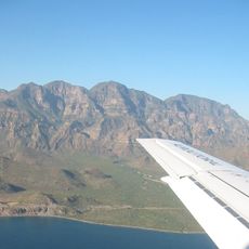
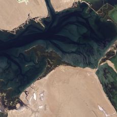
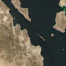
Bahía Concepción, Natural bay in Baja California Sur, Mexico
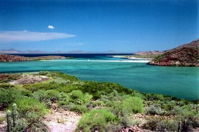
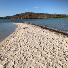
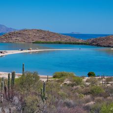
Bahía Concepción is a large bay along the Gulf of California featuring numerous beaches with fine white sand and turquoise waters. The coastline is broken by several islands and offers sheltered coves with varying water depths.
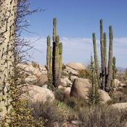
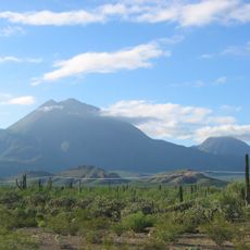
The bay formed through geological processes during the creation of the Gulf of California millions of years ago. This tectonic activity left behind thermal phenomena that remain visible in the landscape today.
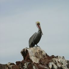
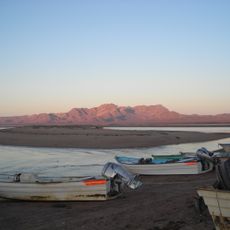
The fishing communities here maintain their traditional craft, selling fresh catches directly to visitors as part of everyday life. The work of fishermen shapes the rhythm of life in this area.
You can reach the various beaches easily from Highway 1, with Playa Santispac offering parking spots for RVs. It's wise to check local conditions before arriving, as facilities and services vary depending on the season.
The bay contains several islands such as Isla San Ramón and Isla Coyote that can be explored by water. A lighthouse on Isla Pitahaya marks the entrance to the protected coves.
Location: Baja California Sur
GPS coordinates: 26.67075,-111.81359
Latest update: December 6, 2025 17:42
Baja California is a Mexican peninsula that offers striking contrasts in its landscapes. Desert valleys meet sandy beaches, while marine reserves protect coastal waters. The region holds ancient cave paintings, volcanic peaks, and colonial-era buildings that tell stories of human settlement. Canyons...
El Vizcaíno Biosphere Reserve
269.6 km
Rock Paintings of Sierra de San Francisco
161.7 km
Bahía de Loreto National Park
113.3 km
Islands and Protected Areas of the Gulf of California
121.3 km
Tres Vírgenes
117.7 km
Estadio Sonora
276.7 km
Laguna Ojo de Liebre
269.5 km
San Ignacio Lagoon
137.3 km
Iglesia de Santa Bárbara
86.8 km
San Lorenzo Marine Archipelago National Park
261.4 km
Estrecho del Infiernillo
272.8 km
San Pedro Mártir Island
196.4 km
Arena Sonora
195.5 kmSierra de Guadalupe cave paintings
160.1 km
La Reforma
109.4 km
Misión Santa Rosalía de Mulegé
29.4 km
Aguajito
122.6 km
Sacred Heart of Jesus Cathedral, Ciudad Obregón
207.8 km
Sonora Museum of Art
280.1 km
Loreto
87 km
Lake Oviáchic
231.1 km
Temple of Saint Rose of Lima
197.6 km
Tabor Canyon
108 km
Jesuit Missions of Loreto Museum
87.2 km
Punta Púlpito
40.6 km
Playa el Requesón
4 km
San Borjitas Cave
49.3 kmVisited this place? Tap the stars to rate it and share your experience / photos with the community! Try now! You can cancel it anytime.
Discover hidden gems everywhere you go!
From secret cafés to breathtaking viewpoints, skip the crowded tourist spots and find places that match your style. Our app makes it easy with voice search, smart filtering, route optimization, and insider tips from travelers worldwide. Download now for the complete mobile experience.
A unique approach to discovering new places❞
— Le Figaro
All the places worth exploring❞
— France Info
A tailor-made excursion in just a few clicks❞
— 20 Minutes