Cumaribo, Administrative municipality in Vichada Department, Colombia
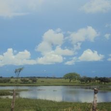
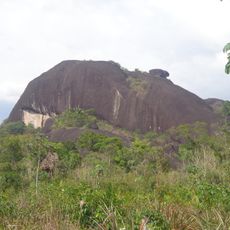
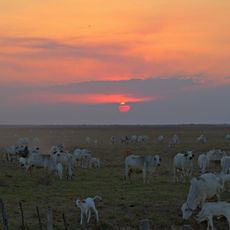
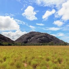
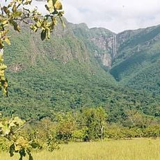
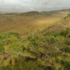
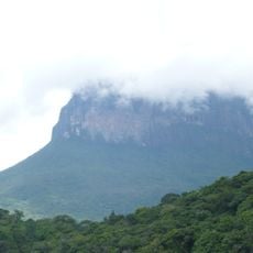
Cumaribo is a municipality in Vichada Department spanning across the Orinoquia region with savannas and jungle landscapes. The territory is crossed by several major river systems and borders Venezuela to the east.
The municipality was established in 1959, marking the beginning of formal administration in this Amazon region. This founding enabled the gradual organization and development of the sparsely populated territory.
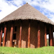
Several indigenous groups including the Guahibo and Curripaco live in designated reserve areas and maintain their ancestral customs through daily practices and traditions. Visitors can observe traditional crafts and ways of life that have been passed down through generations in these communities.
Access is mainly through regional transportation routes connecting to nearby departments of Meta, Guaviare, and Guainía. Travel is easier during drier months when roads and river crossings are more passable.
Three major rivers - the Orinoco, Meta, and Guaviare - flow through the territory creating a complex network of waterways. These river systems shape the landscape and influence both wildlife and local life patterns.
Location: Vichada Department
Inception: 1959
Elevation above the sea: 125 m
Part of: Vichada Department
Website: http://cumaribo-vichada.gov.co
GPS coordinates: 4.44611,-69.79556
Latest update: December 7, 2025 19:27
Playa Blanca
371.1 km
Pisba National Natural Park
347 km
Santos Luzardo National Park
352.3 km
Cerro Autana
264.2 km
The Hub on Causeway
270.9 km
El Tuparro National Natural Park
175.9 km
Piedra del Cocuy
486.7 km
Ritacuba Blanco
358.9 km
Ocetá Páramo
361.4 km
Sun Temple
374.3 km
Piedra del Cocuy Natural Monument
486.7 km
Hato El Cedral
336.9 km
Yapacana National Park
344.4 km
Piedra La Tortuga Natural Monument
274.1 km
Archaeology Museum
374.3 km
Morcá
372.1 km
Duida-Marahuaca National Park
493.5 km
Casa sobre La Piedra
276.5 km
Hato El Frío
393.5 km
Ciudad de Nutrias
409.8 km
El Cocuy National Park
344.5 km
Cerro Duida
472.8 km
Iglesia de Firavitoba
379.6 km
Yutaje Falls
428.7 km
Santiago de las Atalayas Stadium
306.9 km
Estadio Antonio José de Sucre
277.1 km
Galeras del Cinaruco
369.2 km
Cerro Yaví Natural Monument
454 kmVisited this place? Tap the stars to rate it and share your experience / photos with the community! Try now! You can cancel it anytime.
Discover hidden gems everywhere you go!
From secret cafés to breathtaking viewpoints, skip the crowded tourist spots and find places that match your style. Our app makes it easy with voice search, smart filtering, route optimization, and insider tips from travelers worldwide. Download now for the complete mobile experience.
A unique approach to discovering new places❞
— Le Figaro
All the places worth exploring❞
— France Info
A tailor-made excursion in just a few clicks❞
— 20 Minutes