Chest opened
+${chestReward.xp} XP
Explorer
NOUVEAU ×${chestReward.collectible.quantity}
tapez pour fermer

See the monuments around you in AR Open chests in the app

Around Us is built for your phone — point your camera at the streets and discover the monuments and places around you in augmented reality. Around Us is built for your phone — chests unlock when you walk, explore and capture nearby places.

•

Enable Location

We need your location to show you interesting places around you

Discover nearby places

Find interesting locations and hidden gems around you

Precise directions

Get accurate directions and distances to places

Your location is never shared with other users. It's only used when you tap the location button.

Log in to your account

Start exploring — it's free

Trusted by 94,749 travelers worldwide

Continue with Google
Continue with Apple
or

We will send you a code to connect

By continuing, you accept our Terms and Conditions and our Privacy Policy

Check your inbox

We've sent a pincode in your inbox. Please enter the code below.

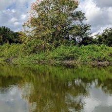
San Estevan, Maya archaeological site in Orange Walk District, Belize.

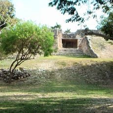
San Estevan is a Maya archaeological site in Orange Walk District, Belize, on the New River halfway between Cerros and Lamanai. Its core was mapped by William Bullard in the 1960s, who restored two Early Classic structures, and later expanded by Norman Hammond with additional plaza groups. Mound XV, 15 m high and dating to the Late Formative, is the tallest structure left after bulldozing in the late 1990s.

San Estevan was occupied from the Formative period (800 BC – AD 300) and by the Late Formative (300 BC – AD 300) had become a regional political center. In the 1960s William Bullard mapped the civic-ceremonial core and restored two Early Classic structures. Norman Hammond later expanded the map with additional plaza groups, and in 1989–1990 Laura Levi recorded outlying house groups. In the late 1990s bulldozers removed much of the monumental core for road fill, leaving Mound XV, 15 m high, as the tallest survivor.

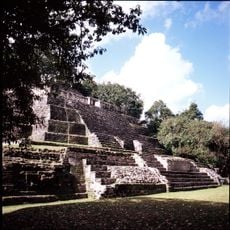
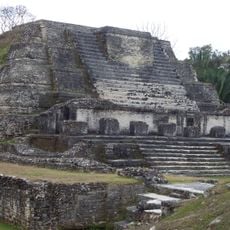
The structures display features of Maya building practices, including limestone blocks and stepped pyramid forms that remain visible today. These architectural elements offer insight into the craftsmanship and knowledge of the ancient inhabitants.

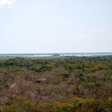
The site lies 1 km from the modern village of San Estevan in Orange Walk District, on the New River halfway between Cerros and Lamanai. The monumental core was largely bulldozed in the late 1990s, so paths are informal and shade is limited; wear sturdy shoes and expect humid, wet ground in the rainy season. Mound XV, 15 m high, is the tallest structure left.

Mound XV, 15 m high and dating to the Late Formative period, is the tallest structure left at San Estevan. It survived the bulldozers of the late 1990s only because the Belize Department of Archaeology intervened. The destruction of much of the site core opened access to the earliest occupation levels, which Robert Rosenswig of the University at Albany – SUNY began studying in 2002.

The community of curious travelers

AroundUs brings together thousands of curated places, local tips, and hidden gems, enriched daily by 94,749 contributors worldwide.
Start exploring
Inception
300 BCE
GPS coordinates
18.13944,-88.51423
Latest update
November 3, 2026 22:00
Reviews
Share your experience

No review yet

Discussions
Start a discussion...

No discussion yet

« San Estevan - Maya archaeological site in Orange Walk District, Belize » is provided by Around Us (aroundus.com). Images and texts are derived from Wikimedia project under a Creative Commons license. You are allowed to copy, distribute, and modify copies of this page, under the conditions set by the license, as long as this note is clearly visible.

Discover hidden gems everywhere you go!

From secret cafés to breathtaking viewpoints, skip the crowded tourist spots and find places that match your style. Our app makes it easy with voice search, smart filtering, route optimization, and insider tips from travelers worldwide. Download now for the complete mobile experience.

Around Us App Screenshot
❝

A unique approach to discovering new places❞

— Le Figaro

❝

All the places worth exploring❞

— France Info

❝

A tailor-made excursion in just a few clicks❞

— 20 Minutes

Around Us
Travel Guide & Maps
Download

Send to your phone

QR Code
1

Open the camera app on your mobile.

2

Point at the QR code with your camera. A notification will appear.

3

Tap the notification to open the link.