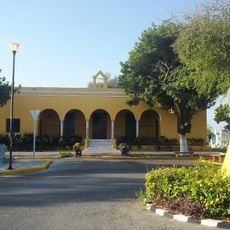
Muna, Administrative division in Yucatán, Mexico
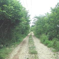
Muna is a municipality in southern Yucatán located around 50 kilometers from Mérida, the state capital. The area consists of rural settlements and villages scattered across low, green terrain with a quiet character.
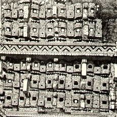
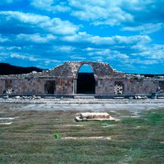
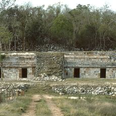
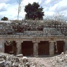
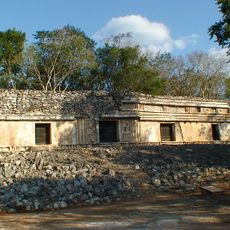
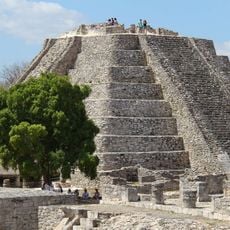
The region was originally under the control of the Tutul Xiu chiefdom until Spanish conquest brought it under colonial rule in 1549. It then became part of the encomienda system that structured Spanish colonial power for centuries.
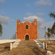
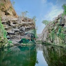
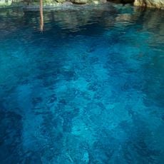
The August celebrations honoring the Virgin of the Assumption bring traditional dances and local festivities that shape the community's calendar. The name itself comes from Yucatec Maya, meaning soft water, reflecting the deep indigenous roots of this place.
The best time to visit is during the August festivities when traditional events fill the community's calendar and bring activity to the area. Plan travel as this is rural territory where having a vehicle makes moving around much easier than in urban centers.
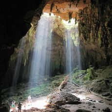
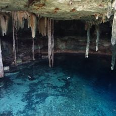
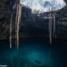
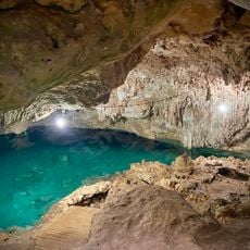
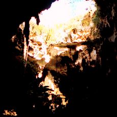
The name comes from Yucatec Maya meaning soft water, a reference to the freshwater springs that flow in this region. This ancient language root shows how deeply indigenous heritage remains woven into the area's identity and place names.
GPS coordinates: 20.48579,-89.71325
Latest update: December 6, 2025 17:44
The Yucatán region contains numerous lesser-known sites waiting to be discovered. Ancient Maya ruins, natural cenotes, and historic buildings tell the story of the region's rich past and living culture. Nature reserves and traditional villages show how people live and work in this part of Mexico. ...
Uxmal
15.3 km
Mayapan
30.8 km
Pyramid of the Magician
15.1 km
Uxmal Archaeological Zone
15.1 km
Kabah
27.3 km
Labna
37.6 km
Sayil
34.9 km
Loltun Cave
37.3 km
Oxkintok
26.4 km
Ring of cenotes
48.5 km
Acanceh
45.5 km
Kiuic
46.4 km
Xlapak
36.4 km
Chacmultun
51.9 km
Cenote Kankirixché
18.8 kmFacultad de Medicina Veterinaria y Zootecnia de la Universidad Autónoma de Yucatán
43.4 kmXculoc
35.9 km
Momias de Santa Elena
19.1 km
Xcalumkin
46.7 km
Chunhuhub
37.6 km
Kampepén (Mérida)
39.4 km
San Antonio X-Coholté
52.1 km
Cenote Santa Barbara
51.3 km
Cenote Noh-Mozon
37.6 km
Cenote Pool Uinic
51.6 km
Calcehtok Caves
24.6 km
El Castillo, Mayapan
30.8 km
Cenote Chac Zinic Che
44.8 kmVisited this place? Tap the stars to rate it and share your experience / photos with the community! Try now! You can cancel it anytime.
Discover hidden gems everywhere you go!
From secret cafés to breathtaking viewpoints, skip the crowded tourist spots and find places that match your style. Our app makes it easy with voice search, smart filtering, route optimization, and insider tips from travelers worldwide. Download now for the complete mobile experience.
A unique approach to discovering new places❞
— Le Figaro
All the places worth exploring❞
— France Info
A tailor-made excursion in just a few clicks❞
— 20 Minutes