Enable Location

We need your location to show you interesting places around you

Discover nearby places

Find interesting locations and hidden gems around you

Precise directions

Get accurate directions and distances to places

Your location is never shared with other users. It's only used when you tap the location button.

Log in to your account

Start exploring — it's free

Trusted by 62,475 travelers worldwide

Continue with Google
Continue with Apple
or

We will send you a code to connect

By continuing, you accept our Terms and Conditions and our Privacy Policy

Check your inbox

We've sent a pincode in your inbox. Please enter the code below.

Sitka Sedge State Natural Area

Sitka Sedge State Natural Area, Natural area in Tillamook County, US

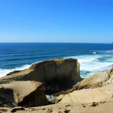
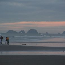
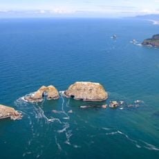
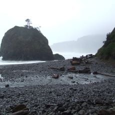
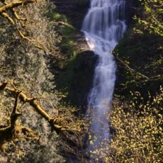
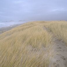
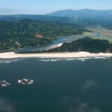
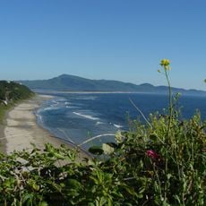
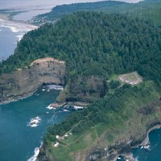
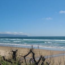
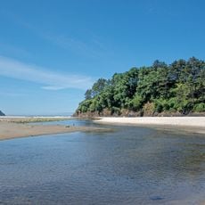
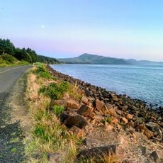
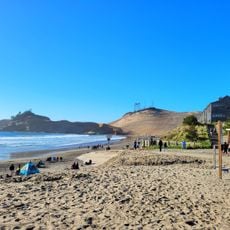
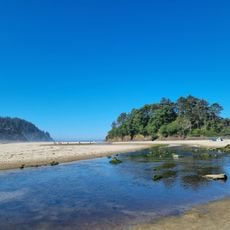
Sitka Sedge State Natural Area spans 365 acres with tidal flats, saltwater marshes, forested wetlands, and beach sections throughout. The landscape transitions smoothly between these different zones, creating varied habitats in a single protected area.

The site was acquired in 2014 by Oregon Parks and Recreation Department using lottery funds and a national conservation grant for coastal wetlands. This purchase protected the land as a natural area for future generations.

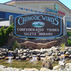
This land was home to the Nestucca group of Tillamook Indians and was part of the Siletz Reservation during the 19th century. Visitors can still sense this indigenous heritage woven into the coastal landscape today.

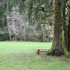
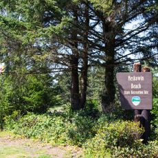
The area features about 3.5 miles of looping trails, including the wheelchair-accessible Beltz Dike Trail for visitors of all abilities. Restrooms and information boards at the trailhead help with orientation and planning your visit.

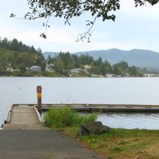
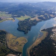
Three separate creeks flow into the southern section, feeding a complex system of tidal marshes, sand and mudflats. This interplay creates an unusually rich and changing ecosystem.

The community of curious travelers

AroundUs brings together thousands of curated places, local tips, and hidden gems, enriched daily by 60,000 contributors worldwide.

Start exploring
Location
GPS coordinates
45.26300,-123.95392
Latest update
December 13, 2025 11:47
Around this place
Tillamook Air Museum
United States of America

Tillamook Air Museum

21.1 km
Cape Kiwanda State Natural Area
United States of America

Cape Kiwanda State Natural Area

5.4 km
Cape Lookout State Park
United States of America

Cape Lookout State Park

10.1 km
Chinook Winds Casino
United States of America

Chinook Winds Casino

29.8 km
Cape Meares Lighthouse
United States of America

Cape Meares Lighthouse

25 km
Three Arch Rocks National Wildlife Refuge
United States of America

Three Arch Rocks National Wildlife Refuge

22.4 km
Short Beach
United States of America

Short Beach

23.6 km
H. B. Van Duzer Forest State Scenic Corridor
United States of America

H. B. Van Duzer Forest State Scenic Corridor

27.1 km
Naval Air Station Tillamook
United States of America

Naval Air Station Tillamook

20.8 km
Devil's Lake State Recreation Area
United States of America

Devil's Lake State Recreation Area

32.9 km
Munson Creek Falls State Natural Site
United States of America

Munson Creek Falls State Natural Site

18.2 km
Bob Straub State Park
United States of America

Bob Straub State Park

8.9 km
Salmon River
United States of America

Salmon River

28.4 km
Neskowin Beach State Recreation Site
United States of America

Neskowin Beach State Recreation Site

18.1 km
Oceanside Beach State Recreation Site
United States of America

Oceanside Beach State Recreation Site

22.1 km
Nestucca Bay National Wildlife Refuge
United States of America

Nestucca Bay National Wildlife Refuge

10.1 km
Cape Meares National Wildlife Refuge
United States of America

Cape Meares National Wildlife Refuge

25 km
Oceanside Beach State Recreation Site

Oceanside Beach State Recreation Site

22.2 km
Roads End State Recreation Site
United States of America

Roads End State Recreation Site

28.7 km
Drift Creek Bridge
United States of America

Drift Creek Bridge

30.5 km
Wilson River Bridge
United States of America

Wilson River Bridge

25.5 km
Neskowin Beach
United States of America

Neskowin Beach

18.1 km
Wilson Beach
United States of America

Wilson Beach

18.4 km
McPhillips Beach
United States of America

McPhillips Beach

4.1 km
Hangar B
United States of America

Hangar B

21 km
Latimer Quilt & Textile Center
United States of America

Latimer Quilt & Textile Center

25.2 km
NAS Tillamook dirigible hangars
United States of America

NAS Tillamook dirigible hangars

20.7 km
Neskowin Beach
United States of America

Neskowin Beach

18.2 km
Show the full map
« Sitka Sedge State Natural Area - Natural area in Tillamook County, US » is provided by Around Us (aroundus.com). Images and texts are derived from Wikimedia project under a Creative Commons license. You are allowed to copy, distribute, and modify copies of this page, under the conditions set by the license, as long as this note is clearly visible.

Discover hidden gems everywhere you go!

From secret cafés to breathtaking viewpoints, skip the crowded tourist spots and find places that match your style. Our app makes it easy with voice search, smart filtering, route optimization, and insider tips from travelers worldwide. Download now for the complete mobile experience.

Around Us App Screenshot

A unique approach to discovering new places

Le Figaro

All the places worth exploring

France Info

A tailor-made excursion in just a few clicks

20 Minutes

Around Us
Travel Guide & Maps
Download

Send to your phone

QR Code
1

Open the camera app on your mobile.

2

Point at the QR code with your camera. A notification will appear.

3

Tap the notification to open the link.