Chest opened
+${chestReward.xp} XP
Explorer
NOUVEAU ×${chestReward.collectible.quantity}
tapez pour fermer
Chest locked

Open chests in the app

Around Us is built for your phone — chests unlock when you walk, explore and capture nearby places.

Enable Location

We need your location to show you interesting places around you

Discover nearby places

Find interesting locations and hidden gems around you

Precise directions

Get accurate directions and distances to places

Your location is never shared with other users. It's only used when you tap the location button.

Hood Canal

Log in to your account

Start exploring — it's free

Trusted by 72,900 travelers worldwide

Continue with Google
Continue with Apple
or

We will send you a code to connect

By continuing, you accept our Terms and Conditions and our Privacy Policy

Check your inbox

We've sent a pincode in your inbox. Please enter the code below.

Hood Canal
Discussion Reviews 1 Photos
42.9k Popularity

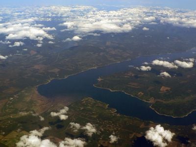
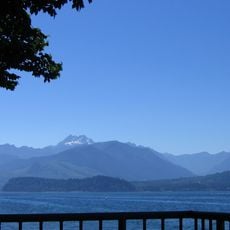
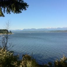
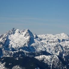
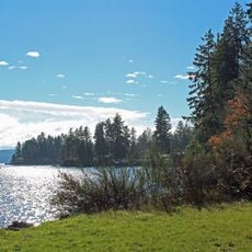
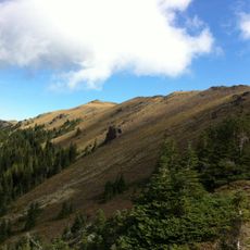
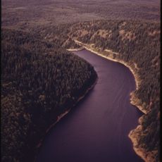
Hood Canal, Fjord in western Washington, USA.

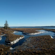
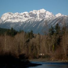
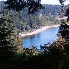
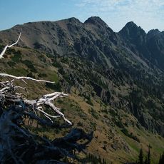
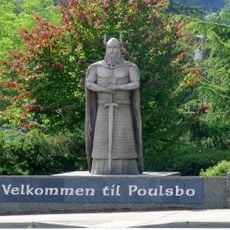
Hood Canal is a fjord between the Olympic and Kitsap peninsulas in western Washington. It provides access to multiple state parks, beaches, and recreational areas along its shores.

This waterway was named in 1792 by British Captain George Vancouver in honor of Admiral Samuel Hood. The name became officially recognized in 1932.

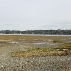
The waterfront towns here maintain ties to maritime traditions through shellfish farming and fishing, activities that shape daily life for many residents.

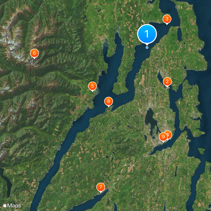
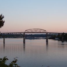
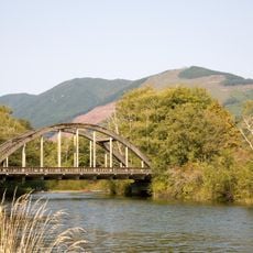
A bridge system connects both shores and US Route 101 runs along the western edge, making parks and beaches easily accessible by car. Most visitor facilities are spread along the main road corridors.

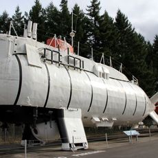
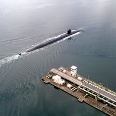
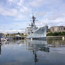
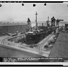
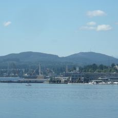
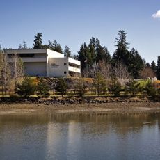
A naval base operates on the eastern shore with restricted operations in a nearby bay that most visitors never see. This military presence is a defining feature of one section of the waterway.

The community of curious travelers

AroundUs brings together thousands of curated places, local tips, and hidden gems, enriched daily by 60,000 contributors worldwide.

Start exploring
Location
Location
Location
Location
Part of
Puget Sound
GPS coordinates
47.80000,-122.70000
Latest update
December 14, 2025 21:13
Around this place
Bathyscaphe Trieste
Italy

Bathyscaphe Trieste

12.5 km
Hood Canal Bridge
United States of America

Hood Canal Bridge

8.7 km
USS Turner Joy
United States of America

USS Turner Joy

26.9 km
Dosewallips State Park
United States of America

Dosewallips State Park

19.8 km
Mount Constance
United States of America

Mount Constance

32.1 km
Belfair State Park
United States of America

Belfair State Park

43.3 km
Scenic Beach State Park
United States of America

Scenic Beach State Park

20 km
Puget Sound Naval Shipyard Historic District
United States of America

Puget Sound Naval Shipyard Historic District

27.2 km
Kitsap Memorial State Park
United States of America

Kitsap Memorial State Park

4.1 km
Illahee State Park
United States of America

Illahee State Park

23.7 km
Buckhorn Wilderness
United States of America

Buckhorn Wilderness

31.9 km
Puget Sound Navy Museum
United States of America

Puget Sound Navy Museum

27 km
Manette Bridge
United States of America

Manette Bridge

26.3 km
Gold Mountain
United States of America

Gold Mountain

28.7 km
The Brothers Wilderness
United States of America

The Brothers Wilderness

31.4 km
Triton Cove State Park
United States of America

Triton Cove State Park

30.4 km
United States of America

Shine Tidelands State Park

10.4 km
Suquamish Museum and Cultural Center
United States of America

Suquamish Museum and Cultural Center

13.6 km
United States of America

Hamma Hamma Balds Natural Area Preserve

37.3 km
United States of America

Pleasant Harbor State Park

21.6 km
Mount Townsend
United States of America

Mount Townsend

27.9 km
Green Mountain
United States of America

Green Mountain

27.6 km
Norseman Statue
United States of America

Norseman Statue

6.8 km
Casad Dam
United States of America

Casad Dam

29.8 km
Hospital Reservation Historic District
United States of America

Hospital Reservation Historic District

26.7 km
Naval Undersea Museum
United States of America

Naval Undersea Museum

12.4 km
Duckabush River Bridge
United States of America

Duckabush River Bridge

24.3 km
Warrior Peak
United States of America

Warrior Peak

32.4 km
Show the full map
Reviews
Share your experience

No review yet

Discussions
Start a discussion...

No discussion yet

« Hood Canal - Fjord in western Washington, USA » is provided by Around Us (aroundus.com). Images and texts are derived from Wikimedia project under a Creative Commons license. You are allowed to copy, distribute, and modify copies of this page, under the conditions set by the license, as long as this note is clearly visible.

Discover hidden gems everywhere you go!

From secret cafés to breathtaking viewpoints, skip the crowded tourist spots and find places that match your style. Our app makes it easy with voice search, smart filtering, route optimization, and insider tips from travelers worldwide. Download now for the complete mobile experience.

Around Us App Screenshot

A unique approach to discovering new places

Le Figaro

All the places worth exploring

France Info

A tailor-made excursion in just a few clicks

20 Minutes

Around Us
Travel Guide & Maps
Download

Send to your phone

QR Code
1

Open the camera app on your mobile.

2

Point at the QR code with your camera. A notification will appear.

3

Tap the notification to open the link.