Chest opened
+${chestReward.xp} XP
Explorer
NOUVEAU ×${chestReward.collectible.quantity}
tapez pour fermer
Chest locked

Open chests in the app

Around Us is built for your phone — chests unlock when you walk, explore and capture nearby places.

Enable Location

We need your location to show you interesting places around you

Discover nearby places

Find interesting locations and hidden gems around you

Precise directions

Get accurate directions and distances to places

Your location is never shared with other users. It's only used when you tap the location button.

Fort Mojave Indian Reservation

Log in to your account

Start exploring — it's free

Trusted by 73,029 travelers worldwide

Continue with Google
Continue with Apple
or

We will send you a code to connect

By continuing, you accept our Terms and Conditions and our Privacy Policy

Check your inbox

We've sent a pincode in your inbox. Please enter the code below.

Fort Mojave Indian Reservation
Discussion Reviews 1 Photos
14.7k Popularity

Fort Mojave Indian Reservation, Native American reservation across Arizona, California, and Nevada.

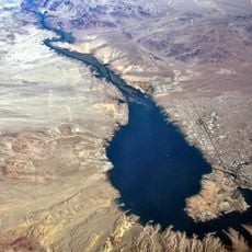
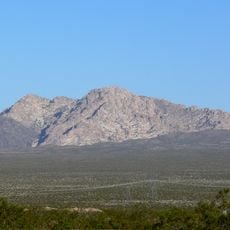
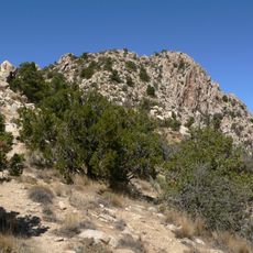
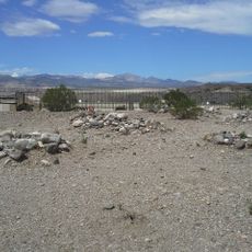
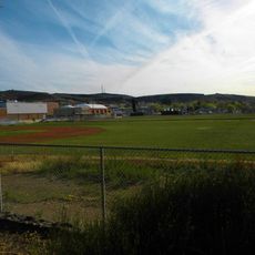
Fort Mojave Indian Reservation spans about 42,000 acres across Arizona, California, and Nevada along the Colorado River. The land includes desert terrain, agricultural fields, and developed areas where residents live, with administrative offices located in Needles, California.

A military fort was established here in 1859 to protect and support river transportation and settlements in the region. The area was formally designated as an Indian reservation in 1890 under federal administration.

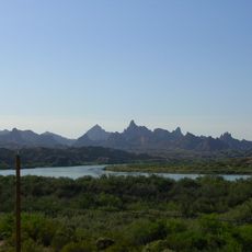
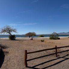
The Fort Mojave people call themselves Pipa Aha Macav, meaning People by the River, and keep their traditions alive through events and gatherings where elders share knowledge with younger generations. The connection to the Colorado River shapes how the community sees itself and its place in the landscape.

This is a desert environment with varying terrain, so bring plenty of water and expect hot conditions, especially in summer months. The area is spread out across three states, so having a vehicle and checking local conditions beforehand will help you make the most of your visit.

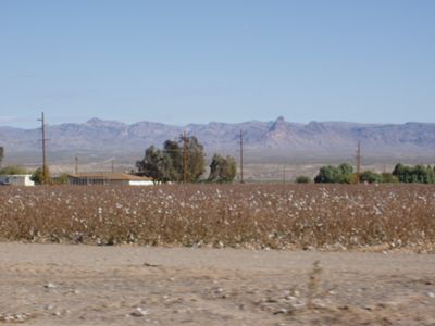
The reservation operates Avi Kwa'Ame Farms, which grows cotton and carefully manages water from the Colorado River. This working farmland shows how the community maintains both agriculture and stewardship of water resources.

The community of curious travelers

AroundUs brings together thousands of curated places, local tips, and hidden gems, enriched daily by 60,000 contributors worldwide.

Start exploring
Location
Location
Location
GPS coordinates
34.94278,-114.60917
Latest update
December 7, 2025 20:20
Around this place
Lake Havasu
United States of America

Lake Havasu

55.2 km
Castle Mountains National Monument
United States of America

Castle Mountains National Monument

57.1 km
Atchison, Topeka and Santa Fe Railway 3759
United States of America

Atchison, Topeka and Santa Fe Railway 3759

57.2 km
Grapevine Canyon Petroglyphs
United States of America

Grapevine Canyon Petroglyphs

32.4 km
The Needles
United States of America

The Needles

33.6 km
Havasu National Wildlife Refuge
United States of America

Havasu National Wildlife Refuge

18.8 km
Spirit Mountain
United States of America

Spirit Mountain

38.4 km
Bigelow Cholla Garden Wilderness
United States of America

Bigelow Cholla Garden Wilderness

28.3 km
Old Trails Bridge
United States of America

Old Trails Bridge

27.7 km
Dead Mountains
United States of America

Dead Mountains

12.9 km
Red Rock Bridge
United States of America

Red Rock Bridge

27.4 km
United States of America

Topock Gorge

34.2 km
Spirit Mountain Wilderness
United States of America

Spirit Mountain Wilderness

36.3 km
Warm Springs Wilderness
United States of America

Warm Springs Wilderness

28 km
United States of America

Bridge Canyon Wilderness

32.9 km
Windsor Beach
United States of America

Windsor Beach

55.3 km
Boundary Cone
United States of America

Boundary Cone

18.2 km
Hardyville Cemetery
United States of America

Hardyville Cemetery

19.9 km
Grapevine Canyon
United States of America

Grapevine Canyon

32.4 km
United States of America

Alexey W. Von Schmidt

9.3 km
Goffs Schoolhouse
United States of America

Goffs Schoolhouse

40.8 km
Mohave Museum of History and Arts
United States of America

Mohave Museum of History and Arts

57 km
Mohave County Hospital
United States of America

Mohave County Hospital

57.2 km
Mohave Canyon
United States of America

Mohave Canyon

35.9 km
Oatman Drug Company Building
United States of America

Oatman Drug Company Building

22.7 km
Foster S. Dennis House
United States of America

Foster S. Dennis House

57.3 km
House at 809 Grand View
United States of America

House at 809 Grand View

57.4 km
Area 66
United States of America

Area 66

43.3 km
Show the full map
Reviews
Share your experience

No review yet

Discussions
Start a discussion...

No discussion yet

« Fort Mojave Indian Reservation - Native American reservation across Arizona, California, and Nevada » is provided by Around Us (aroundus.com). Images and texts are derived from Wikimedia project under a Creative Commons license. You are allowed to copy, distribute, and modify copies of this page, under the conditions set by the license, as long as this note is clearly visible.

Discover hidden gems everywhere you go!

From secret cafés to breathtaking viewpoints, skip the crowded tourist spots and find places that match your style. Our app makes it easy with voice search, smart filtering, route optimization, and insider tips from travelers worldwide. Download now for the complete mobile experience.

Around Us App Screenshot

A unique approach to discovering new places

Le Figaro

All the places worth exploring

France Info

A tailor-made excursion in just a few clicks

20 Minutes

Around Us
Travel Guide & Maps
Download

Send to your phone

QR Code
1

Open the camera app on your mobile.

2

Point at the QR code with your camera. A notification will appear.

3

Tap the notification to open the link.