Chest opened
+${chestReward.xp} XP
Explorer
NOUVEAU ×${chestReward.collectible.quantity}
tapez pour fermer
Chest locked

Open chests in the app

Around Us is built for your phone — chests unlock when you walk, explore and capture nearby places.

Enable Location

We need your location to show you interesting places around you

Discover nearby places

Find interesting locations and hidden gems around you

Precise directions

Get accurate directions and distances to places

Your location is never shared with other users. It's only used when you tap the location button.

Ochoco National Forest

Log in to your account

Start exploring — it's free

Trusted by 72,890 travelers worldwide

Continue with Google
Continue with Apple
or

We will send you a code to connect

By continuing, you accept our Terms and Conditions and our Privacy Policy

Check your inbox

We've sent a pincode in your inbox. Please enter the code below.

Ochoco National Forest
Discussion Reviews 1 Photos
9.1k Popularity

Ochoco National Forest, National forest in Oregon, United States

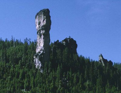
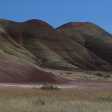
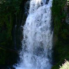
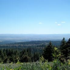
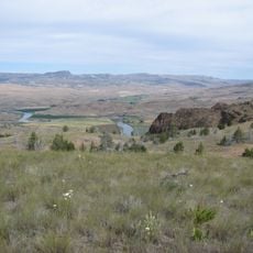
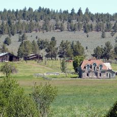
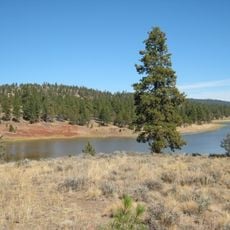
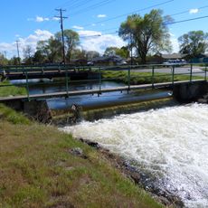
Ochoco National Forest is a forested area in central Oregon featuring mountains, canyons, and river systems spread across rolling terrain. The landscape transitions between dense woodlands and open meadows depending on elevation and exposure to weather.

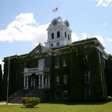
This forest was protected in the early 1900s as part of the national forest system to manage timber and protect the natural landscape. The designation reflected the growing interest in preserving western wilderness during that era.

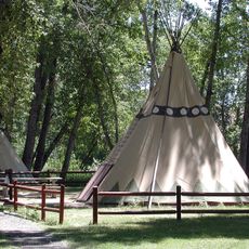
Native American peoples, including the Nez Perce and Umatilla tribes, relied on this land for hunting and gathering for centuries. Their relationship to these forests continues to shape how people understand the region today.

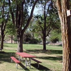
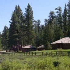
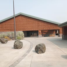
Multiple access points surround the forest with parking and visitor facilities at major entrances. Well-marked trails and campgrounds are available throughout the area, though weather conditions change significantly with elevation and season.

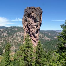
The forest is known for extensive ponderosa pine stands that thrive at higher elevations, creating a distinctive open woodland with widely spaced trees. These pine forests feel more spacious and airy than many other forest types, with long sight lines through the canopy.

The community of curious travelers

AroundUs brings together thousands of curated places, local tips, and hidden gems, enriched daily by 60,000 contributors worldwide.

Start exploring
Location
GPS coordinates
44.37640,-120.11700
Latest update
December 10, 2025 15:59
Around this place
Smith Rock State Park
United States of America

Smith Rock State Park

81.2 km
Painted Hills
United States of America

Painted Hills

34.1 km
Bridge Creek Wilderness
United States of America

Bridge Creek Wilderness

13.9 km
James Cant Ranch
United States of America

James Cant Ranch

42.5 km
Black Canyon Wilderness
United States of America

Black Canyon Wilderness

37.1 km
Mill Creek Wilderness
United States of America

Mill Creek Wilderness

34.4 km
Spring Basin Wilderness
United States of America

Spring Basin Wilderness

62.4 km
Clyde Holliday State Recreation Site
United States of America

Clyde Holliday State Recreation Site

82 km
Dyer State Wayside
United States of America

Dyer State Wayside

83.5 km
Ochoco State Scenic Viewpoint
United States of America

Ochoco State Scenic Viewpoint

60.6 km
Prineville Reservoir Wildlife Area
United States of America

Prineville Reservoir Wildlife Area

56.5 km
Roba Ranch
United States of America

Roba Ranch

19 km
Grizzly Mountain
United States of America

Grizzly Mountain

67 km
Crook County Courthouse
United States of America

Crook County Courthouse

58.5 km
Antelope Flat Reservoir
United States of America

Antelope Flat Reservoir

46.9 km
A. R. Bowman Memorial Museum
United States of America

A. R. Bowman Memorial Museum

58.7 km
Thomas M. Baldwin House
United States of America

Thomas M. Baldwin House

58.8 km
Thomas Benton Hoover House
United States of America

Thomas Benton Hoover House

69.8 km
Allison Ranger Station
United States of America

Allison Ranger Station

66 km
Old First National Bank of Prineville
United States of America

Old First National Bank of Prineville

58.7 km
Crook County Bank Building
United States of America

Crook County Bank Building

58.7 km
Fossil Public School
United States of America

Fossil Public School

69.9 km
Marion Reed Elliott House
United States of America

Marion Reed Elliott House

58.8 km
Lamonta Compound
United States of America

Lamonta Compound

59.1 km
Thomas Condon Paleontology Center
United States of America

Thomas Condon Paleontology Center

42.3 km
Pine Theater
United States of America

Pine Theater

58.7 km
Pilot Butte Canal Downtown Redmond Segment
United States of America

Pilot Butte Canal Downtown Redmond Segment

84.3 km
Stein's Pillar
United States of America

Stein's Pillar

40.2 km
Show the full map
Reviews
Share your experience

No review yet

Discussions
Start a discussion...

No discussion yet

« Ochoco National Forest - National forest in Oregon, United States » is provided by Around Us (aroundus.com). Images and texts are derived from Wikimedia project under a Creative Commons license. You are allowed to copy, distribute, and modify copies of this page, under the conditions set by the license, as long as this note is clearly visible.

Discover hidden gems everywhere you go!

From secret cafés to breathtaking viewpoints, skip the crowded tourist spots and find places that match your style. Our app makes it easy with voice search, smart filtering, route optimization, and insider tips from travelers worldwide. Download now for the complete mobile experience.

Around Us App Screenshot

A unique approach to discovering new places

Le Figaro

All the places worth exploring

France Info

A tailor-made excursion in just a few clicks

20 Minutes

Around Us
Travel Guide & Maps
Download

Send to your phone

QR Code
1

Open the camera app on your mobile.

2

Point at the QR code with your camera. A notification will appear.

3

Tap the notification to open the link.