Chest opened
+${chestReward.xp} XP
Explorer
NOUVEAU ×${chestReward.collectible.quantity}
tapez pour fermer
Chest locked

Open chests in the app

Around Us is built for your phone — chests unlock when you walk, explore and capture nearby places.

Enable Location

We need your location to show you interesting places around you

Discover nearby places

Find interesting locations and hidden gems around you

Precise directions

Get accurate directions and distances to places

Your location is never shared with other users. It's only used when you tap the location button.

Seven Devils Mountains

Log in to your account

Start exploring — it's free

Trusted by 72,888 travelers worldwide

Continue with Google
Continue with Apple
or

We will send you a code to connect

By continuing, you accept our Terms and Conditions and our Privacy Policy

Check your inbox

We've sent a pincode in your inbox. Please enter the code below.

Seven Devils Mountains
Discussion Reviews 1 Photos
12.9k Popularity

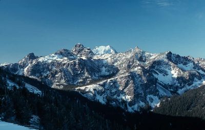
Seven Devils Mountains, Mountain range in Hells Canyon Wilderness, Idaho.

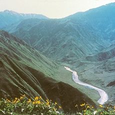
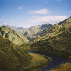
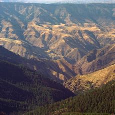
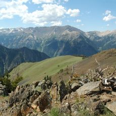
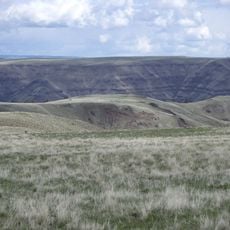
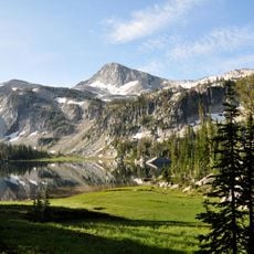
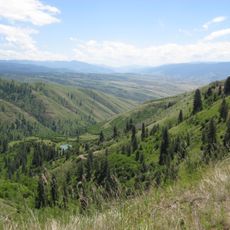
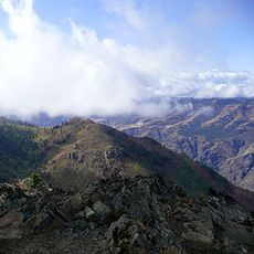
The Seven Devils Mountains is a range in Hells Canyon Wilderness along the Idaho-Oregon border, with 64 peaks varying in elevation from 1,000 to 9,422 feet (305 to 2,873 m). The terrain is rugged with steep rock faces, thick forests, and streams cutting through narrow canyons.

The range was first documented in 1927 when Harold St. John and Lowell Mullen climbed He Devil, the highest peak. Since then it has become an established destination for mountaineers and hikers exploring the wilderness.

The Nez Perce people tell a story of seven giants who hunted children until Coyote trapped them in boiling holes and turned them to stone mountains. This legend remains alive in how local communities relate to and speak about this range today.

Access is via forest road 517 from Highway 95 near Riggins, climbing through 17 miles (27 km) of gravel road with substantial elevation gain. Plan for a vehicle capable of handling rough terrain and be prepared for primitive conditions with limited facilities.

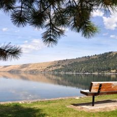
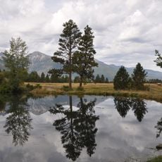
The range contains around 56 lakes scattered throughout its terrain at different elevations. These waters offer fishing opportunities and remain relatively unvisited compared to other mountain destinations.

The community of curious travelers

AroundUs brings together thousands of curated places, local tips, and hidden gems, enriched daily by 60,000 contributors worldwide.

Start exploring
Location
GPS coordinates
45.32410,-116.54800
Latest update
December 7, 2025 20:42
Around this place
Hells Canyon
United States of America

Hells Canyon

8.8 km
Hells Canyon National Recreation Area
United States of America

Hells Canyon National Recreation Area

30.9 km
Hells Canyon Wilderness
United States of America

Hells Canyon Wilderness

25.4 km
Sacajawea Peak
United States of America

Sacajawea Peak

59 km
Hells Canyon Dam
United States of America

Hells Canyon Dam

14.7 km
Ponderosa State Park
United States of America

Ponderosa State Park

57 km
Zumwalt Prairie
United States of America

Zumwalt Prairie

48.7 km
Wallowa Lake Tramway
United States of America

Wallowa Lake Tramway

50 km
Wallowa Lake State Park
United States of America

Wallowa Lake State Park

52.4 km
Eagle Cap
United States of America

Eagle Cap

61.7 km
Mount Howard
United States of America

Mount Howard

49.9 km
White Bird Grade
United States of America

White Bird Grade

59.4 km
Iwetemlaykin State Heritage Site
United States of America

Iwetemlaykin State Heritage Site

52.9 km
Sheep Rock
United States of America

Sheep Rock

17.6 km
Wallowa County Courthouse
United States of America

Wallowa County Courthouse

58.1 km
OK Theatre
United States of America

OK Theatre

58.3 km
College Creek Ranger Station
United States of America

College Creek Ranger Station

22 km
William P. Warnock House
United States of America

William P. Warnock House

57.4 km
First Bank of Joseph
United States of America

First Bank of Joseph

53.4 km
Enterprise Public Library
United States of America

Enterprise Public Library

58 km
Flora School
United States of America

Flora School

60.2 km
Dr. J. W. Barnard Building and First National Bank of Joseph
United States of America

Dr. J. W. Barnard Building and First National Bank of Joseph

53.3 km
Lick Creek Guard Station
United States of America

Lick Creek Guard Station

41.9 km
Col. E. M. Heigho House
United States of America

Col. E. M. Heigho House

44.4 km
Alvin M. and Betty Josephy Library of Western History and Culture
United States of America

Alvin M. and Betty Josephy Library of Western History and Culture

53.5 km
Enterprise I.O.O.F. Hall
United States of America

Enterprise I.O.O.F. Hall

58 km
Matterhorn Village
United States of America

Matterhorn Village

52 km
Hat Point Fire Lookout Tower
United States of America

Hat Point Fire Lookout Tower

15.5 km
Show the full map
Reviews
Share your experience

No review yet

Discussions
Start a discussion...

No discussion yet

« Seven Devils Mountains - Mountain range in Hells Canyon Wilderness, Idaho » is provided by Around Us (aroundus.com). Images and texts are derived from Wikimedia project under a Creative Commons license. You are allowed to copy, distribute, and modify copies of this page, under the conditions set by the license, as long as this note is clearly visible.

Discover hidden gems everywhere you go!

From secret cafés to breathtaking viewpoints, skip the crowded tourist spots and find places that match your style. Our app makes it easy with voice search, smart filtering, route optimization, and insider tips from travelers worldwide. Download now for the complete mobile experience.

Around Us App Screenshot

A unique approach to discovering new places

Le Figaro

All the places worth exploring

France Info

A tailor-made excursion in just a few clicks

20 Minutes

Around Us
Travel Guide & Maps
Download

Send to your phone

QR Code
1

Open the camera app on your mobile.

2

Point at the QR code with your camera. A notification will appear.

3

Tap the notification to open the link.