
Cachoeira da Caba, Wasserfall in Brasilien
Location: Amazonas
Elevation above the sea: 187 m
GPS coordinates: 1.36667,-64.13333
Latest update: June 7, 2025 05:36

Pico da Neblina
218.1 km
Piedra del Cocuy
299.5 km
Pico da Neblina National Park
232.9 km
Pico 31 de Março
217.7 km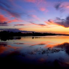
Jaú National Park
428.4 km
Serranía La Neblina National Park
217.1 km
Piedra del Cocuy Natural Monument
299.5 km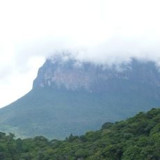
Jaua-Sarisariñama National Park
369.1 km
Parima-Tapirapecó National Park
186.3 km
Yapacana National Park
392.1 km
Serra do Tepequém
377.2 km
Duida-Marahuaca National Park
292.2 km
Mamirauá Sustainable Development Reserve
438.9 km
Cachoeira do El Dorado
104 km
Cerro Duida
284.6 km
Morro dos Seis Lagos Biological Reserve
307.8 km
Serra da Mocidade National Park
253.8 km
Serra do Aracá State Park
87.7 km
Viruá National Park
334.2 km
Forte de São José de Marabitanas
301.4 km
Cué-cué/Marabitanas Indigenous Territory
311.8 km
Reserva Extrativista do Rio Unini
444 km
Parú-Euaja Massif Natural Monument
377.5 km
União Operária Beneficente
418 km
Cerros Vinilla y Aratitiyope Natural Monument
177.6 km
Sierra Unturan Natural Monument
150.6 km
Sierra Marutani Natural Monument
294.4 km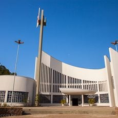
Cathedral Cristo Redentor in Boa Vista
417.5 kmReviews
Visited this place? Tap the stars to rate it and share your experience / photos with the community! Try now! You can cancel it anytime.
Discover hidden gems everywhere you go!
From secret cafés to breathtaking viewpoints, skip the crowded tourist spots and find places that match your style. Our app makes it easy with voice search, smart filtering, route optimization, and insider tips from travelers worldwide. Download now for the complete mobile experience.

A unique approach to discovering new places❞
— Le Figaro
All the places worth exploring❞
— France Info
A tailor-made excursion in just a few clicks❞
— 20 Minutes