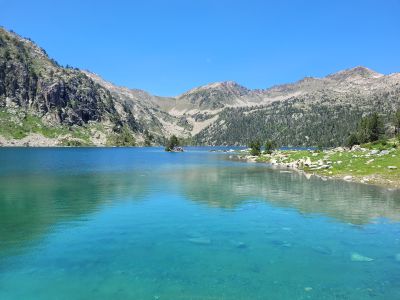
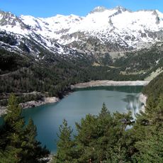
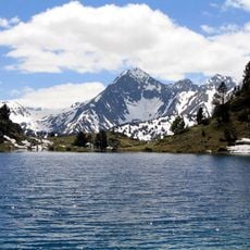
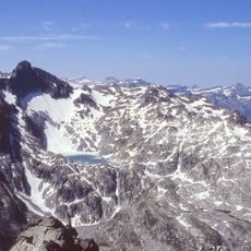
Lac d'Aubert, Artificial lake in Vielle-Aure, France.
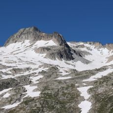
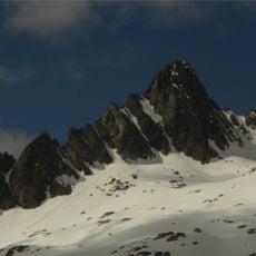
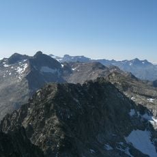
Lac d'Aubert is an artificial lake in the Pyrenees at roughly 2,150 meters elevation, sitting in a high-altitude valley surrounded by steep mountain slopes. The water surface reflects rocky peaks and sparse mountain plants that cling to the surrounding terrain.
The lake was created in the 1930s to generate electricity for the surrounding region. This project was part of a larger effort to develop hydroelectric power in the French Pyrenees.
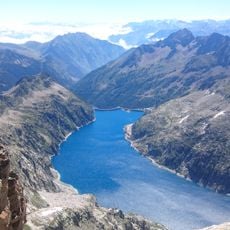
The reservoir represents a notable example of French engineering projects that transformed the Pyrenees landscape while maintaining natural mountain environments.
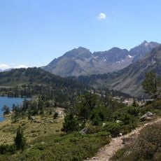
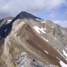
The lake is reached by walking trails that are most passable during the warmer months. The best time to visit is between June and September when the paths are clear of snow and weather conditions are stable.
The water feeds from a mountain river and is part of a larger water system serving the entire region. This connection to other waterways makes the lake a key point in mountain water management.
Location: Vielle-Aure
Inception: January 1, 1933
Operator: EDF
Address: Lac d'Aubert, 65170, France
GPS coordinates: 42.84250,0.13765
Latest update: December 6, 2025 17:44
Occitanie hosts a wide variety of lakes spread between the Pyrenees and the Massif Central. Natural lakes mainly occupy high-altitude zones in the Pyrenees, where glacial erosion has carved out cirques and basins now filled with water. Lake Oô, located at 4,950 feet (1,507 meters) altitude, receives...
Col du Tourmalet
7.4 km
Col de Portet
8.1 km
Téléphérique du pic du Midi de Bigorre
8.2 km
Lac d'Orédon
2.7 kmNéouvielle National Nature Reserve
1.8 km
Pic de Néouvielle
2 km
Lac d'Aumar
986 m
Lac de Cap-de-Long
2.1 km
Station thermale de Barèges
8.5 km
Pic de Bugatet
5 km
Le Géant
7.3 km
Campbieil
5.8 km
Turon de Néouvielle
2.9 km
Pic Ramougn
1.7 km
Chapelle des Templiers d'Aragnouet
8.3 km
Jardin botanique du Tourmalet
7.4 km
Trois Conseillers
2.4 km
Pic de Bastan
5.8 km
Estaragne
5.1 km
Chapelle Notre-Dame de La Mongie
8.2 km
Pic Badet
5.7 km
Pic Maubic
5.2 km
Lenquo de Capo
7.5 km
Pic Maou
6 km
Pic de Crabounouse
6 km
Agulla Tourrat
4.9 km
Agulla Badet
5.7 km
Punta Reboul Vidal
3 kmVisited this place? Tap the stars to rate it and share your experience / photos with the community! Try now! You can cancel it anytime.
Discover hidden gems everywhere you go!
From secret cafés to breathtaking viewpoints, skip the crowded tourist spots and find places that match your style. Our app makes it easy with voice search, smart filtering, route optimization, and insider tips from travelers worldwide. Download now for the complete mobile experience.
A unique approach to discovering new places❞
— Le Figaro
All the places worth exploring❞
— France Info
A tailor-made excursion in just a few clicks❞
— 20 Minutes